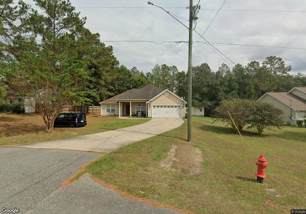
515 Sand Pine Dr Midway, FL 32343
3
Beds
--
Bath
1,770
Sq Ft
10,890
Sq Ft Lot
About This Home
This home is located at 515 Sand Pine Dr, Midway, FL 32343. 515 Sand Pine Dr is a home located in Gadsden County.
Create a Home Valuation Report for This Property
The Home Valuation Report is an in-depth analysis detailing your home's value as well as a comparison with similar homes in the area
Home Values in the Area
Average Home Value in this Area
Tax History
| Year | Tax Paid | Tax Assessment Tax Assessment Total Assessment is a certain percentage of the fair market value that is determined by local assessors to be the total taxable value of land and additions on the property. | Land | Improvement |
|---|---|---|---|---|
| 2024 | $1,977 | $147,467 | -- | -- |
| 2023 | $1,923 | $143,172 | $0 | $0 |
| 2022 | $1,848 | $139,002 | $0 | $0 |
| 2021 | $1,811 | $134,954 | $0 | $0 |
| 2020 | $1,772 | $133,091 | $0 | $0 |
| 2019 | $1,746 | $130,099 | $0 | $0 |
| 2018 | $1,747 | $127,673 | $0 | $0 |
| 2017 | $1,700 | $125,047 | $0 | $0 |
| 2016 | $1,671 | $122,475 | $0 | $0 |
| 2015 | $1,654 | $121,624 | $0 | $0 |
| 2014 | $1,609 | $120,659 | $0 | $0 |
Source: Public Records
Map
Nearby Homes
- 17 Pine Bark Ln
- 25 Pine Bark Ln
- 396 Sand Pine Cir
- 122 Loblolly Cir
- 31 Stevens Dr
- 0 Central Rd Unit 381525
- 305 Delores Madison Dr
- 6 Slash Ln
- 34 Frank Run
- 604 Rustling Pines Blvd
- 545 Slash Cir
- 668 M l King Blvd
- 359 Mae Cato Dr
- 380 Sumpter Ridge Dr
- 407 Mae Cato Dr
- 8877 High Bridge Rd
- 8873 High Bridge Rd
- 325 Mine Rd
- 00 Blue Star Hwy
- 10 Yvonne Ct
- 519 Sand Pine Dr
- 501 Sand Pine Dr
- 570 Sand Pine Dr
- 553 Sand Pine Dr Unit 1
- 553 Sand Pine Dr
- 485 Sand Pine Dr
- 500 Sand Pine Dr
- 565 Sand Pine Dr
- 0 Pine Bark Trail Unit A4527999
- 560 Sand Pine Cir
- 463 Sand Pine Dr
- 555 Sand Pine Cir
- 470 Sand Pine Dr
- 30 Pine Bark Trail Unit o
- 30 Pine Bark Trail
- 577 Sand Pine Dr
- 554 Sand Pine Cir
- 554 Sand Pine Cir
- 455 Sand Pine Dr
- 54 Pine Bark Trail
Your Personal Tour Guide
Ask me questions while you tour the home.