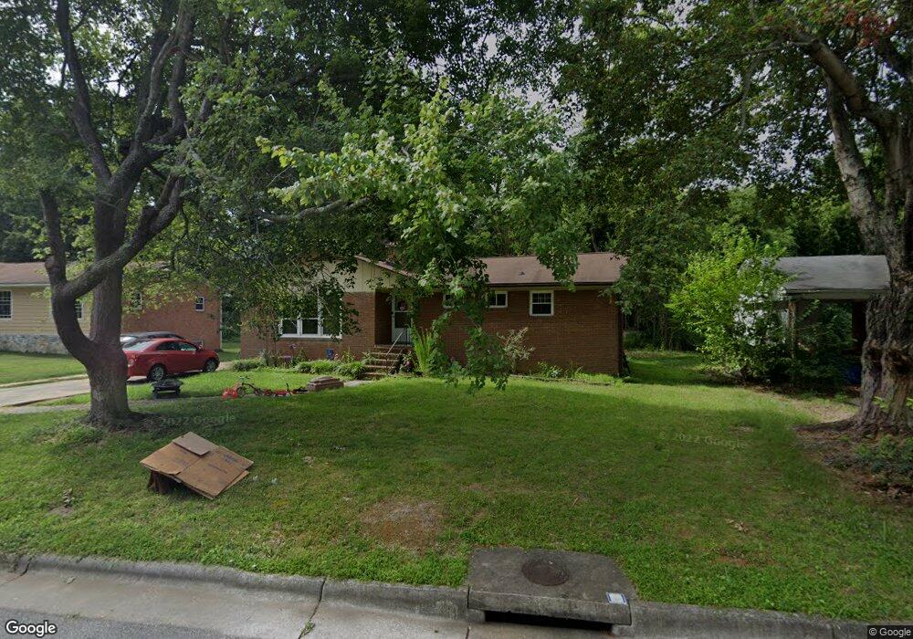
515 Sherbrook Dr High Point, NC 27262
Greater High Point NeighborhoodEstimated Value: $240,000 - $278,000
About This Home
This home is located at 515 Sherbrook Dr, High Point, NC 27262 and is currently estimated at $261,015, approximately $161 per square foot. 515 Sherbrook Dr is a home located in Guilford County with nearby schools including Oak View Elementary School, Ferndale Middle School, and High Point Central High School.
Ownership History
We collect this data history from publicly available records. To have your information removed, we recommend requesting removal directly through your county’s website.
Purchase Details
Purchase Details
Home Financials for this Owner
Home Financials are based on the most recent Mortgage that was taken out on this home.Purchase Details
Home Financials for this Owner
Home Financials are based on the most recent Mortgage that was taken out on this home.Purchase Details
Home Financials for this Owner
Home Financials are based on the most recent Mortgage that was taken out on this home.Home Values in the Area
Average Home Value in this Area
Purchase History
We collect this data history from publicly available records. To have your information removed, we recommend requesting removal directly through your county’s website.
| Date | Buyer | Sale Price | Title Company |
|---|---|---|---|
| -- | None Listed On Document | ||
| -- | None Listed On Document | ||
| -- | -- | ||
| -- | -- | ||
| $97,000 | -- |
Mortgage History
We collect this data history from publicly available records. To have your information removed, we recommend requesting removal directly through your county’s website.
| Date | Status | Borrower | Loan Amount |
|---|---|---|---|
| Previous Owner | $87,300 |
Tax History
We collect this data history from publicly available records. To have your information removed, we recommend requesting removal directly through your county’s website.
| Year | Tax Paid | Tax Assessment Tax Assessment Total Assessment is a certain percentage of the fair market value that is determined by local assessors to be the total taxable value of land and additions on the property. | Land | Improvement |
|---|---|---|---|---|
| 2025 | $2,323 | $168,600 | $38,000 | $130,600 |
| 2024 | $2,323 | $168,600 | $38,000 | $130,600 |
| 2023 | $2,323 | $168,600 | $38,000 | $130,600 |
| 2022 | $2,273 | $168,600 | $38,000 | $130,600 |
| 2021 | $1,891 | $137,200 | $25,000 | $112,200 |
| 2020 | $1,891 | $137,200 | $25,000 | $112,200 |
| 2019 | $1,891 | $137,200 | $0 | $0 |
| 2018 | $1,881 | $137,200 | $0 | $0 |
| 2017 | $1,891 | $137,200 | $0 | $0 |
| 2016 | $1,792 | $127,800 | $0 | $0 |
| 2015 | $1,802 | $127,800 | $0 | $0 |
| 2014 | $1,833 | $127,800 | $0 | $0 |
Map
- 629 Rockspring Rd
- 611 W Lexington Ave
- 619 W Lexington Ave
- 427 W Lexington Ave
- 307 Rockspring Rd
- 1700 Long St
- 1313 Prescott Place
- 1311 Prescott Place
- 705 W Lexington Ave
- 219 Rockspring Rd
- 413 Edgedale Dr
- 1001 Country Club Dr
- 405 Edgedale Dr
- 1300 Kentucky St
- 510 Otteray Ave
- 1600 Johnson St
- 1312 Kensington Dr
- 1105 Robin Hood Rd Unit F
- 101 Oxford Place Unit 19
- 1607 Larkin St
- 512 Hayworth Cir
- 510 Hayworth Cir
- 514 Hayworth Cir
- 517 Sherbrook Dr
- 511 Hayworth Cir
- 513 Sherbrook Dr
- 508 Hayworth Cir
- 516 Hayworth Cir
- 509 Hayworth Cir
- 603 Sherbrook Dr
- 518 Hayworth Cir
- 511 Sherbrook Dr
- 507 Hayworth Cir
- 506 Hayworth Cir
- 515 Birchwood Dr
- 605 Sherbrook Dr
- 508 Overbrook Dr
- 506 Overbrook Dr
- 602 Sherbrook Dr
- 512 Sherbrook Dr
Ask me questions while you tour the home.