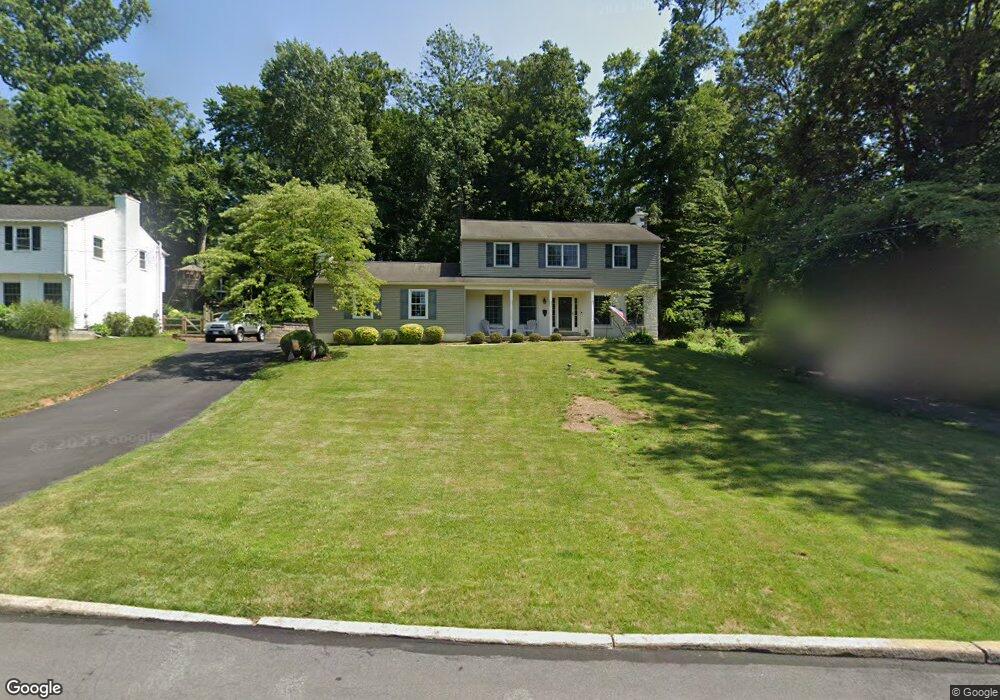
518 Trinity Dr West Chester, PA 19382
Estimated Value: $571,000 - $780,000
About This Home
This home is located at 518 Trinity Dr, West Chester, PA 19382 and is currently estimated at $674,000, approximately $294 per square foot. 518 Trinity Dr is a home located in Chester County with nearby schools including Sarah W Starkweather Elementary School, Stetson Middle School, and Bayard Rustin High School.
Ownership History
We collect this data history from publicly available records. To have your information removed, we recommend requesting removal directly through your county’s website.
Purchase Details
Home Financials for this Owner
Home Financials are based on the most recent Mortgage that was taken out on this home.Purchase Details
Home Values in the Area
Average Home Value in this Area
Purchase History
We collect this data history from publicly available records. To have your information removed, we recommend requesting removal directly through your county’s website.
| Date | Buyer | Sale Price | Title Company |
|---|---|---|---|
| $165,000 | Fidelity National Title Ins | ||
| -- | -- |
Mortgage History
We collect this data history from publicly available records. To have your information removed, we recommend requesting removal directly through your county’s website.
| Date | Status | Borrower | Loan Amount |
|---|---|---|---|
| Open | $148,500 |
Tax History
We collect this data history from publicly available records. To have your information removed, we recommend requesting removal directly through your county’s website.
| Year | Tax Paid | Tax Assessment Tax Assessment Total Assessment is a certain percentage of the fair market value that is determined by local assessors to be the total taxable value of land and additions on the property. | Land | Improvement |
|---|---|---|---|---|
| 2026 | $466 | $152,580 | $43,260 | $109,320 |
| 2025 | $4,423 | $152,580 | $43,260 | $109,320 |
| 2024 | $4,423 | $152,580 | $43,260 | $109,320 |
| 2023 | $4,423 | $152,580 | $43,260 | $109,320 |
| 2022 | $4,366 | $152,580 | $43,260 | $109,320 |
| 2021 | $4,305 | $152,580 | $43,260 | $109,320 |
| 2020 | $4,277 | $152,580 | $43,260 | $109,320 |
| 2019 | $4,218 | $152,580 | $43,260 | $109,320 |
| 2018 | $4,128 | $152,580 | $43,260 | $109,320 |
| 2017 | $4,038 | $152,580 | $43,260 | $109,320 |
| 2016 | $3,267 | $152,580 | $43,260 | $109,320 |
| 2015 | $3,267 | $152,580 | $43,260 | $109,320 |
| 2014 | $3,267 | $152,580 | $43,260 | $109,320 |
Map
- 524 Raspberry Ln
- 702 Lenape Rd
- 820 Spruce Ave
- 205 Oak Ln
- 830 Amber Ln
- 849 Parkside Ave
- 217 Shropshire Dr
- 303 Price St
- 328 Dean St
- 10 Yorktown Ave
- 830 Pietro Place
- 516 S Church St
- 125 Price St
- 206 Reid Way
- 204 Shropshire Dr
- 410 S Church St
- 819 W Miner St
- 734 S Matlack St
- 129 W Union St
- 531 S Walnut St
Ask me questions while you tour the home.