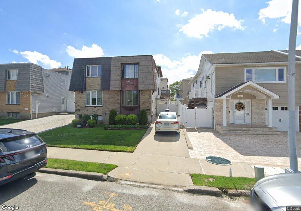
52 E Reading Ave Staten Island, NY 10308
Great Kills NeighborhoodEstimated Value: $677,309 - $807,000
Studio
4
Baths
1,600
Sq Ft
$469/Sq Ft
Est. Value
About This Home
This home is located at 52 E Reading Ave, Staten Island, NY 10308 and is currently estimated at $750,077, approximately $468 per square foot. 52 E Reading Ave is a home located in Richmond County with nearby schools including P.S. 32 The Gifford School, I.S. 075 Frank D. Paulo, and Susan E Wagner High School.
Ownership History
Date
Name
Owned For
Owner Type
Purchase Details
Closed on
Jul 20, 2020
Sold by
Benvenuto Eileen
Bought by
Benvenuto Lori
Current Estimated Value
Purchase Details
Closed on
Jul 10, 2018
Sold by
Sarubbo Ann
Bought by
Patella Debra and Sarubbi Joseph
Purchase Details
Closed on
Feb 2, 2017
Sold by
Sarubbi Joseph and Sarubbi Ann
Bought by
Sarubbi Ann and Ann Sarubbi Revocable Trust
Create a Home Valuation Report for This Property
The Home Valuation Report is an in-depth analysis detailing your home's value as well as a comparison with similar homes in the area
Home Values in the Area
Average Home Value in this Area
Purchase History
| Date | Buyer | Sale Price | Title Company |
|---|---|---|---|
| Benvenuto Lori | -- | None Available | |
| Patella Debra | -- | None Available | |
| Sarubbi Ann | -- | None Available |
Source: Public Records
Tax History
| Year | Tax Paid | Tax Assessment Tax Assessment Total Assessment is a certain percentage of the fair market value that is determined by local assessors to be the total taxable value of land and additions on the property. | Land | Improvement |
|---|---|---|---|---|
| 2025 | $2,282 | $41,760 | $6,651 | $35,109 |
| 2024 | $2,387 | $39,540 | $6,627 | $32,913 |
| 2023 | $2,420 | $30,326 | $6,274 | $24,052 |
| 2022 | $2,223 | $35,580 | $8,640 | $26,940 |
| 2021 | $2,276 | $34,800 | $8,640 | $26,160 |
| 2020 | $2,176 | $33,960 | $8,640 | $25,320 |
| 2019 | $1,984 | $32,460 | $8,640 | $23,820 |
| 2018 | $1,917 | $25,272 | $8,290 | $16,982 |
| 2017 | $2,542 | $24,060 | $8,640 | $15,420 |
| 2016 | $3,636 | $23,662 | $8,434 | $15,228 |
| 2015 | $3,433 | $22,323 | $6,647 | $15,676 |
| 2014 | $3,433 | $21,060 | $7,200 | $13,860 |
Source: Public Records
Map
Nearby Homes
- 890 Armstrong Ave Unit 2-3
- 892 Armstrong Ave Unit 23
- 478 Leverett Ave
- 360 Barlow Ave Unit 1
- 360 Barlow Ave Unit 40A
- 360 Barlow Ave Unit 29
- 360 Barlow Ave Unit 32
- 360 Barlow Ave Unit 24
- 28 Fenway Cir Unit 2-2
- 287 Abingdon Ave
- 309 Abingdon Ave
- 147 Cortelyou Ave Unit 2-3
- 969 Armstrong Ave
- 526 Leverett Ave
- 538 Leverett Ave
- 125 Cortelyou Ave Unit 2-2
- 193 Brookfield Ave
- 67 Genesee Ave
- 483 Barlow Ave
- 76 E Brandis Ave
- 50 E Reading Ave
- 56 E Reading Ave
- 48 E Reading Ave
- 58 E Reading Ave
- 46 E Reading Ave
- 62 E Reading Ave
- 42 E Reading Ave
- 429 Leverett Ave
- 433 Leverett Ave
- 427 Leverett Ave
- 435 Leverett Ave
- 425 Leverett Ave
- 40 E Reading Ave
- 423 Leverett Ave
- 439 Leverett Ave
- 439 Leverett Ave Unit 2NDFL
- 419 Leverett Ave
- 903 Armstrong Ave
- 36 E Reading Ave
- 417 Leverett Ave
Your Personal Tour Guide
Ask me questions while you tour the home.