Estimated Value: $147,834 - $212,000
About This Home
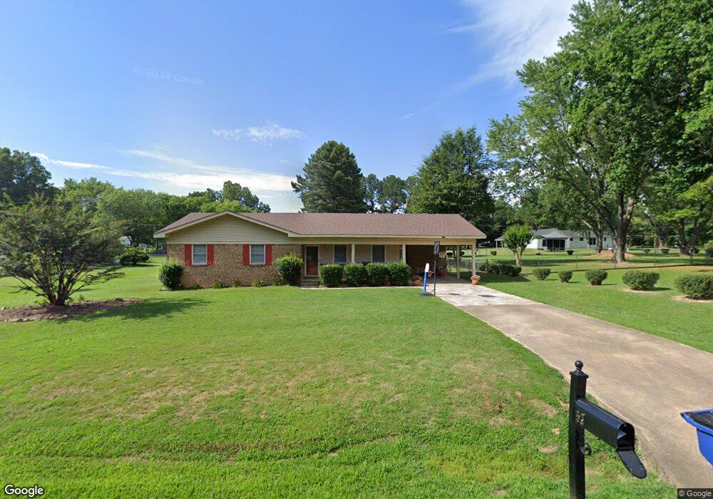
This home is located at 52 Mark Lynn Cir, Cabot, AR 72023 and is currently estimated at $182,959, approximately $142 per square foot. 52 Mark Lynn Cir is a home located in Lonoke County with nearby schools including Southside Elementary School, Cabot Junior High South, and Cabot Middle School South.
Ownership History
We collect this data history from publicly available records. To have your information removed, we recommend requesting removal directly through your county’s website.
Purchase Details
Purchase Details
Home Financials for this Owner
Home Financials are based on the most recent Mortgage that was taken out on this home.Purchase Details
Home Financials for this Owner
Home Financials are based on the most recent Mortgage that was taken out on this home.Purchase Details
Purchase Details
Purchase Details
Purchase Details
Purchase History
We collect this data history from publicly available records. To have your information removed, we recommend requesting removal directly through your county’s website.
| Date | Buyer | Sale Price | Title Company |
|---|---|---|---|
| -- | None Listed On Document | ||
| -- | Lenders Title Company | ||
| -- | Lenders Title Company | ||
| $106,700 | -- | ||
| $100,000 | -- | ||
| -- | -- | ||
| $54,900 | -- | ||
| $51,000 | -- |
Mortgage History
We collect this data history from publicly available records. To have your information removed, we recommend requesting removal directly through your county’s website.
| Date | Status | Borrower | Loan Amount |
|---|---|---|---|
| Previous Owner | $107,000 | ||
| Previous Owner | $107,777 |
Tax History
We collect this data history from publicly available records. To have your information removed, we recommend requesting removal directly through your county’s website.
| Year | Tax Paid | Tax Assessment Tax Assessment Total Assessment is a certain percentage of the fair market value that is determined by local assessors to be the total taxable value of land and additions on the property. | Land | Improvement |
|---|---|---|---|---|
| 2025 | $542 | $19,000 | $3,000 | $16,000 |
| 2024 | $542 | $19,000 | $3,000 | $16,000 |
| 2023 | $542 | $19,000 | $3,000 | $16,000 |
| 2022 | $592 | $19,000 | $3,000 | $16,000 |
| 2021 | $584 | $19,000 | $3,000 | $16,000 |
| 2020 | $538 | $17,940 | $3,000 | $14,940 |
| 2019 | $538 | $17,940 | $3,000 | $14,940 |
| 2018 | $536 | $17,940 | $3,000 | $14,940 |
| 2017 | $823 | $17,940 | $3,000 | $14,940 |
| 2016 | $536 | $17,940 | $3,000 | $14,940 |
| 2015 | $833 | $18,140 | $3,000 | $15,140 |
| 2014 | $896 | $18,140 | $3,000 | $15,140 |
Map
- 37 Mustang Dr
- 12 Tulip Ln
- 11 Tradewinds Dr
- 24 Tulip Ln
- 15 Castle Heights Dr
- 13 Brentwood Cove
- 42 Pine Terrace Dr
- 2302 S Pine St
- 20 Violet Cove
- 120 Michael Dr
- 18 Pinewood Dr
- 10 Pinewood St
- 1309 S Pine St
- 11 Warren St
- 40 Mary Ann Cir
- Lots 44 &45 Broadmoor Cir
- 27 Mary Ann Cir
- 19 Denali Dr
- 00 Bill Foster Memorial Hwy E
- 1 Bill Foster Memorial Hwy E
- 56 Mark Lynn Cir
- 32 Mark Lynn Cir
- 421 Bradley Dr
- 51 Mark Lynn Cir
- 481 Bradley Dr
- 31 Mark Lynn Cir
- 81 Mark Lynn Cir
- 212 Mark Lynn Cir
- 381 Bradley Dr
- 11 Mark Lynn Cir
- 422 Bradley Dr
- 16 Thunderbird Dr
- 18 Thunderbird Dr
- 14 Thunderbird Dr
- 20 Thunderbird Dr
- 12 Thunderbird Dr
- 571 Mark Lynn Cir
- 22 Thunderbird Dr
- 57 Mark Lynn Cir
- 382 Bradley Dr
Ask me questions while you tour the home.