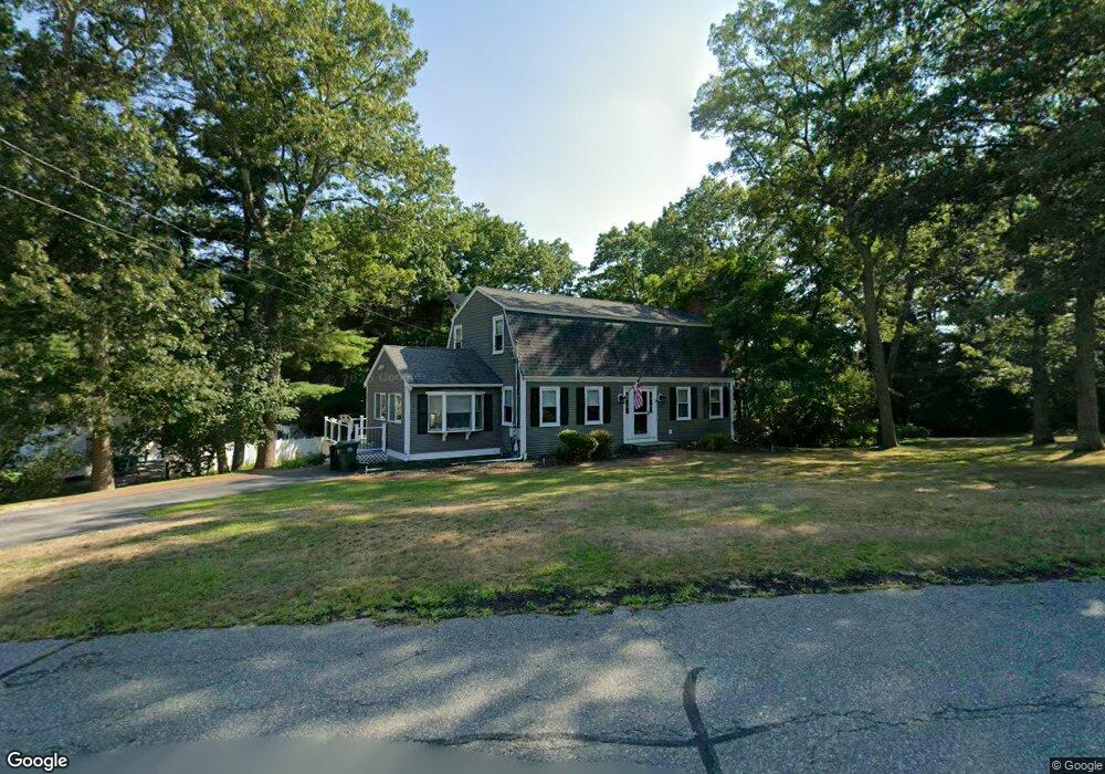
52 Peterson Path Marshfield, MA 02050
Estimated Value: $855,955 - $1,152,000
4
Beds
4
Baths
2,947
Sq Ft
$337/Sq Ft
Est. Value
About This Home
This home is located at 52 Peterson Path, Marshfield, MA 02050 and is currently estimated at $991,989, approximately $336 per square foot. 52 Peterson Path is a home located in Plymouth County with nearby schools including Governor Edward Winslow School, Furnace Brook Middle School, and Marshfield High School.
Ownership History
Date
Name
Owned For
Owner Type
Purchase Details
Closed on
Dec 30, 2011
Sold by
Carter Robert and Carter Lynda R
Bought by
Corbo Daniel and Corbo Karen A
Current Estimated Value
Home Financials for this Owner
Home Financials are based on the most recent Mortgage that was taken out on this home.
Original Mortgage
$238,000
Outstanding Balance
$159,137
Interest Rate
4%
Mortgage Type
Purchase Money Mortgage
Estimated Equity
$832,852
Purchase Details
Closed on
Aug 15, 2007
Sold by
Morrison Cathleen
Bought by
Carter Robert and Carter Lynda R
Create a Home Valuation Report for This Property
The Home Valuation Report is an in-depth analysis detailing your home's value as well as a comparison with similar homes in the area
Home Values in the Area
Average Home Value in this Area
Purchase History
We collect this data history from publicly available records. To have your information removed, we recommend requesting removal directly through your county’s website.
| Date | Buyer | Sale Price | Title Company |
|---|---|---|---|
| Corbo Daniel | $415,000 | -- | |
| Corbo Daniel | $415,000 | -- | |
| Carter Robert | $535,000 | -- | |
| Carter Robert | $535,000 | -- |
Source: Public Records
Mortgage History
We collect this data history from publicly available records. To have your information removed, we recommend requesting removal directly through your county’s website.
| Date | Status | Borrower | Loan Amount |
|---|---|---|---|
| Open | Corbo Daniel | $238,000 | |
| Closed | Carter Robert | $238,000 | |
| Previous Owner | Carter Robert | $40,000 |
Source: Public Records
Tax History
| Year | Tax Paid | Tax Assessment Tax Assessment Total Assessment is a certain percentage of the fair market value that is determined by local assessors to be the total taxable value of land and additions on the property. | Land | Improvement |
|---|---|---|---|---|
| 2025 | $8,457 | $854,200 | $303,600 | $550,600 |
| 2024 | $8,196 | $788,800 | $289,100 | $499,700 |
| 2023 | $7,841 | $692,700 | $258,200 | $434,500 |
| 2022 | $7,545 | $582,600 | $216,800 | $365,800 |
| 2021 | $7,222 | $547,500 | $216,800 | $330,700 |
| 2020 | $6,906 | $518,100 | $196,200 | $321,900 |
| 2019 | $6,665 | $498,100 | $196,200 | $301,900 |
| 2018 | $6,581 | $492,200 | $196,200 | $296,000 |
| 2017 | $6,421 | $468,000 | $196,200 | $271,800 |
| 2016 | $6,250 | $450,300 | $196,200 | $254,100 |
| 2015 | $5,906 | $444,400 | $196,200 | $248,200 |
| 2014 | $5,939 | $446,900 | $196,200 | $250,700 |
Source: Public Records
Map
Nearby Homes
- 108 Observatory Waye
- 40 Signal Hill Rd
- 46 Fairways Edge Dr
- 555 Webster St
- 264 Webster St
- 45 Red Gold Farm Rd
- 154 Partridge Brook Cir
- 184 King Phillips Pathe
- 713 Webster St
- 1 Old Pilgrim Trail
- 643 Careswell St
- 585 Careswell St
- 599 Moraine St
- 19 Copeland St
- 66 Simmons Dr
- 71 Ice House Ln
- 156 Duck Hill Rd
- 152 Acorn St
- 245 Careswell St
- 47 Old Colony Ln Unit 127
- 60 Peterson Path
- 38 Peterson Path
- 19 Stagecoach Dr
- 20 Stagecoach Dr
- 45 Peterson Path
- 57 Peterson Path
- 70 Peterson Path
- 13 Travelers Ln
- 35 Peterson Path
- 30 Peterson Path
- 67 Peterson Path
- 22 Stagecoach Dr
- 25 Peterson Path
- 21 Meetinghouse Ln
- 80 Peterson Path
- 21 Travelers Ln
- 39 Stagecoach Dr
- 104 Barouche Dr
- 7 Meetinghouse Ln
- 94 Barouche Dr
Your Personal Tour Guide
Ask me questions while you tour the home.