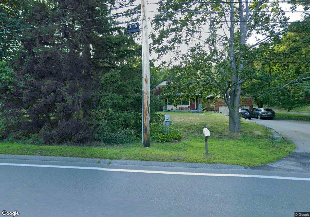
52 Powers Rd Littleton, MA 01460
Estimated Value: $660,000 - $704,109
About This Home
This home is located at 52 Powers Rd, Littleton, MA 01460 and is currently estimated at $682,777, approximately $418 per square foot. 52 Powers Rd is a home located in Middlesex County with nearby schools including Col John Robinson, John A. Crisafulli Elementary School, and Blanchard Middle School.
Ownership History
We collect this data history from publicly available records. To have your information removed, we recommend requesting removal directly through your county’s website.
Purchase Details
Purchase Details
Purchase History
We collect this data history from publicly available records. To have your information removed, we recommend requesting removal directly through your county’s website.
| Date | Buyer | Sale Price | Title Company |
|---|---|---|---|
| -- | -- | ||
| $142,500 | -- |
Mortgage History
We collect this data history from publicly available records. To have your information removed, we recommend requesting removal directly through your county’s website.
| Date | Status | Borrower | Loan Amount |
|---|---|---|---|
| Previous Owner | $25,100 |
Tax History
We collect this data history from publicly available records. To have your information removed, we recommend requesting removal directly through your county’s website.
| Year | Tax Paid | Tax Assessment Tax Assessment Total Assessment is a certain percentage of the fair market value that is determined by local assessors to be the total taxable value of land and additions on the property. | Land | Improvement |
|---|---|---|---|---|
| 2025 | $100 | $672,400 | $205,300 | $467,100 |
| 2024 | $9,389 | $632,700 | $209,300 | $423,400 |
| 2023 | $8,736 | $537,600 | $193,200 | $344,400 |
| 2022 | $8,269 | $466,900 | $193,200 | $273,700 |
| 2021 | $6,926 | $391,300 | $163,000 | $228,300 |
| 2020 | $6,648 | $374,100 | $156,300 | $217,800 |
| 2019 | $6,565 | $359,900 | $150,500 | $209,400 |
| 2018 | $5,587 | $308,000 | $154,400 | $153,600 |
| 2017 | $5,345 | $294,500 | $146,700 | $147,800 |
| 2016 | $5,201 | $294,000 | $146,700 | $147,300 |
| 2015 | $5,012 | $276,900 | $127,400 | $149,500 |
Map
- 84 Powers Rd
- 3 Pickard Ln
- 4 Meadow Dr
- 25 Laurel Rd
- 16 Lakeview Dr
- 16 Preservation Way
- 18 Ivy Rd
- 7 Banbury Dr
- Lot A-2 Durkee Ln
- 1 Partridge Ln
- 30 Dahlia Dr
- 3 Farmstead Way
- 3 Sydney Ln
- 37 Dogwood Rd
- 1 Village Ln
- 505 Tumbling Hawk Unit 505
- 559 Great Elm Way Unit 559
- 425 Great Elm Way Unit 425
- 484 Great Road -3
- 363 Great Rd
Ask me questions while you tour the home.