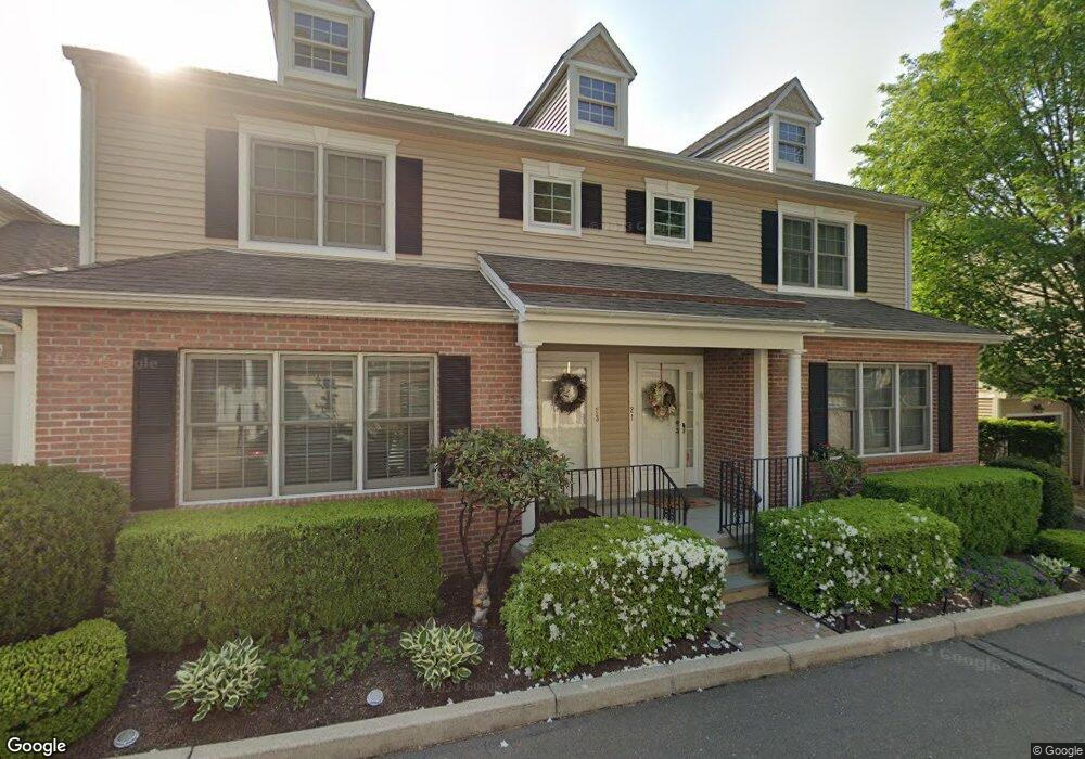
52 Redspire Ct Trumbull, CT 06611
Trumbull Center NeighborhoodEstimated Value: $523,000 - $615,000
3
Beds
2
Baths
2,028
Sq Ft
$289/Sq Ft
Est. Value
About This Home
This home is located at 52 Redspire Ct, Trumbull, CT 06611 and is currently estimated at $585,499, approximately $288 per square foot. 52 Redspire Ct is a home located in Fairfield County with nearby schools including Frenchtown Elementary School, Hillcrest Middle School, and Trumbull High School.
Ownership History
Date
Name
Owned For
Owner Type
Purchase Details
Closed on
Feb 28, 2024
Sold by
Banks Steven G and Banks Victoria
Bought by
Na Sangkook and Na Mina
Current Estimated Value
Home Financials for this Owner
Home Financials are based on the most recent Mortgage that was taken out on this home.
Original Mortgage
$378,350
Outstanding Balance
$372,021
Interest Rate
6.6%
Mortgage Type
Purchase Money Mortgage
Estimated Equity
$213,478
Purchase Details
Closed on
Dec 30, 2014
Sold by
Greta Sutphen Ret and Sutphen
Bought by
Banks Steven and Banks Victoria
Create a Home Valuation Report for This Property
The Home Valuation Report is an in-depth analysis detailing your home's value as well as a comparison with similar homes in the area
Home Values in the Area
Average Home Value in this Area
Purchase History
We collect this data history from publicly available records. To have your information removed, we recommend requesting removal directly through your county’s website.
| Date | Buyer | Sale Price | Title Company |
|---|---|---|---|
| Na Sangkook | $540,500 | None Available | |
| Banks Steven | -- | -- |
Source: Public Records
Mortgage History
We collect this data history from publicly available records. To have your information removed, we recommend requesting removal directly through your county’s website.
| Date | Status | Borrower | Loan Amount |
|---|---|---|---|
| Open | Na Sangkook | $378,350 |
Source: Public Records
Tax History
| Year | Tax Paid | Tax Assessment Tax Assessment Total Assessment is a certain percentage of the fair market value that is determined by local assessors to be the total taxable value of land and additions on the property. | Land | Improvement |
|---|---|---|---|---|
| 2025 | $8,704 | $235,760 | $0 | $235,760 |
| 2024 | $8,466 | $235,760 | $0 | $235,760 |
| 2023 | $8,329 | $235,760 | $0 | $235,760 |
| 2022 | $8,196 | $235,760 | $0 | $235,760 |
| 2021 | $7,704 | $214,900 | $0 | $214,900 |
| 2020 | $7,704 | $214,900 | $0 | $214,900 |
| 2018 | $7,514 | $214,900 | $0 | $214,900 |
| 2017 | $7,362 | $214,900 | $0 | $214,900 |
| 2016 | $7,214 | $214,900 | $0 | $214,900 |
| 2015 | $7,865 | $231,600 | $0 | $231,600 |
| 2014 | $7,696 | $231,600 | $0 | $231,600 |
Source: Public Records
Map
Nearby Homes
- 54 Redspire Ct Unit 54
- 12 Sunset Ave
- 35 Elberta Ave
- 7 Cedar Crest Rd
- 28 Grandview Dr
- 220 Algonquin Trail
- 26 Craig Ln
- 58 Daniels Farm Rd
- 5 Arrowhead Rd
- 22 Country Ln
- 1183 Old Town Rd
- 36 Lillian Dr
- 22 Larkspur Dr
- 45 Frenchtown Rd
- 75 Brookside Ave
- Lot 31 Valley View Rd
- 315 Church Hill Rd
- 715 Frenchtown Rd Unit 3
- 71 Sunshine Cir
- 286 Daniels Farm Rd
- 56 Redspire Ct
- 55 Redspire Ct
- 54 Redspire Ct
- 53 Redspire Ct
- 51 Redspire Ct
- 43 Hawthorne Ridge Cir
- 41 Hawthorne Ridge Cir
- 37 Hawthorne Ridge Cir
- 35 Hawthorne Ridge Cir
- 30 Hawthorne Ridge Cir
- 29 Hawthorne Ridge Cir
- 28 Hawthorne Ridge Cir
- 27 Hawthorne Ridge Cir
- 26 Hawthorne Ridge Cir
- 25 Hawthorne Ridge Cir
- 24 Hawthorne Ridge Cir
- 23 Hawthorne Ridge Cir
- 22 Hawthorne Ridge Cir
- 21 Hawthorne Ridge Cir
- 20 Hawthorne Ridge Cir
Your Personal Tour Guide
Ask me questions while you tour the home.