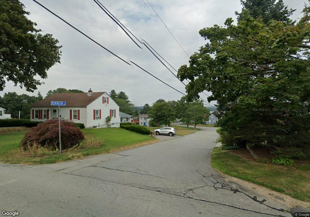
52 Remington Dr Somerset, MA 02726
Somerset Historic Village NeighborhoodEstimated Value: $481,000 - $609,000
3
Beds
2
Baths
1,364
Sq Ft
$396/Sq Ft
Est. Value
About This Home
This home is located at 52 Remington Dr, Somerset, MA 02726 and is currently estimated at $540,536, approximately $396 per square foot. 52 Remington Dr is a home located in Bristol County with nearby schools including North Elementary School and Somerset Middle School.
Ownership History
Date
Name
Owned For
Owner Type
Purchase Details
Closed on
Oct 17, 1994
Sold by
25 Bedford Corp
Bought by
Mays Wayne A and Mays Mary Jo
Current Estimated Value
Home Financials for this Owner
Home Financials are based on the most recent Mortgage that was taken out on this home.
Original Mortgage
$100,000
Interest Rate
8.43%
Mortgage Type
Purchase Money Mortgage
Create a Home Valuation Report for This Property
The Home Valuation Report is an in-depth analysis detailing your home's value as well as a comparison with similar homes in the area
Home Values in the Area
Average Home Value in this Area
Purchase History
| Date | Buyer | Sale Price | Title Company |
|---|---|---|---|
| Mays Wayne A | $135,000 | -- | |
| Mays Wayne A | $135,000 | -- |
Source: Public Records
Mortgage History
| Date | Status | Borrower | Loan Amount |
|---|---|---|---|
| Open | Mays Wayne A | $87,000 | |
| Closed | Mays Wayne A | $100,000 | |
| Previous Owner | Mays Wayne A | $141,500 |
Source: Public Records
Tax History
| Year | Tax Paid | Tax Assessment Tax Assessment Total Assessment is a certain percentage of the fair market value that is determined by local assessors to be the total taxable value of land and additions on the property. | Land | Improvement |
|---|---|---|---|---|
| 2025 | $5,926 | $445,600 | $186,400 | $259,200 |
| 2024 | $5,560 | $434,700 | $186,400 | $248,300 |
| 2023 | $4,875 | $384,500 | $162,100 | $222,400 |
| 2022 | $4,520 | $340,100 | $140,700 | $199,400 |
| 2021 | $4,563 | $310,800 | $127,700 | $183,100 |
| 2020 | $4,618 | $303,400 | $128,400 | $175,000 |
| 2019 | $5,221 | $286,100 | $128,400 | $157,700 |
| 2018 | $4,644 | $273,800 | $127,300 | $146,500 |
| 2017 | $4,534 | $260,600 | $121,400 | $139,200 |
| 2016 | $4,563 | $260,600 | $121,400 | $139,200 |
| 2015 | $4,270 | $246,100 | $116,000 | $130,100 |
| 2014 | $5,936 | $245,800 | $112,600 | $133,200 |
Source: Public Records
Map
Nearby Homes
- 526 Pleasant St
- 3200 County St Unit 11
- 97 Dublin St
- 259 Lynch Ave
- 989 Elm St
- 2617 Pleasant St
- 4700 N Main St Unit 1
- 258 Folsom Ave
- 5239 N Main St Unit 20
- 5065 N Main St Unit 2
- 107 Apple Creek Ln
- 65 Marvel St
- 8 Ferry Ln
- 3057 Clubhouse Dr Unit Model
- 5 Nottingham Cir
- 3753 N Main St Unit 2
- R65 Clubhouse Dr Unit 65
- 74R Club House Dr Unit 74R
- 73H Club House Dr Unit Lot 73H
- RR36 Club House Dr Unit Lot RR36
- 30 Remington Dr
- 70 Remington Dr
- 29 Remington Dr
- 10 Remington Dr
- 432 Pleasant St
- 414 Pleasant St
- 105 Sargent St
- 105 Sargent St Unit 1
- 450 Pleasant St
- 7 Remington Dr
- 108 Sargent St
- 168 Homer Dr
- 433 Pleasant St
- 392 Pleasant St
- 490 Pleasant St
- 370 Pleasant St
- 89 Sargent St
- 48 Sargent St
- 148 Homer Dr
- 109 Homer Dr
Your Personal Tour Guide
Ask me questions while you tour the home.