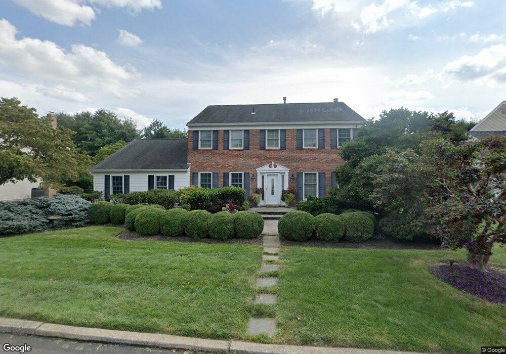
520 Denbign Rd Langhorne, PA 19047
Middletown AreaEstimated Value: $746,000 - $826,000
About This Home
This home is located at 520 Denbign Rd, Langhorne, PA 19047 and is currently estimated at $792,948, approximately $270 per square foot. 520 Denbign Rd is a home located in Bucks County with nearby schools including Pearl S. Buck Elementary School, Maple Point Middle School, and Neshaminy High School.
Ownership History
We collect this data history from publicly available records. To have your information removed, we recommend requesting removal directly through your county’s website.
Purchase Details
Purchase Details
Home Financials for this Owner
Home Financials are based on the most recent Mortgage that was taken out on this home.Home Values in the Area
Average Home Value in this Area
Purchase History
We collect this data history from publicly available records. To have your information removed, we recommend requesting removal directly through your county’s website.
| Date | Buyer | Sale Price | Title Company |
|---|---|---|---|
| -- | None Available | ||
| -- | None Available |
Mortgage History
We collect this data history from publicly available records. To have your information removed, we recommend requesting removal directly through your county’s website.
| Date | Status | Borrower | Loan Amount |
|---|---|---|---|
| Closed | $60,000 | ||
| Closed | $133,000 | ||
| Closed | $110,000 | ||
| Closed | $125,000 |
Tax History
We collect this data history from publicly available records. To have your information removed, we recommend requesting removal directly through your county’s website.
| Year | Tax Paid | Tax Assessment Tax Assessment Total Assessment is a certain percentage of the fair market value that is determined by local assessors to be the total taxable value of land and additions on the property. | Land | Improvement |
|---|---|---|---|---|
| 2026 | $10,655 | $46,700 | $6,480 | $40,220 |
| 2025 | $10,167 | $46,700 | $6,480 | $40,220 |
| 2024 | $10,167 | $46,700 | $6,480 | $40,220 |
| 2023 | $10,005 | $46,700 | $6,480 | $40,220 |
| 2022 | $9,743 | $46,700 | $6,480 | $40,220 |
| 2021 | $9,743 | $46,700 | $6,480 | $40,220 |
| 2020 | $9,626 | $46,700 | $6,480 | $40,220 |
| 2019 | $9,411 | $46,700 | $6,480 | $40,220 |
| 2018 | $9,238 | $46,700 | $6,480 | $40,220 |
| 2017 | $9,002 | $46,700 | $6,480 | $40,220 |
| 2016 | $9,002 | $46,700 | $6,480 | $40,220 |
| 2015 | $9,192 | $46,700 | $6,480 | $40,220 |
| 2014 | $9,192 | $46,700 | $6,480 | $40,220 |
Map
- 41 Apple Valley Dr
- 255 Pintail Ct
- 1475 Langhorne Yardley Rd
- 1475 Langhorne Yardley Rd
- 477 Trappe Ln
- 119 Bellflower Rd Unit V70
- 307 Starflower Ln Unit V68
- 11 Gunning Ln
- 244 Strawberry Cir
- 11108 Cornerstone Dr
- 7 Blue Flax Ln Unit 187
- 11201 Cornerstone Dr Unit 26
- 1519 Silver Lake Rd
- 14304 Cornerstone Dr Unit 169
- 2733 Village Rd
- 1805 Lynbrooke Dr Unit 152
- 8 Tupelo Ln
- 2703 Sterling Rd Unit 186
- 629 Bellflower Rd Unit V259
- 559 Palmer Farm Dr
Ask me questions while you tour the home.