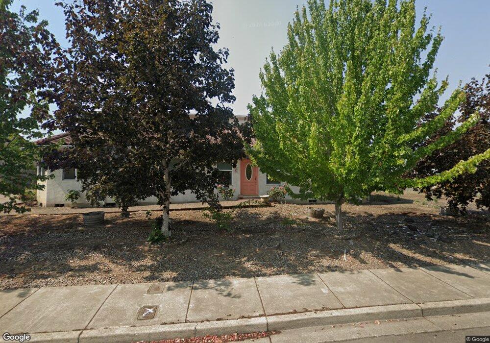
520 NW Blair Loop Sheridan, OR 97378
Estimated Value: $445,000 - $545,000
2
Beds
3
Baths
2,414
Sq Ft
$200/Sq Ft
Est. Value
About This Home
This home is located at 520 NW Blair Loop, Sheridan, OR 97378 and is currently estimated at $482,981, approximately $200 per square foot. 520 NW Blair Loop is a home located in Yamhill County with nearby schools including Faulconer-Chapman School, Sheridan High School, and Sheridan Allprep Academy.
Ownership History
Date
Name
Owned For
Owner Type
Purchase Details
Closed on
Jan 4, 2021
Sold by
Simbeck Carmen Lee
Bought by
Simbeck Carmen Lee and The Carmen Lee Simbeck Trust
Current Estimated Value
Purchase Details
Closed on
Feb 4, 2004
Sold by
Norse Woods/Hunters Glen Llc
Bought by
Simbeck Ramon and Simbeck Carmen
Home Financials for this Owner
Home Financials are based on the most recent Mortgage that was taken out on this home.
Original Mortgage
$224,200
Outstanding Balance
$109,436
Interest Rate
5.62%
Mortgage Type
Construction
Estimated Equity
$373,545
Create a Home Valuation Report for This Property
The Home Valuation Report is an in-depth analysis detailing your home's value as well as a comparison with similar homes in the area
Home Values in the Area
Average Home Value in this Area
Purchase History
| Date | Buyer | Sale Price | Title Company |
|---|---|---|---|
| Simbeck Carmen Lee | -- | None Available | |
| Simbeck Ramon | $50,000 | Western Title & Escrow Co |
Source: Public Records
Mortgage History
| Date | Status | Borrower | Loan Amount |
|---|---|---|---|
| Open | Simbeck Ramon | $224,200 |
Source: Public Records
Tax History
| Year | Tax Paid | Tax Assessment Tax Assessment Total Assessment is a certain percentage of the fair market value that is determined by local assessors to be the total taxable value of land and additions on the property. | Land | Improvement |
|---|---|---|---|---|
| 2025 | $4,223 | $311,561 | -- | -- |
| 2024 | $3,878 | $302,486 | -- | -- |
| 2023 | $3,766 | $293,676 | $0 | $0 |
| 2022 | $3,662 | $285,122 | $0 | $0 |
| 2021 | $4,145 | $276,817 | $0 | $0 |
| 2020 | $4,005 | $268,754 | $0 | $0 |
| 2019 | $3,934 | $260,926 | $0 | $0 |
| 2018 | $3,823 | $253,326 | $0 | $0 |
| 2017 | $3,752 | $245,948 | $0 | $0 |
| 2016 | $3,603 | $238,784 | $0 | $0 |
| 2015 | $3,466 | $231,832 | $0 | $0 |
| 2014 | $3,297 | $225,081 | $0 | $0 |
Source: Public Records
Map
Nearby Homes
- 364 NW Blair St
- 561 NW Evans St
- 0 NW Viola St
- 328 NW Sherman St
- 519 W Main St
- 220 NW Lincoln St
- 226 NW Sagan Loop
- 218 NW Sagan Loop
- 404 N Bridge St
- 617 SW Monroe St
- 18940 SW Canyon Rd
- 408 NE Faulconer St
- 819 W Main St
- 21000 SW Canyon Rd
- 410 SW Mill St
- 426 NE Hill St
- 518 S Bridge St
- 341 SW Madison St
- 1200 NE Center St
- 510 NE Hill St
- 502 NW Blair St
- 522 NW Blair Loop
- 524 NW Blair Loop
- 504 NW Blair St
- 526 NW Blair Loop
- 523 NW Blair Loop
- 521 NW Blair Loop
- 525 NW Blair Loop
- 505 NW Blair St
- 519 NW Blair Loop
- 509 NW Blair St
- 527 NW Blair Loop
- 503 NW Blair St
- 506 NW Blair St
- 530 NW Blair Loop
- 511 NW Blair St
- 529 NW Blair Loop
- 501 NW Blair St
- 378 NW Blair St
Your Personal Tour Guide
Ask me questions while you tour the home.