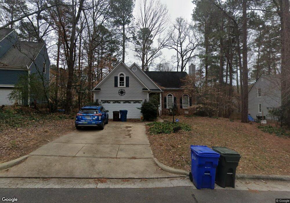
5201 Brookstone Dr Durham, NC 27713
Woodcroft NeighborhoodEstimated Value: $509,000 - $618,000
About This Home
This home is located at 5201 Brookstone Dr, Durham, NC 27713 and is currently estimated at $564,525, approximately $220 per square foot. 5201 Brookstone Dr is a home located in Durham County with nearby schools including Southwest Elementary School, Morehead Montessori, and Sherwood Githens Middle.
Ownership History
We collect this data history from publicly available records. To have your information removed, we recommend requesting removal directly through your county’s website.
Purchase Details
Home Financials for this Owner
Home Financials are based on the most recent Mortgage that was taken out on this home.Purchase Details
Home Financials for this Owner
Home Financials are based on the most recent Mortgage that was taken out on this home.Home Values in the Area
Average Home Value in this Area
Purchase History
We collect this data history from publicly available records. To have your information removed, we recommend requesting removal directly through your county’s website.
| Date | Buyer | Sale Price | Title Company |
|---|---|---|---|
| $290,000 | -- | ||
| $257,000 | None Available |
Mortgage History
We collect this data history from publicly available records. To have your information removed, we recommend requesting removal directly through your county’s website.
| Date | Status | Borrower | Loan Amount |
|---|---|---|---|
| Open | $265,567 | ||
| Previous Owner | $190,000 | ||
| Previous Owner | $25,000 |
Tax History
We collect this data history from publicly available records. To have your information removed, we recommend requesting removal directly through your county’s website.
| Year | Tax Paid | Tax Assessment Tax Assessment Total Assessment is a certain percentage of the fair market value that is determined by local assessors to be the total taxable value of land and additions on the property. | Land | Improvement |
|---|---|---|---|---|
| 2025 | $5,331 | $537,773 | $135,300 | $402,473 |
| 2024 | $4,548 | $326,058 | $55,215 | $270,843 |
| 2023 | $4,271 | $326,058 | $55,215 | $270,843 |
| 2022 | $4,173 | $326,058 | $55,215 | $270,843 |
| 2021 | $4,154 | $326,058 | $55,215 | $270,843 |
| 2020 | $4,056 | $326,058 | $55,215 | $270,843 |
| 2019 | $4,056 | $326,058 | $55,215 | $270,843 |
| 2018 | $3,975 | $293,037 | $42,945 | $250,092 |
| 2017 | $3,946 | $293,037 | $42,945 | $250,092 |
| 2016 | $3,813 | $293,037 | $42,945 | $250,092 |
| 2015 | $3,628 | $262,116 | $43,825 | $218,291 |
| 2014 | $3,628 | $262,116 | $43,825 | $218,291 |
Map
- 5305 Oakbrook Dr
- 3803 Chimney Ridge Place Unit 4
- 136 Long Shadow Place
- 3706 Chimney Ridge Place Unit 108
- 3704 Chimney Ridge Place Unit 207
- 4913 Harwood Ct
- 5 Briarfield Ct
- 9 Hickorywood Square
- 121 Weathersfield Dr
- 715 Sleepy Creek Dr
- 112 Hollow Oak Dr
- 5107 Bridgewood Dr
- 22 Preakness Dr
- 610 Cross Timbers Dr
- 15 Preakness Dr
- 7 Fox Chase Ln
- 616 Morningside Dr
- 54 Citation Dr
- 3913 Kettering Dr
- 708 Cross Timbers Dr
- 5203 Brookstone Dr
- 5113 Brookstone Dr
- 5218 Oakbrook Dr
- 5214 Oakbrook Dr
- 5205 Brookstone Dr
- 5222 Oakbrook Dr
- 5111 Brookstone Dr
- 5202 Brookstone Dr
- 5112 Brookstone Dr
- 5204 Brookstone Dr
- 5224 Oakbrook Dr
- 5210 Oakbrook Dr
- 5109 Brookstone Dr
- 5207 Brookstone Dr
- 5110 Brookstone Dr
- 5208 Oakbrook Dr
- 5210 Brookstone Dr
- 5302 Oakbrook Dr
- 5221 Oakbrook Dr
- 5217 Oakbrook Dr
Ask me questions while you tour the home.