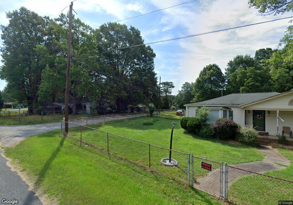
5201 Power Line St Kannapolis, NC 28081
Estimated Value: $176,281 - $259,000
2
Beds
1
Bath
864
Sq Ft
$237/Sq Ft
Est. Value
About This Home
This home is located at 5201 Power Line St, Kannapolis, NC 28081 and is currently estimated at $204,820, approximately $237 per square foot. 5201 Power Line St is a home located in Cabarrus County with nearby schools including Fred L. Wilson Elementary School, Kannapolis Middle, and A.L. Brown High School.
Ownership History
Date
Name
Owned For
Owner Type
Purchase Details
Closed on
Mar 21, 2026
Sold by
Hilliard Murphy and Hilliard Keenan B
Bought by
Hilliard Phillip
Current Estimated Value
Purchase Details
Closed on
Oct 4, 1999
Sold by
Barnhardt Cora Belle
Bought by
Barnhardt Bobby Glenn and Hilliard Lillie Barnhardt
Create a Home Valuation Report for This Property
The Home Valuation Report is an in-depth analysis detailing your home's value as well as a comparison with similar homes in the area
Home Values in the Area
Average Home Value in this Area
Purchase History
We collect this data history from publicly available records. To have your information removed, we recommend requesting removal directly through your county’s website.
| Date | Buyer | Sale Price | Title Company |
|---|---|---|---|
| Hilliard Phillip | $20,000 | None Listed On Document | |
| Barnhardt Bobby Glenn | -- | -- |
Source: Public Records
Tax History
| Year | Tax Paid | Tax Assessment Tax Assessment Total Assessment is a certain percentage of the fair market value that is determined by local assessors to be the total taxable value of land and additions on the property. | Land | Improvement |
|---|---|---|---|---|
| 2025 | $442 | $130,890 | $48,000 | $82,890 |
| 2024 | $442 | $130,890 | $48,000 | $82,890 |
| 2023 | $330 | $78,620 | $31,200 | $47,420 |
| 2022 | $330 | $78,620 | $31,200 | $47,420 |
| 2021 | $660 | $78,620 | $31,200 | $47,420 |
| 2020 | $330 | $78,620 | $31,200 | $47,420 |
| 2019 | $239 | $56,950 | $15,600 | $41,350 |
| 2018 | $234 | $56,950 | $15,600 | $41,350 |
| 2017 | $222 | $56,950 | $15,600 | $41,350 |
| 2016 | $209 | $59,180 | $18,000 | $41,180 |
| 2015 | -- | $59,180 | $18,000 | $41,180 |
| 2014 | -- | $59,180 | $18,000 | $41,180 |
Source: Public Records
Map
Nearby Homes
- 5953 Yale Ave
- 5921 Princeton Ave
- 6443 Roanoke Dr
- 0 Tanglewood Dr Unit CAR4382660
- 2273 Trail Ave
- 5620 Tuckaseegee Rd
- 5021 Athens St
- 5851 Tuckaseegee Rd
- 0 Rollingwood Dr Unit 43 and 44
- 5760 Turner Dr
- 115 Northcrest Dr
- 4268 Vincent St
- 117 S Enochville Ave
- 5033 Macon St
- 2403 W C St
- 5444 S Oakmont St Unit 7
- 6360 Pagemont Rd
- 6340 Pagemont Rd
- 6310 Pagemont Rd
- 6290 Pagemont Rd
- 5141 Woodside St
- 5211 Power Line St
- 6239 Sardis Ave
- 5125 Woodside St
- 5220 Power Line St
- 5260 Woodside St
- 5250 Woodside St
- 5132 Woodside St
- 5225 Power Line St
- 6212 Silas Ave
- 6236 Silas Ave
- 5119 Woodside St
- 6212 Sardis Ave
- 5266 Woodside St
- 5245 Power Line St
- 5126 Woodside St
- 6208 Silas Ave
- 5113 Woodside St
- 6211 Sardis Ave
- 6206 Silas Ave
Your Personal Tour Guide
Ask me questions while you tour the home.