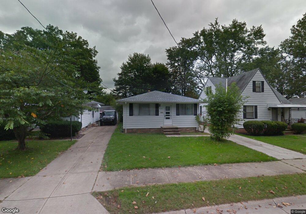
5209 Milo Ave Maple Heights, OH 44137
Estimated Value: $108,805 - $127,000
2
Beds
1
Bath
988
Sq Ft
$120/Sq Ft
Est. Value
About This Home
This home is located at 5209 Milo Ave, Maple Heights, OH 44137 and is currently estimated at $118,451, approximately $119 per square foot. 5209 Milo Ave is a home located in Cuyahoga County with nearby schools including Abraham Lincoln Elementary School, Rockside/ J.F. Kennedy School, and Barack Obama School.
Ownership History
Date
Name
Owned For
Owner Type
Purchase Details
Closed on
Jul 17, 2007
Sold by
Meckel Rose Marie and Meckel Richard K
Bought by
Rice Audrey L
Current Estimated Value
Home Financials for this Owner
Home Financials are based on the most recent Mortgage that was taken out on this home.
Original Mortgage
$67,000
Outstanding Balance
$40,971
Interest Rate
6.54%
Mortgage Type
Purchase Money Mortgage
Estimated Equity
$77,480
Purchase Details
Closed on
Nov 3, 2004
Sold by
Pirrone Helen C
Bought by
Meckel Rose Marie
Purchase Details
Closed on
Jul 18, 1988
Sold by
Pirrone Helen C
Bought by
Pirrone Helen C
Purchase Details
Closed on
Jan 1, 1975
Bought by
Pirrone Helen C
Create a Home Valuation Report for This Property
The Home Valuation Report is an in-depth analysis detailing your home's value as well as a comparison with similar homes in the area
Home Values in the Area
Average Home Value in this Area
Purchase History
We collect this data history from publicly available records. To have your information removed, we recommend requesting removal directly through your county’s website.
| Date | Buyer | Sale Price | Title Company |
|---|---|---|---|
| Rice Audrey L | $67,000 | Ohio Title Corp | |
| Meckel Rose Marie | -- | -- | |
| Pirrone Helen C | -- | -- | |
| Pirrone Helen C | -- | -- |
Source: Public Records
Mortgage History
We collect this data history from publicly available records. To have your information removed, we recommend requesting removal directly through your county’s website.
| Date | Status | Borrower | Loan Amount |
|---|---|---|---|
| Open | Rice Audrey L | $67,000 |
Source: Public Records
Tax History
| Year | Tax Paid | Tax Assessment Tax Assessment Total Assessment is a certain percentage of the fair market value that is determined by local assessors to be the total taxable value of land and additions on the property. | Land | Improvement |
|---|---|---|---|---|
| 2025 | $2,902 | $35,770 | $7,000 | $28,770 |
| 2024 | $3,224 | $35,770 | $7,000 | $28,770 |
| 2023 | $2,666 | $18,760 | $3,710 | $15,050 |
| 2022 | $2,053 | $18,760 | $3,710 | $15,050 |
| 2021 | $2,185 | $18,760 | $3,710 | $15,050 |
| 2020 | $1,875 | $14,210 | $2,800 | $11,410 |
| 2019 | $1,863 | $40,600 | $8,000 | $32,600 |
| 2018 | $1,766 | $14,210 | $2,800 | $11,410 |
| 2017 | $1,819 | $13,580 | $3,570 | $10,010 |
| 2016 | $1,759 | $13,580 | $3,570 | $10,010 |
| 2015 | $1,662 | $13,580 | $3,570 | $10,010 |
| 2014 | $1,662 | $14,010 | $3,680 | $10,330 |
Source: Public Records
Map
Nearby Homes
- 5197 Milo Ave
- 14417 Maple Ave
- 14510 Granger Rd
- 14512 Granger Rd
- 13917 Wolf Ave
- 4955 E 141st St
- 5360 E 131st St
- 15413 Raymond St
- 5137 Miller Ave
- 13019 Darlington Ave
- 13009 Darlington Ave
- 5036 Claremont Blvd
- 13402 Shady Oak Blvd
- 12328 Granger Rd
- 13203 Woodward Blvd
- 16029 Friend Ave
- 12304 Tonsing Dr
- 4816 E 135th St
- 16101 Raymond St
- 12328 Park Knoll Dr
Your Personal Tour Guide
Ask me questions while you tour the home.