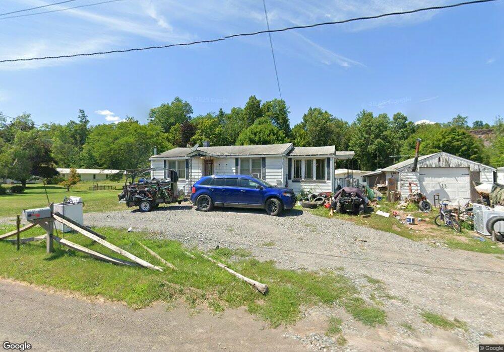
523 Springbrook Dr Canton, PA 17724
Estimated Value: $93,528 - $165,000
2
Beds
3
Baths
--
Sq Ft
41,818
Sq Ft Lot
About This Home
This home is located at 523 Springbrook Dr, Canton, PA 17724 and is currently estimated at $120,382. 523 Springbrook Dr is a home located in Bradford County with nearby schools including Canton Area Elementary School and Canton Junior/Senior High School.
Ownership History
Date
Name
Owned For
Owner Type
Purchase Details
Closed on
Nov 2, 2007
Sold by
Case Virginia L and Lawrence Case M
Bought by
Preston Donald and Preston Cindy
Current Estimated Value
Home Financials for this Owner
Home Financials are based on the most recent Mortgage that was taken out on this home.
Original Mortgage
$59,920
Outstanding Balance
$37,990
Interest Rate
6.42%
Mortgage Type
New Conventional
Estimated Equity
$82,392
Create a Home Valuation Report for This Property
The Home Valuation Report is an in-depth analysis detailing your home's value as well as a comparison with similar homes in the area
Purchase History
| Date | Buyer | Sale Price | Title Company |
|---|---|---|---|
| Preston Donald | $74,900 | None Available |
Source: Public Records
Mortgage History
| Date | Status | Borrower | Loan Amount |
|---|---|---|---|
| Open | Preston Donald | $59,920 |
Source: Public Records
Tax History
| Year | Tax Paid | Tax Assessment Tax Assessment Total Assessment is a certain percentage of the fair market value that is determined by local assessors to be the total taxable value of land and additions on the property. | Land | Improvement |
|---|---|---|---|---|
| 2025 | $943 | $17,000 | $0 | $0 |
| 2024 | $906 | $17,000 | $0 | $0 |
| 2023 | $906 | $17,000 | $0 | $0 |
| 2022 | $896 | $17,000 | $0 | $0 |
| 2021 | $897 | $17,000 | $0 | $0 |
| 2020 | $887 | $17,000 | $0 | $0 |
| 2019 | $886 | $17,000 | $0 | $0 |
| 2018 | $848 | $17,000 | $0 | $0 |
| 2017 | $836 | $17,000 | $0 | $0 |
| 2016 | -- | $17,000 | $0 | $0 |
| 2015 | -- | $17,000 | $0 | $0 |
| 2014 | $339 | $17,000 | $0 | $0 |
Source: Public Records
Map
Nearby Homes
- 55 Clinton St
- 49-51 T-329
- 374 S Minnequa Ave
- 20 E South Ave
- 94 N Center St
- 160 N Center St
- 108 S Washington St
- 85 N Minnequa Ave
- 386 Troy St
- 151 Montague St
- 490 N Center St
- 7129 Route 14
- 203 De-Morgan Acres Ln
- 14751 Route 14
- 15130 Route 14
- 13632 Route 414
- 12240 Route 154
- 2537 Ogdensburg Rd
- PARCEL 030 Glory Ridge Rd
- Parc 030 Glory Ridge Rd
- 477 Springbrook Dr
- 551 Springbrook Dr
- 571 Springbrook Dr
- 420 Springbrook Dr
- 610 Springbrook Dr
- 613 Springbrook Dr
- 5860 Rr1 Box
- 417 Springbrook Dr
- 628 Springbrook Dr
- 637 Springbrook Dr
- 385 Springbrook Dr
- 652 Springbrook Dr
- 673 Springbrook Dr
- 697 Springbrook Dr
- 673 W South Ave Unit 689
- Lot 46
- 283 Springbrook Dr
- 615 W South Ave
- 620 Lycoming St
- 241 Springbrook Dr
Your Personal Tour Guide
Ask me questions while you tour the home.