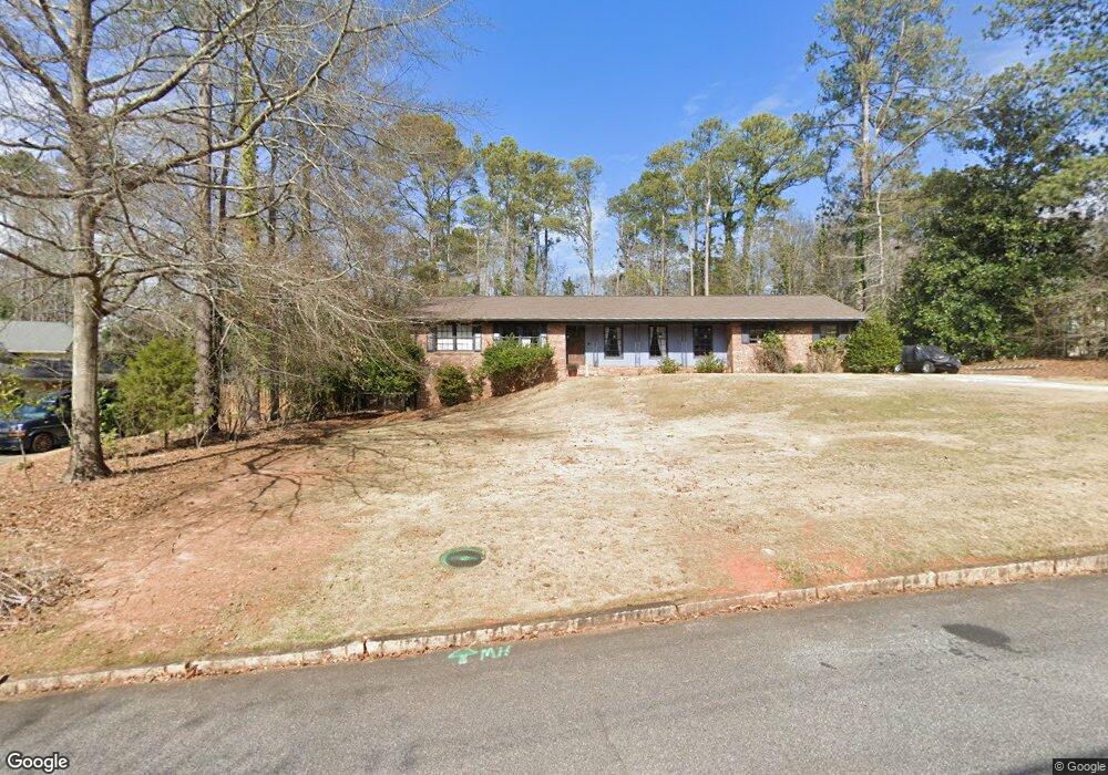
525 Forest Rd Athens, GA 30605
Green - Crestwood NeighborhoodEstimated Value: $297,000 - $400,000
3
Beds
2
Baths
1,636
Sq Ft
$219/Sq Ft
Est. Value
About This Home
This home is located at 525 Forest Rd, Athens, GA 30605 and is currently estimated at $358,042, approximately $218 per square foot. 525 Forest Rd is a home located in Clarke County with nearby schools including Barnett Shoals Elementary School, Hilsman Middle School, and Cedar Shoals High School.
Ownership History
Date
Name
Owned For
Owner Type
Purchase Details
Closed on
Aug 17, 2009
Sold by
Smith Brian Charles
Bought by
Lookofsky Kathryn A
Current Estimated Value
Home Financials for this Owner
Home Financials are based on the most recent Mortgage that was taken out on this home.
Original Mortgage
$155,138
Outstanding Balance
$100,219
Interest Rate
5.11%
Mortgage Type
FHA
Estimated Equity
$257,823
Purchase Details
Closed on
Mar 31, 1999
Sold by
Brown J Glenn
Bought by
Smith Brian Charles and Smith Valarie M
Purchase Details
Closed on
Aug 7, 1998
Sold by
Elder Willie Jo
Bought by
Brown J Glenn
Create a Home Valuation Report for This Property
The Home Valuation Report is an in-depth analysis detailing your home's value as well as a comparison with similar homes in the area
Home Values in the Area
Average Home Value in this Area
Purchase History
We collect this data history from publicly available records. To have your information removed, we recommend requesting removal directly through your county’s website.
| Date | Buyer | Sale Price | Title Company |
|---|---|---|---|
| Lookofsky Kathryn A | $158,000 | -- | |
| Smith Brian Charles | $102,000 | -- | |
| Brown J Glenn | $81,000 | -- |
Source: Public Records
Mortgage History
We collect this data history from publicly available records. To have your information removed, we recommend requesting removal directly through your county’s website.
| Date | Status | Borrower | Loan Amount |
|---|---|---|---|
| Open | Lookofsky Kathryn A | $155,138 |
Source: Public Records
Tax History
| Year | Tax Paid | Tax Assessment Tax Assessment Total Assessment is a certain percentage of the fair market value that is determined by local assessors to be the total taxable value of land and additions on the property. | Land | Improvement |
|---|---|---|---|---|
| 2025 | $3,386 | $132,343 | $14,000 | $118,343 |
| 2024 | $3,386 | $113,685 | $14,000 | $99,685 |
| 2023 | $2,181 | $104,789 | $14,000 | $90,789 |
| 2022 | $2,640 | $92,751 | $14,000 | $78,751 |
| 2021 | $2,326 | $79,013 | $13,000 | $66,013 |
| 2020 | $2,169 | $74,372 | $13,000 | $61,372 |
| 2019 | $2,001 | $68,940 | $12,000 | $56,940 |
| 2018 | $1,805 | $63,169 | $12,000 | $51,169 |
| 2017 | $1,604 | $57,259 | $12,000 | $45,259 |
| 2016 | $1,502 | $54,234 | $12,000 | $42,234 |
| 2015 | $1,494 | $53,932 | $12,000 | $41,932 |
| 2014 | $1,524 | $54,748 | $12,000 | $42,748 |
Source: Public Records
Map
Nearby Homes
- 160 Tara Place
- 535 Brookwood Dr
- 155 Crestwood Dr
- 625 Forest Rd
- 352 Greencrest Dr
- 140 Ashbrook Dr
- 285 Ashbrook Dr Unit Lot 1
- 283 Ashbrook Dr Unit Lot 2
- 281 Ashbrook Dr Unit Lot 3
- 279 Ashbrook Dr Unit Lot 4
- 225 Greencrest Dr
- 121 Ashbrook Dr
- 135 Mcduffie Dr
- 1305 Cedar Shoals Dr Unit 501
- 1305 Cedar Shoals Dr Unit 201
- 1305 Cedar Shoals Dr Unit 500
- 1325 Cedar Shoals Dr Unit 1000
- 129 Mcduffie Dr
- 1283 Cedar Shoals Dr
- 190 Curtis Dr
Your Personal Tour Guide
Ask me questions while you tour the home.