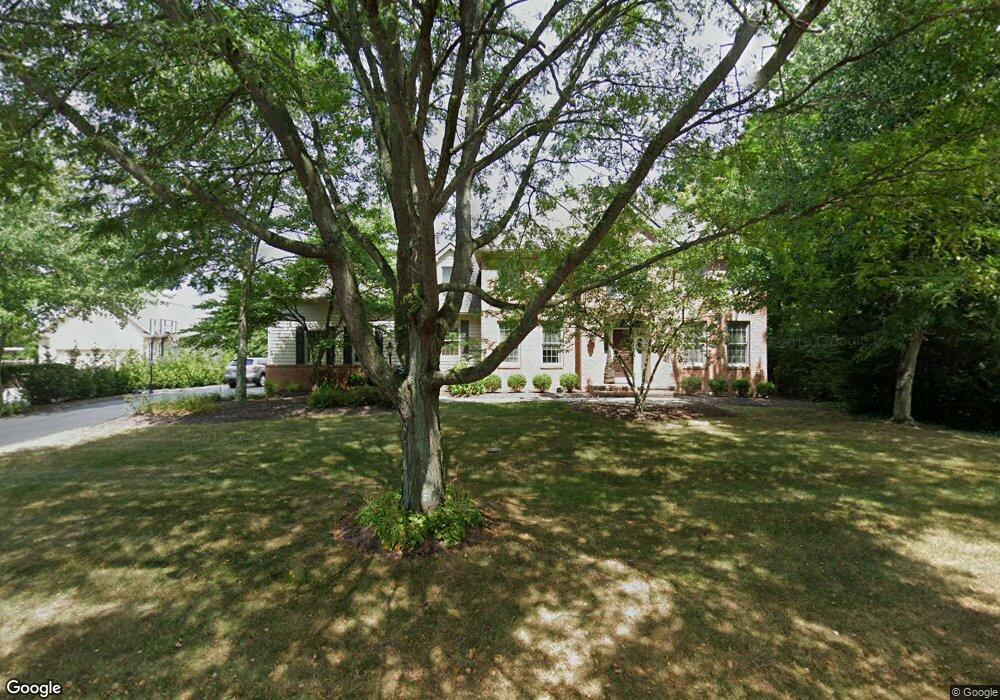
5256 Sheffield Ave Powell, OH 43065
Estimated Value: $800,917 - $900,000
4
Beds
3
Baths
3,115
Sq Ft
$273/Sq Ft
Est. Value
About This Home
This home is located at 5256 Sheffield Ave, Powell, OH 43065 and is currently estimated at $851,229, approximately $273 per square foot. 5256 Sheffield Ave is a home located in Delaware County with nearby schools including Scioto Ridge Elementary School, Olentangy Liberty Middle School, and Olentangy Liberty High School.
Ownership History
Date
Name
Owned For
Owner Type
Purchase Details
Closed on
Sep 21, 2005
Sold by
Collver Laurel L and Michael Collver J
Bought by
Adams Shawn A and Adams Noelle P
Current Estimated Value
Home Financials for this Owner
Home Financials are based on the most recent Mortgage that was taken out on this home.
Original Mortgage
$301,000
Interest Rate
5.93%
Mortgage Type
Fannie Mae Freddie Mac
Create a Home Valuation Report for This Property
The Home Valuation Report is an in-depth analysis detailing your home's value as well as a comparison with similar homes in the area
Home Values in the Area
Average Home Value in this Area
Purchase History
| Date | Buyer | Sale Price | Title Company |
|---|---|---|---|
| Adams Shawn A | $427,000 | Crown Title |
Source: Public Records
Mortgage History
| Date | Status | Borrower | Loan Amount |
|---|---|---|---|
| Closed | Adams Shawn A | $301,000 |
Source: Public Records
Tax History
| Year | Tax Paid | Tax Assessment Tax Assessment Total Assessment is a certain percentage of the fair market value that is determined by local assessors to be the total taxable value of land and additions on the property. | Land | Improvement |
|---|---|---|---|---|
| 2024 | $12,464 | $235,280 | $63,530 | $171,750 |
| 2023 | $12,512 | $235,280 | $63,530 | $171,750 |
| 2022 | $10,804 | $160,800 | $48,130 | $112,670 |
| 2021 | $10,869 | $160,800 | $48,130 | $112,670 |
| 2020 | $10,921 | $160,800 | $48,130 | $112,670 |
| 2019 | $10,002 | $155,440 | $48,130 | $107,310 |
| 2018 | $10,183 | $155,440 | $48,130 | $107,310 |
| 2017 | $9,527 | $146,450 | $44,350 | $102,100 |
| 2016 | $10,076 | $146,450 | $44,350 | $102,100 |
| 2015 | $9,112 | $146,450 | $44,350 | $102,100 |
| 2014 | $9,238 | $146,450 | $44,350 | $102,100 |
| 2013 | $9,259 | $143,470 | $44,350 | $99,120 |
Source: Public Records
Map
Nearby Homes
- 10669 Riverside Dr
- 4876 Paddington Way
- 4840 Paddington Way
- 8219 Campden Lakes Blvd
- 10618 Riverside Dr
- 8236 Campden Lakes Blvd
- 10542 Wellington Blvd
- 5000 Deer Run Dr
- 7985 Riverside Dr
- 4552 N Hampton Dr
- 5119 Reserve Dr
- 5314 Hawthornden Ct
- 10417 Cambridge Place
- 8589 Crail Ct
- 4650 Chatham Ct
- 4933 Emerald Lakes Blvd Unit 4903
- 3910 Summit View Rd
- 4545 Dunleary Dr
- 9821 Oxford Cir
- 10010 Beckford Ct
- 5234 Sheffield Ave
- 5272 Sheffield Ave
- 53653 Sheffield Ave
- 5253 Sheffield Ave
- 5212 Sheffield Ave
- 5225 Sheffield Ave
- 5245 Woodbridge Ave
- 5281 Sheffield Ave
- 5221 Woodbridge Ave
- 5263 Woodbridge Ave
- 5199 Woodbridge Ave
- 5196 Sheffield Ave
- 5314 Sheffield Ave
- 5345 Stockton Ct
- 5307 Sheffield Ave
- 10953 Hastings Ln
- 5258 Brighton Place
- 5279 Woodbridge Ave
- 10947 Hastings Ln
- 5232 Brighton Place
Your Personal Tour Guide
Ask me questions while you tour the home.