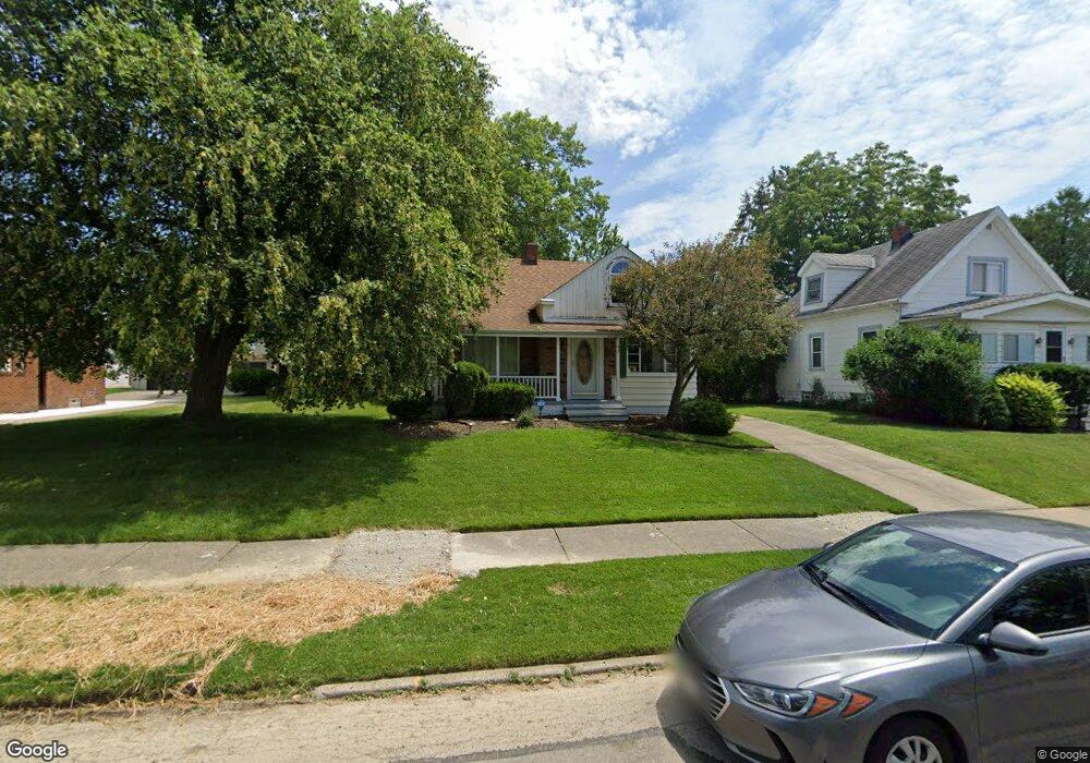
5259 Thomas St Maple Heights, OH 44137
Estimated Value: $116,076 - $158,000
3
Beds
1
Bath
1,253
Sq Ft
$109/Sq Ft
Est. Value
About This Home
This home is located at 5259 Thomas St, Maple Heights, OH 44137 and is currently estimated at $137,019, approximately $109 per square foot. 5259 Thomas St is a home located in Cuyahoga County with nearby schools including Abraham Lincoln Elementary School, Rockside/ J.F. Kennedy School, and Barack Obama School.
Ownership History
Date
Name
Owned For
Owner Type
Purchase Details
Closed on
Oct 2, 1998
Sold by
Gustely David B
Bought by
Woodall Angela M
Current Estimated Value
Home Financials for this Owner
Home Financials are based on the most recent Mortgage that was taken out on this home.
Original Mortgage
$81,600
Outstanding Balance
$15,328
Interest Rate
6.98%
Estimated Equity
$121,691
Purchase Details
Closed on
Jan 31, 1986
Sold by
Stevenson Carl
Bought by
Gustely David B
Purchase Details
Closed on
Sep 6, 1985
Sold by
Stevenson Lyndia
Bought by
Stevenson Carl
Purchase Details
Closed on
May 5, 1976
Sold by
Seminuk George T
Bought by
Stevenson Lyndia
Purchase Details
Closed on
Sep 24, 1975
Sold by
Seminuk Geroge T
Bought by
Seminuk George T
Purchase Details
Closed on
Jan 1, 1975
Sold by
Seminuk Geroge T
Bought by
Seminuk Geroge T
Create a Home Valuation Report for This Property
The Home Valuation Report is an in-depth analysis detailing your home's value as well as a comparison with similar homes in the area
Home Values in the Area
Average Home Value in this Area
Purchase History
| Date | Buyer | Sale Price | Title Company |
|---|---|---|---|
| Woodall Angela M | $85,900 | National Title Agency | |
| Gustely David B | $43,400 | -- | |
| Stevenson Carl | -- | -- | |
| Stevenson Lyndia | -- | -- | |
| Seminuk George T | -- | -- | |
| Seminuk Geroge T | -- | -- |
Source: Public Records
Mortgage History
| Date | Status | Borrower | Loan Amount |
|---|---|---|---|
| Open | Woodall Angela M | $81,600 |
Source: Public Records
Tax History
| Year | Tax Paid | Tax Assessment Tax Assessment Total Assessment is a certain percentage of the fair market value that is determined by local assessors to be the total taxable value of land and additions on the property. | Land | Improvement |
|---|---|---|---|---|
| 2025 | $2,179 | $35,665 | $7,245 | $28,420 |
| 2024 | $2,437 | $35,665 | $7,245 | $28,420 |
| 2023 | $2,377 | $22,270 | $4,380 | $17,890 |
| 2022 | $2,369 | $22,260 | $4,380 | $17,890 |
| 2021 | $2,525 | $22,260 | $4,380 | $17,890 |
| 2020 | $2,158 | $16,870 | $3,330 | $13,550 |
| 2019 | $2,146 | $48,200 | $9,500 | $38,700 |
| 2018 | $2,018 | $16,870 | $3,330 | $13,550 |
| 2017 | $2,053 | $15,750 | $3,080 | $12,670 |
| 2016 | $1,987 | $15,750 | $3,080 | $12,670 |
| 2015 | $1,989 | $15,750 | $3,080 | $12,670 |
| 2014 | $1,989 | $17,330 | $3,400 | $13,930 |
Source: Public Records
Map
Nearby Homes
- 5231 Philip Ave
- 5177 Cato St
- 5246 Philip Ave
- 5150 Arch St
- 5234 Erwin St
- 5127 Erwin St
- 17409 Mapleboro Ave
- 5100 Erwin St
- 5031 Cato St
- 18715 Libby Rd
- 17005 Mapleboro Ave
- 17282 Mccracken Rd
- 5341 Hollywood Ave
- 5481 Dalewood Ave
- 18840 Nitra Ave
- 18909 Maple Heights Blvd
- 18217 Edinboro Ave
- 5194 Homewood Ave
- 18851 Raymond St
- 5408 Oakwood Ave
- 5261 Thomas St
- 5251 Thomas St
- 5245 Thomas St
- 5243 Thomas St
- 5248 Cato St
- 17707 Libby Rd
- 17703 Libby Rd Unit 4
- 17703 Libby Rd Unit 6
- 17703 Libby Rd Unit 3
- 17703 Libby Rd Unit 7
- 17703 Libby Rd Unit 11
- 17703 Libby Rd Unit 9
- 17703 Libby Rd Unit 12
- 17703 Libby Rd Unit 2
- 17703 Libby Rd Unit 1
- 17703 Libby Rd
- 5244 Cato St
- 5262 Thomas St
- 5254 Thomas St
- 5237 Thomas St
Your Personal Tour Guide
Ask me questions while you tour the home.