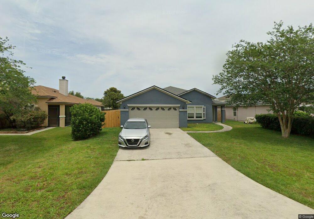
526 Mackenzie Cir Saint Augustine, FL 32092
Estimated Value: $364,583 - $395,000
4
Beds
2
Baths
1,937
Sq Ft
$194/Sq Ft
Est. Value
About This Home
This home is located at 526 Mackenzie Cir, Saint Augustine, FL 32092 and is currently estimated at $375,896, approximately $194 per square foot. 526 Mackenzie Cir is a home located in St. Johns County with nearby schools including Picolata Crossing Elementary School, Pacetti Bay Middle School, and Mill Creek Baptist Christian Academy.
Ownership History
Date
Name
Owned For
Owner Type
Purchase Details
Closed on
Feb 25, 2004
Sold by
Kb Home Jacksonville Llc
Bought by
Taylor Sylvia D
Current Estimated Value
Home Financials for this Owner
Home Financials are based on the most recent Mortgage that was taken out on this home.
Original Mortgage
$126,336
Outstanding Balance
$61,431
Interest Rate
6.25%
Mortgage Type
Purchase Money Mortgage
Estimated Equity
$314,465
Create a Home Valuation Report for This Property
The Home Valuation Report is an in-depth analysis detailing your home's value as well as a comparison with similar homes in the area
Purchase History
| Date | Buyer | Sale Price | Title Company |
|---|---|---|---|
| Taylor Sylvia D | $158,000 | Multiple |
Source: Public Records
Mortgage History
| Date | Status | Borrower | Loan Amount |
|---|---|---|---|
| Open | Taylor Sylvia D | $126,336 | |
| Closed | Taylor Sylvia D | $31,584 |
Source: Public Records
Tax History
| Year | Tax Paid | Tax Assessment Tax Assessment Total Assessment is a certain percentage of the fair market value that is determined by local assessors to be the total taxable value of land and additions on the property. | Land | Improvement |
|---|---|---|---|---|
| 2025 | $1,438 | $140,595 | -- | -- |
| 2024 | $1,438 | $136,633 | -- | -- |
| 2023 | $1,438 | $132,653 | $0 | $0 |
| 2022 | $1,381 | $128,789 | $0 | $0 |
| 2021 | $1,363 | $125,038 | $0 | $0 |
| 2020 | $1,355 | $123,312 | $0 | $0 |
| 2019 | $1,368 | $120,540 | $0 | $0 |
| 2018 | $1,343 | $118,292 | $0 | $0 |
| 2017 | $1,334 | $115,859 | $0 | $0 |
| 2016 | $1,329 | $116,880 | $0 | $0 |
| 2015 | $1,348 | $116,068 | $0 | $0 |
| 2014 | $1,349 | $115,147 | $0 | $0 |
Source: Public Records
Map
Nearby Homes
- 1314 Ardmore St
- 1315 Ardmore St
- 1194 Ardmore St
- 861 Mackenzie Cir
- 3737 Berenstain Dr
- 4208 S Franklinia St
- 3541 Pacetti Rd
- 36 Sunberry Way
- 2844 Oakgrove Ave
- 49 Sunberry Way
- 80 Oak Cluster Ln
- 2498 Trailmark Dr
- 64 Oak Cluster Ln
- 448 Bostwick Cir
- 3533 Crest St
- 2624 Oakgrove Ave
- 5220 Comfort Ct
- 214 Pepperpike Way
- 4636 Tuscan Wood Ct
- 4640 Tuscan Wood Ct
- 530 Mackenzie Cir
- 522 Mackenzie Cir
- 1417 Heather
- 1417 Heather Ct
- 1413 Heather Ct
- 518 Mackenzie Cir
- 534 Mackenzie Cir
- 1421 Heather Ct
- 1409 Heather Ct
- 525 Mackenzie Cir
- 1425 Heather Ct
- 529 Mackenzie Cir
- 538 Mackenzie Cir
- 514 Mackenzie Cir
- 1405 Heather Ct
- 533 Mackenzie Cir
- 517 Mackenzie Cir
- 1429 Heather Ct
- 537 Mackenzie Cir
- 542 Mackenzie Cir
Your Personal Tour Guide
Ask me questions while you tour the home.