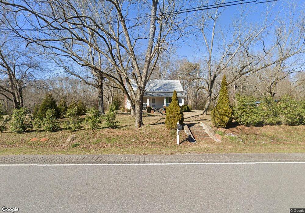
5281 Highway 72 E Carlton, GA 30627
Estimated Value: $121,000 - $249,000
Studio
2
Baths
1,308
Sq Ft
$153/Sq Ft
Est. Value
About This Home
This home is located at 5281 Highway 72 E, Carlton, GA 30627 and is currently estimated at $200,349, approximately $153 per square foot. 5281 Highway 72 E is a home located in Madison County with nearby schools including Madison County High School.
Ownership History
Date
Name
Owned For
Owner Type
Purchase Details
Closed on
Apr 27, 2015
Sold by
Harris Janice
Bought by
Floyd Brent Michael
Current Estimated Value
Home Financials for this Owner
Home Financials are based on the most recent Mortgage that was taken out on this home.
Original Mortgage
$86,632
Outstanding Balance
$66,427
Interest Rate
3.79%
Mortgage Type
New Conventional
Estimated Equity
$133,922
Purchase Details
Closed on
Dec 21, 2006
Sold by
Kristin Barbara Pavone
Bought by
Janis Kristin Barbara Pavone and Janis Kristin Harris
Purchase Details
Closed on
Nov 28, 2005
Sold by
Bridges Nancy Hart
Bought by
Janis Kristin Barbara Pavone and Janis Kristin Harris
Purchase Details
Closed on
Jan 1, 1981
Bought by
Bridges Nancy Hart
Create a Home Valuation Report for This Property
The Home Valuation Report is an in-depth analysis detailing your home's value as well as a comparison with similar homes in the area
Purchase History
| Date | Buyer | Sale Price | Title Company |
|---|---|---|---|
| Floyd Brent Michael | $84,900 | -- | |
| Janis Kristin Barbara Pavone | -- | -- | |
| Janis Kristin Barbara Pavone | $40,000 | -- | |
| Bridges Nancy Hart | -- | -- |
Source: Public Records
Mortgage History
| Date | Status | Borrower | Loan Amount |
|---|---|---|---|
| Open | Floyd Brent Michael | $86,632 |
Source: Public Records
Tax History
| Year | Tax Paid | Tax Assessment Tax Assessment Total Assessment is a certain percentage of the fair market value that is determined by local assessors to be the total taxable value of land and additions on the property. | Land | Improvement |
|---|---|---|---|---|
| 2025 | $1,174 | $44,174 | $14,168 | $30,006 |
| 2024 | $11 | $43,126 | $14,168 | $28,958 |
| 2023 | $1,319 | $38,667 | $11,806 | $26,861 |
| 2022 | $885 | $31,854 | $8,118 | $23,736 |
| 2021 | $742 | $23,641 | $8,118 | $15,523 |
| 2020 | $705 | $22,461 | $6,938 | $15,523 |
| 2019 | $777 | $24,320 | $7,632 | $16,688 |
| 2018 | $728 | $22,838 | $6,982 | $15,856 |
| 2017 | $680 | $21,132 | $5,903 | $15,229 |
| 2016 | $524 | $18,070 | $5,370 | $12,700 |
| 2015 | $543 | $18,100 | $5,400 | $12,700 |
| 2014 | $550 | $18,296 | $5,616 | $12,680 |
| 2013 | -- | $18,296 | $5,616 | $12,680 |
Source: Public Records
Map
Nearby Homes
- 670 S Railroad Ave
- 88 S Railroad Ave
- 6367 Highway 72 E
- 825 New Town Church Rd
- 3614 Georgia 72
- 376 Paoli Rd
- 275 Emma Cooper Rd
- 295 Berkeley Rd
- 217 Broad River Rd
- 2987 Georgia 72
- 00 River Rd
- 737 Broad River Rd
- 0 River Rd Unit 10639917
- 2224 Osley Mill Rd
- 2975 Georgia 72
- 0 Osley Mill Rd Unit 10671196
- 109 Mill Run
- 1163 Nickville Rd
- 1584 Lexington Carlton Rd
- 0 Clairmont Ave Unit 10700774
- 5281 Georgia 72
- 0 Highway 72 Unit 7141058
- 0 Highway 72 Unit 6807069
- 0 Highway 72 Unit 8687412
- 0 Highway 72 Unit 8562558
- 5281 Hwy 72e
- 5303 Highway 72 E
- 817 S Railroad Ave
- 755 S Railroad Ave
- BlockH/L S Railroad Ave
- S S Railroad Ave
- 715 S Railroad Ave
- 836 S Railroad Ave
- 27 North St
- 5391 Highway 72 E
- 5391 Highway 72 E
- 697 S Railroad Ave
- 884 S Railroad Ave
- 790 S Railroad Ave
- 904 S Railroad Ave
Your Personal Tour Guide
Ask me questions while you tour the home.