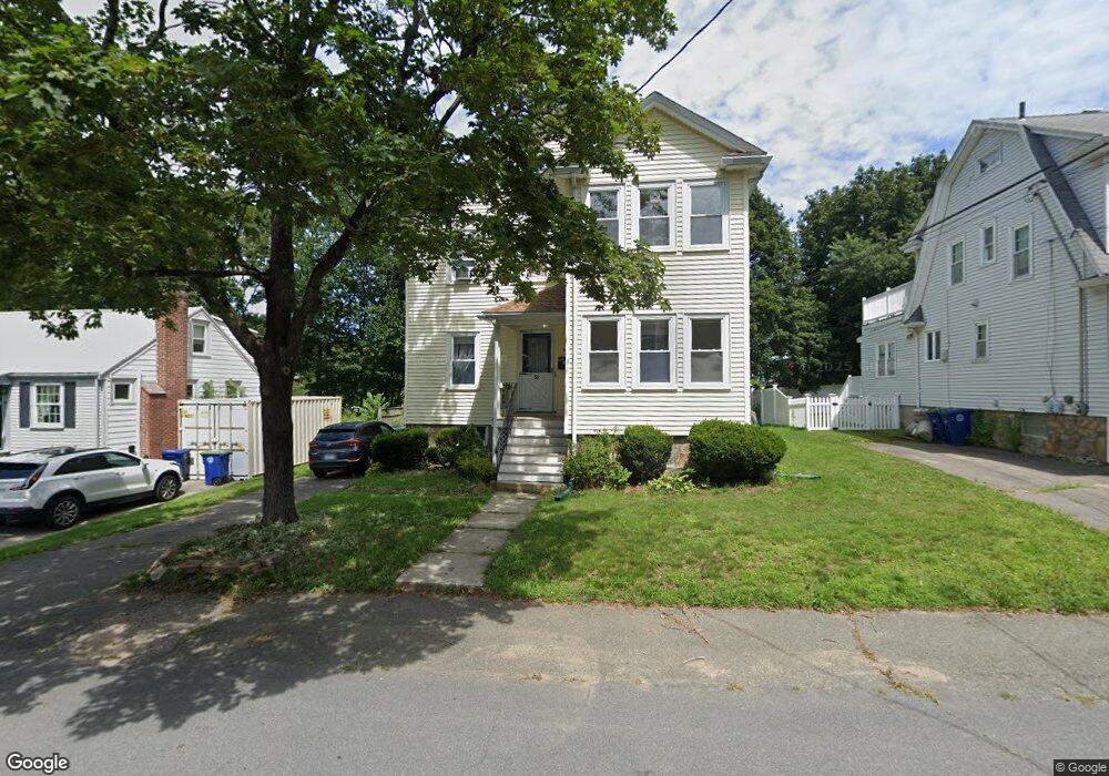
53 Williams St Braintree, MA 02184
Weymouth Landing NeighborhoodEstimated Value: $733,535 - $854,000
6
Beds
2
Baths
2,176
Sq Ft
$368/Sq Ft
Est. Value
About This Home
This home is located at 53 Williams St, Braintree, MA 02184 and is currently estimated at $800,634, approximately $367 per square foot. 53 Williams St is a home located in Norfolk County with nearby schools including Braintree High School, South Shore Christian Academy, and Sacred Heart Elementary School.
Ownership History
Date
Name
Owned For
Owner Type
Purchase Details
Closed on
Jul 3, 2006
Sold by
Hutchinson Barbara L and Hutchinson Irving B
Bought by
Irving B Hutchinson T and Hutchinson Barbara L
Current Estimated Value
Purchase Details
Closed on
Oct 23, 1990
Sold by
Hemingway Richard
Bought by
Hutchinson Barbara L
Create a Home Valuation Report for This Property
The Home Valuation Report is an in-depth analysis detailing your home's value as well as a comparison with similar homes in the area
Home Values in the Area
Average Home Value in this Area
Purchase History
We collect this data history from publicly available records. To have your information removed, we recommend requesting removal directly through your county’s website.
| Date | Buyer | Sale Price | Title Company |
|---|---|---|---|
| Irving B Hutchinson T | -- | -- | |
| Hutchinson Barbara L | $170,000 | -- | |
| Hutchinson Barbara L | $170,000 | -- |
Source: Public Records
Tax History
| Year | Tax Paid | Tax Assessment Tax Assessment Total Assessment is a certain percentage of the fair market value that is determined by local assessors to be the total taxable value of land and additions on the property. | Land | Improvement |
|---|---|---|---|---|
| 2025 | $7,065 | $707,900 | $317,600 | $390,300 |
| 2024 | $6,150 | $648,700 | $296,100 | $352,600 |
| 2023 | $5,788 | $593,000 | $266,100 | $326,900 |
| 2022 | $5,645 | $567,300 | $240,400 | $326,900 |
| 2021 | $5,073 | $509,800 | $217,200 | $292,600 |
| 2020 | $4,798 | $486,600 | $197,400 | $289,200 |
| 2019 | $4,980 | $493,600 | $188,800 | $304,800 |
| 2018 | $4,877 | $462,700 | $171,700 | $291,000 |
| 2017 | $4,877 | $454,100 | $163,100 | $291,000 |
| 2016 | $4,169 | $379,700 | $137,300 | $242,400 |
| 2015 | $4,184 | $378,000 | $135,600 | $242,400 |
| 2014 | $3,825 | $334,900 | $123,600 | $211,300 |
Source: Public Records
Map
Nearby Homes
- 12 Franklin St
- 38 Stonewood Ln
- 67 Washington St
- 37 Lantern Ln
- 115 Pilgrim Rd
- 61 Broad St
- 51 Faxon St
- 33 Hunt St
- 40 Kingman St
- 296 Commercial St Unit 21
- 99 Louise Rd
- 80 Kensington Rd
- 229 Summer St
- 485 Union St
- 16 Cotton Ave
- 114 Meredith Way
- 7 Somerville Ave
- 40 Bell Rd
- 25 Fairmount Ave
- 28 Hillcrest Rd
- 53 Williams St Unit 2
- 53 Williams St Unit 1
- 49 Williams St
- 57 Williams St
- 45 Williams St
- 26 Elliot St
- 32 Elliot St
- 52 Williams St
- 36 Elliot St
- 28 Sterling Park
- 24 Elliot St
- 11 Sterling Park Unit 2L
- 11 Sterling Park Unit 1L
- 11 Sterling Park
- 11 Sterling Park Unit 2R
- 22 Sterling Park
- 44 Williams St
- 14 Sterling Park
- 22 Elliot St
- 38 Williams St
Your Personal Tour Guide
Ask me questions while you tour the home.