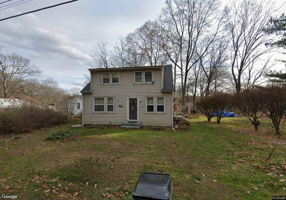
530 Laurel Trail Coventry, CT 06238
Estimated Value: $270,000 - $341,000
4
Beds
2
Baths
1,404
Sq Ft
$217/Sq Ft
Est. Value
About This Home
This home is located at 530 Laurel Trail, Coventry, CT 06238 and is currently estimated at $304,816, approximately $217 per square foot. 530 Laurel Trail is a home located in Tolland County with nearby schools including Coventry Grammar School, George Hersey Robertson School, and Capt. Nathan Hale School.
Ownership History
Date
Name
Owned For
Owner Type
Purchase Details
Closed on
Apr 29, 1993
Sold by
Old Stone Bk
Bought by
Crosby Robert and Crosby Diane
Current Estimated Value
Home Financials for this Owner
Home Financials are based on the most recent Mortgage that was taken out on this home.
Original Mortgage
$76,000
Interest Rate
7.51%
Mortgage Type
Unknown
Create a Home Valuation Report for This Property
The Home Valuation Report is an in-depth analysis detailing your home's value as well as a comparison with similar homes in the area
Home Values in the Area
Average Home Value in this Area
Purchase History
We collect this data history from publicly available records. To have your information removed, we recommend requesting removal directly through your county’s website.
| Date | Buyer | Sale Price | Title Company |
|---|---|---|---|
| Crosby Robert | $80,000 | -- | |
| Crosby Robert | $80,000 | -- |
Source: Public Records
Mortgage History
We collect this data history from publicly available records. To have your information removed, we recommend requesting removal directly through your county’s website.
| Date | Status | Borrower | Loan Amount |
|---|---|---|---|
| Open | Crosby Robert | $115,097 | |
| Closed | Crosby Robert | $9,000 | |
| Closed | Crosby Robert | $76,000 |
Source: Public Records
Tax History
| Year | Tax Paid | Tax Assessment Tax Assessment Total Assessment is a certain percentage of the fair market value that is determined by local assessors to be the total taxable value of land and additions on the property. | Land | Improvement |
|---|---|---|---|---|
| 2025 | $3,419 | $143,900 | $45,400 | $98,500 |
| 2024 | $3,101 | $93,100 | $37,600 | $55,500 |
| 2023 | $2,955 | $93,100 | $37,600 | $55,500 |
| 2022 | $2,900 | $93,100 | $37,600 | $55,500 |
| 2021 | $2,900 | $93,100 | $37,600 | $55,500 |
| 2020 | $2,902 | $93,100 | $37,600 | $55,500 |
| 2019 | $3,001 | $93,200 | $37,600 | $55,600 |
| 2018 | $3,233 | $100,400 | $37,600 | $62,800 |
| 2017 | $3,213 | $100,400 | $37,600 | $62,800 |
| 2016 | $3,132 | $100,400 | $37,600 | $62,800 |
| 2015 | $3,132 | $100,400 | $37,600 | $62,800 |
| 2014 | $3,226 | $113,300 | $45,500 | $67,800 |
Source: Public Records
Map
Nearby Homes
- 2392 Main St
- 51 John Hand Dr
- 21 Arlington Rd
- 2288 Main St
- 2478 Main St
- 152 Cheney Ln
- 112 John Hand Dr
- 0 Englewood Trail Unit 24173868
- 109 Sam Green Rd
- 5 Avery Shores
- 0 Seneca Trail
- 91 Washburn Ave
- 2880 Main St
- 0 Hinkel Mae Dr
- 16 Gardner Tavern Rd
- 24 Barry Rd
- 220 Springdale Ave
- 0 Woodland Rd
- 398 Ripley Hill Rd
- 403 Riley Mountain Rd
Your Personal Tour Guide
Ask me questions while you tour the home.