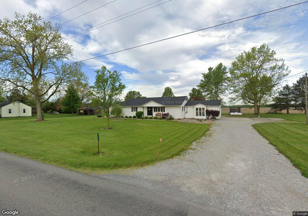
530 S Conant Rd Spencerville, OH 45887
Estimated Value: $173,000 - $298,935
4
Beds
3
Baths
2,059
Sq Ft
$123/Sq Ft
Est. Value
About This Home
This home is located at 530 S Conant Rd, Spencerville, OH 45887 and is currently estimated at $252,984, approximately $122 per square foot. 530 S Conant Rd is a home located in Allen County with nearby schools including Spencerville Elementary School, Spencerville Middle School, and Spencerville High School.
Ownership History
Date
Name
Owned For
Owner Type
Purchase Details
Closed on
Jun 25, 2024
Sold by
Koenig Norman L and Koenig Sydney A
Bought by
Wiechart Reginald L and Wiechart Kerstin M
Current Estimated Value
Home Financials for this Owner
Home Financials are based on the most recent Mortgage that was taken out on this home.
Original Mortgage
$255,000
Outstanding Balance
$251,789
Interest Rate
7.09%
Mortgage Type
New Conventional
Estimated Equity
$1,195
Purchase Details
Closed on
Sep 15, 2022
Sold by
Catlin Louis F
Bought by
Koenig Norman L and Koenig Sydney A
Home Financials for this Owner
Home Financials are based on the most recent Mortgage that was taken out on this home.
Original Mortgage
$159,125
Interest Rate
4.99%
Mortgage Type
New Conventional
Purchase Details
Closed on
Jul 6, 2022
Sold by
Catlin Stephani J
Bought by
Catlin Louis F
Purchase Details
Closed on
Dec 16, 2006
Sold by
Catlin Stephani J and Catlin Louis F
Bought by
Catlin Louis F and Catlin Stephani J
Home Financials for this Owner
Home Financials are based on the most recent Mortgage that was taken out on this home.
Original Mortgage
$157,500
Interest Rate
6.27%
Mortgage Type
New Conventional
Purchase Details
Closed on
Nov 14, 1988
Bought by
Hays David T
Create a Home Valuation Report for This Property
The Home Valuation Report is an in-depth analysis detailing your home's value as well as a comparison with similar homes in the area
Purchase History
| Date | Buyer | Sale Price | Title Company |
|---|---|---|---|
| Wiechart Reginald L | $295,000 | None Listed On Document | |
| Koenig Norman L | $168,500 | -- | |
| Catlin Louis F | -- | Doty Ashley R | |
| Catlin Louis F | -- | None Available | |
| Hays David T | $59,000 | -- |
Source: Public Records
Mortgage History
| Date | Status | Borrower | Loan Amount |
|---|---|---|---|
| Open | Wiechart Reginald L | $255,000 | |
| Previous Owner | Koenig Norman L | $159,125 | |
| Previous Owner | Catlin Louis F | $157,500 |
Source: Public Records
Tax History
| Year | Tax Paid | Tax Assessment Tax Assessment Total Assessment is a certain percentage of the fair market value that is determined by local assessors to be the total taxable value of land and additions on the property. | Land | Improvement |
|---|---|---|---|---|
| 2024 | $2,063 | $65,770 | $10,120 | $55,650 |
| 2023 | $1,751 | $50,580 | $7,770 | $42,810 |
| 2022 | $1,692 | $48,130 | $5,320 | $42,810 |
| 2021 | $1,682 | $48,130 | $5,320 | $42,810 |
| 2020 | $1,458 | $40,430 | $4,870 | $35,560 |
| 2019 | $1,458 | $40,430 | $4,870 | $35,560 |
| 2018 | $1,466 | $40,430 | $4,870 | $35,560 |
| 2017 | $1,394 | $37,770 | $5,430 | $32,340 |
| 2016 | $1,397 | $37,770 | $5,430 | $32,340 |
| 2015 | $1,426 | $37,910 | $5,430 | $32,480 |
| 2014 | $1,426 | $40,610 | $5,150 | $35,460 |
| 2013 | $1,444 | $40,610 | $5,150 | $35,460 |
Source: Public Records
Map
Nearby Homes
- 8240 Spencerville Rd
- 0 N Conant Rd
- 7630 Spencerville Rd
- 3000 Sunderland Rd
- 3000 S Sunderland Rd
- 2566 S Grubb Rd
- 7570 Fort Amanda Rd
- 7551 Fort Amanda Rd
- 115 Oakland Ave
- 22284 Ohio 198
- 449 N Main St
- 313 S Broadway St
- 305 N Broadway St
- 408 N Mulberry St
- 303 N Canal St
- 1553 Bittersweet Dr
- 2670 S Wapak Rd
- 2340 S Wapak Rd
- 1533 N Wapakoneta Rd
- 845 Atalan Trail
Your Personal Tour Guide
Ask me questions while you tour the home.