5300 Al Jones Dr Shady Side, MD 20764
Estimated Value: $279,000 - $353,000
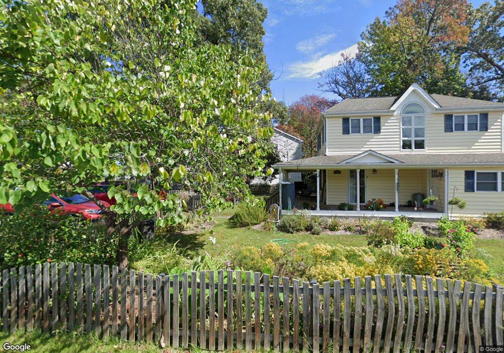
About This Home
This home is located at 5300 Al Jones Dr, Shady Side, MD 20764 and is currently estimated at $320,528, approximately $279 per square foot. 5300 Al Jones Dr is a home located in Anne Arundel County with nearby schools including Shady Side Elementary School, Southern Middle School, and Southern High School.
Ownership History
We collect this data history from publicly available records. To have your information removed, we recommend requesting removal directly through your county’s website.
Purchase Details
Purchase Details
Purchase Details
Home Financials for this Owner
Home Financials are based on the most recent Mortgage that was taken out on this home.Home Values in the Area
Average Home Value in this Area
Purchase History
We collect this data history from publicly available records. To have your information removed, we recommend requesting removal directly through your county’s website.
| Date | Buyer | Sale Price | Title Company |
|---|---|---|---|
| -- | None Listed On Document | ||
| -- | None Listed On Document | ||
| $80,000 | -- | ||
| $80,000 | -- |
Mortgage History
We collect this data history from publicly available records. To have your information removed, we recommend requesting removal directly through your county’s website.
| Date | Status | Borrower | Loan Amount |
|---|---|---|---|
| Previous Owner | $64,000 |
Tax History
We collect this data history from publicly available records. To have your information removed, we recommend requesting removal directly through your county’s website.
| Year | Tax Paid | Tax Assessment Tax Assessment Total Assessment is a certain percentage of the fair market value that is determined by local assessors to be the total taxable value of land and additions on the property. | Land | Improvement |
|---|---|---|---|---|
| 2025 | $3,787 | $236,467 | -- | -- |
| 2024 | $3,787 | $218,133 | $0 | $0 |
| 2023 | $3,561 | $199,800 | $124,700 | $75,100 |
| 2022 | $3,349 | $194,700 | $0 | $0 |
| 2020 | $3,072 | $184,500 | $119,700 | $64,800 |
| 2019 | $2,997 | $180,633 | $0 | $0 |
| 2018 | $1,792 | $176,767 | $0 | $0 |
| 2017 | $2,852 | $172,900 | $0 | $0 |
| 2016 | -- | $172,367 | $0 | $0 |
| 2015 | -- | $171,833 | $0 | $0 |
| 2014 | -- | $171,300 | $0 | $0 |
Map
- 1502 Garst Rd
- 5314 Al Jones Dr
- 5250 Al Jones Dr
- 5235 Al Jones Dr
- 5341 Al Jones Dr
- 1527 Lincoln Rd
- 5211 Al Jones Dr
- 1183 Cedar Ave
- 1172 Cedar Ave
- 1445 & 1447 Haile Pkwy
- 0 Haile Pkwy Unit MDAA2141624
- 1436 Haile Pkwy
- 1430 Haile Pkwy
- 1199 Oak Ave
- 1411 Haile Pkwy
- 1428 Haile Pkwy
- 1235 Spruce Ave
- 1217 Pine Ave
- 5523 Ilchester St
- 0 Pine Ave Unit MDAA2139458
- 1501 Booker Rd
- 1505 Booker Rd
- 1500 Garst Rd
- 1500 Booker Rd
- 5304 Al Jones Dr
- 1707 Columbia Beach Rd
- 1711 Columbia Beach Rd
- 1502 Booker Rd
- 5308 Al Jones Dr
- 1501 Washington Rd
- 1715 Columbia Beach Rd
- 5301 Al Jones Dr
- 5262 Al Jones Dr
- 5271 Al Jones Dr
- 5312 Al Jones Dr
- 5307 Al Jones Dr
- 5269 Al Jones Dr
- 1719 Columbia Beach Rd
- 5267 Al Jones Dr
- 1501 Garst Rd
Ask me questions while you tour the home.