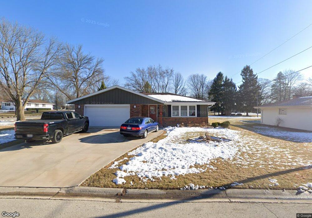
5301 Robin Dr Greendale, WI 53129
Estimated Value: $352,000 - $408,000
4
Beds
2
Baths
1,662
Sq Ft
$231/Sq Ft
Est. Value
About This Home
This home is located at 5301 Robin Dr, Greendale, WI 53129 and is currently estimated at $383,432, approximately $230 per square foot. 5301 Robin Dr is a home located in Milwaukee County with nearby schools including College Park Elementary School, Greendale Middle School, and Greendale High School.
Ownership History
Date
Name
Owned For
Owner Type
Purchase Details
Closed on
Dec 14, 2020
Sold by
Duckart John A and Duclfrt Karen J
Bought by
Bushi Altin and Bushi Teuta
Current Estimated Value
Home Financials for this Owner
Home Financials are based on the most recent Mortgage that was taken out on this home.
Original Mortgage
$230,000
Outstanding Balance
$211,644
Interest Rate
2.7%
Mortgage Type
New Conventional
Estimated Equity
$171,788
Create a Home Valuation Report for This Property
The Home Valuation Report is an in-depth analysis detailing your home's value as well as a comparison with similar homes in the area
Home Values in the Area
Average Home Value in this Area
Purchase History
| Date | Buyer | Sale Price | Title Company |
|---|---|---|---|
| Bushi Altin | $250,000 | None Available |
Source: Public Records
Mortgage History
| Date | Status | Borrower | Loan Amount |
|---|---|---|---|
| Open | Bushi Altin | $230,000 |
Source: Public Records
Tax History
| Year | Tax Paid | Tax Assessment Tax Assessment Total Assessment is a certain percentage of the fair market value that is determined by local assessors to be the total taxable value of land and additions on the property. | Land | Improvement |
|---|---|---|---|---|
| 2024 | $6,042 | $346,300 | $74,800 | $271,500 |
| 2023 | $5,255 | $283,100 | $74,800 | $208,300 |
| 2022 | $5,302 | $283,100 | $74,800 | $208,300 |
| 2021 | $5,381 | $219,900 | $66,800 | $153,100 |
| 2020 | $5,393 | $219,900 | $66,800 | $153,100 |
| 2019 | $5,367 | $219,900 | $66,800 | $153,100 |
| 2018 | $5,073 | $219,900 | $66,800 | $153,100 |
| 2017 | $5,139 | $208,300 | $64,200 | $144,100 |
| 2016 | $5,100 | $208,300 | $64,200 | $144,100 |
| 2015 | $4,831 | $188,600 | $64,200 | $124,400 |
| 2014 | $4,800 | $188,600 | $64,200 | $124,400 |
| 2013 | $4,878 | $188,600 | $64,200 | $124,400 |
Source: Public Records
Map
Nearby Homes
- 5316 Robin Dr
- 5921 Sycamore St
- 5826 Sugarbush Ln
- 5848 Ramona Dr
- 6438 Sycamore St
- 5255 W Princeton Dr
- 6748 S Yale Dr
- 5350 W Yale Dr
- 6110 Thornridge Ln
- 6183 S 40th St
- 4540 W Melissa Ct
- 5623 Bentwood Ln
- 4203 W Tumble Creek Ct
- 5732 W Rawson Ave
- 3701 W Bridge St
- 5422 S 43rd St
- 7236 S Hillendale Dr
- 4213 W Madison Blvd
- 4343 W Mallory Ave
- 7260 S Hillside Dr
Your Personal Tour Guide
Ask me questions while you tour the home.