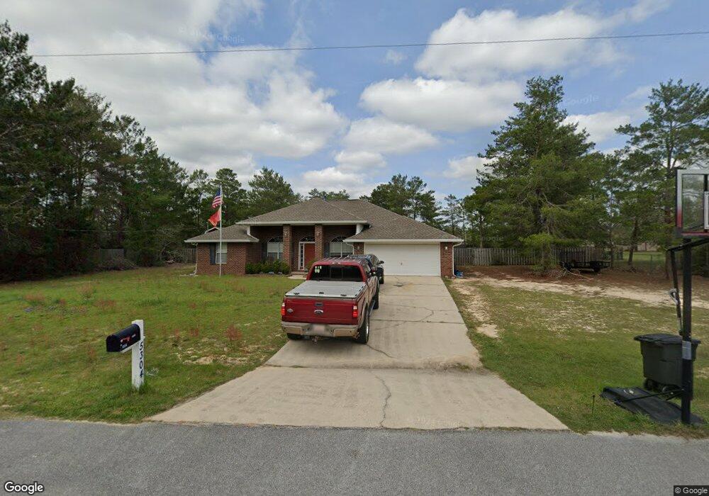
5304 Ten Point Dr Crestview, FL 32539
Estimated Value: $395,000 - $477,000
4
Beds
2
Baths
2,908
Sq Ft
$151/Sq Ft
Est. Value
About This Home
This home is located at 5304 Ten Point Dr, Crestview, FL 32539 and is currently estimated at $438,855, approximately $150 per square foot. 5304 Ten Point Dr is a home located in Okaloosa County with nearby schools including Northwood Elementary School, Davidson Middle School, and Crestview High School.
Ownership History
Date
Name
Owned For
Owner Type
Purchase Details
Closed on
Oct 15, 2009
Sold by
Murphree Alexander P and Murphree Tara K
Bought by
Kopp Robert and Kopp Terisa
Current Estimated Value
Home Financials for this Owner
Home Financials are based on the most recent Mortgage that was taken out on this home.
Original Mortgage
$192,500
Outstanding Balance
$123,967
Interest Rate
5.05%
Mortgage Type
VA
Estimated Equity
$314,888
Purchase Details
Closed on
Jun 30, 2004
Sold by
Adams Homes Of Northwest Florida Inc
Bought by
Murphree Alexander P and Murphree Tara E
Home Financials for this Owner
Home Financials are based on the most recent Mortgage that was taken out on this home.
Original Mortgage
$109,066
Interest Rate
6.25%
Mortgage Type
Purchase Money Mortgage
Create a Home Valuation Report for This Property
The Home Valuation Report is an in-depth analysis detailing your home's value as well as a comparison with similar homes in the area
Home Values in the Area
Average Home Value in this Area
Purchase History
| Date | Buyer | Sale Price | Title Company |
|---|---|---|---|
| Kopp Robert | $192,500 | Moulton Land Title Inc | |
| Murphree Alexander P | $136,400 | -- |
Source: Public Records
Mortgage History
| Date | Status | Borrower | Loan Amount |
|---|---|---|---|
| Open | Kopp Robert | $192,500 | |
| Previous Owner | Murphree Alexander P | $109,066 | |
| Closed | Murphree Alexander P | $27,267 |
Source: Public Records
Tax History
| Year | Tax Paid | Tax Assessment Tax Assessment Total Assessment is a certain percentage of the fair market value that is determined by local assessors to be the total taxable value of land and additions on the property. | Land | Improvement |
|---|---|---|---|---|
| 2025 | $108 | $238,558 | -- | -- |
| 2024 | $108 | $231,835 | -- | -- |
| 2023 | $108 | $225,083 | $0 | $0 |
| 2022 | $108 | $218,527 | $0 | $0 |
| 2021 | $105 | $212,162 | $0 | $0 |
| 2020 | $102 | $209,233 | $0 | $0 |
| 2019 | $99 | $204,529 | $0 | $0 |
| 2018 | $96 | $200,715 | $0 | $0 |
| 2017 | $96 | $196,587 | $0 | $0 |
| 2016 | $93 | $192,544 | $0 | $0 |
| 2015 | $90 | $191,206 | $0 | $0 |
| 2014 | $88 | $189,688 | $0 | $0 |
Source: Public Records
Map
Nearby Homes
- 5315 Ten Point Dr
- 4188 Big Buck Trail
- TBD Mirasol Ln
- 4017 Bear Creek Rd
- 0 Bear Head Rd
- Parcel B Bear Head Rd
- TBD Bear Head Rd
- Parcel A Bear Head Rd
- 3842 Bear Head Rd
- 3985 Highway 90 E
- 3.31 ACRES Bear Branch Rd
- 4099 Highway 90 E
- 5570 Mount Olive Rd
- 5378 Staghorn Rd
- 5761 Highland Hills Rd
- 5698 Ryan Rd
- 4.69 Acres Jv Woolley Rd
- 5719 Woolley Rd
- 5747 J V Woolley Rd
- 0 Ryan Rd
- 5300 Ten Point Dr
- 5314 Ten Point Dr
- 4163 Big Buck Trail
- 5301 Ten Point Dr
- 5309 Ten Point Dr
- 5305 Ten Point Dr
- 5305 10 Point Dr
- 5328 Ten Point Dr
- 5319 Ten Point Dr
- 4152 Big Bulk Trail
- 4152 Big Bulk Trl Trail
- 5323 Ten Point Dr
- 4148 Big Buck Trail
- 4156 Big Buck Trail
- 4152 Big Buck Trail
- 5327 Ten Point Dr
- 4144 Big Buck Trail
- 4168 Big Buck Trail
- 4172 Big Buck Trail
- 4176 Big Buck Trail
Your Personal Tour Guide
Ask me questions while you tour the home.