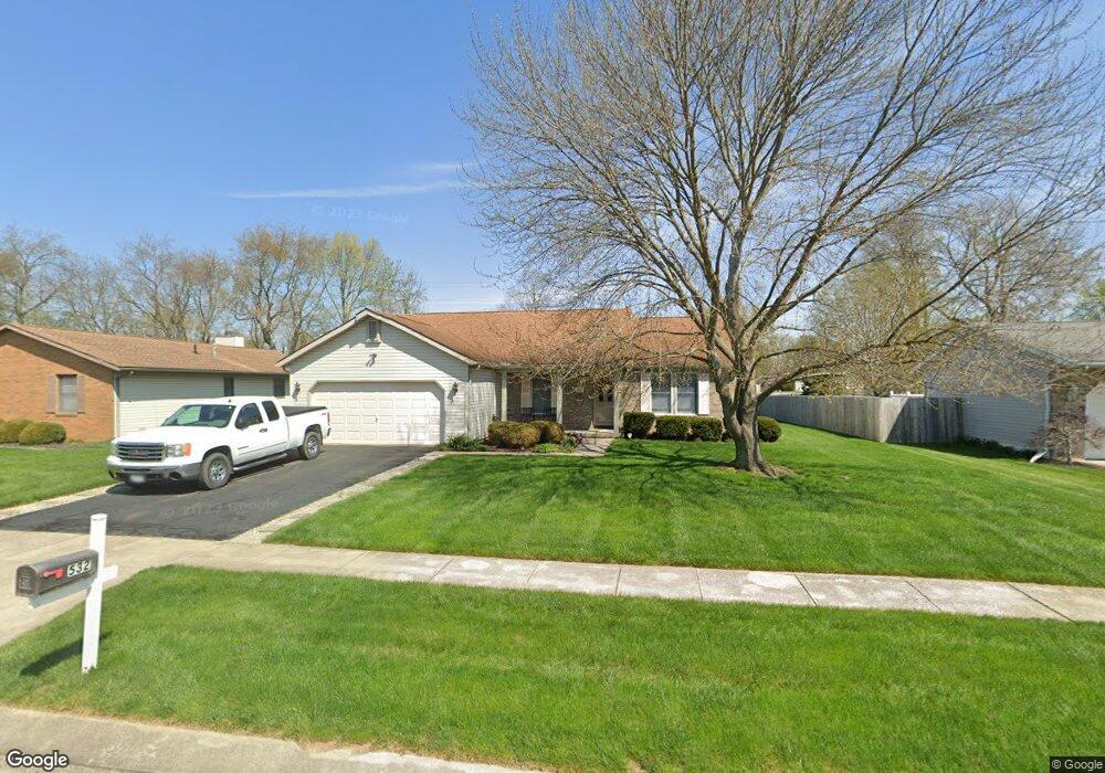
532 Myrtle Ave Newark, OH 43055
Estimated Value: $314,000 - $332,000
2
Beds
2
Baths
1,617
Sq Ft
$198/Sq Ft
Est. Value
About This Home
This home is located at 532 Myrtle Ave, Newark, OH 43055 and is currently estimated at $319,911, approximately $197 per square foot. 532 Myrtle Ave is a home located in Licking County with nearby schools including Legend Elementary School, Liberty Middle School, and Newark High School.
Ownership History
Date
Name
Owned For
Owner Type
Purchase Details
Closed on
Apr 3, 2009
Sold by
Hollingshead Evelyn R
Bought by
Meadows Dean E and Meadows Joyce T
Current Estimated Value
Home Financials for this Owner
Home Financials are based on the most recent Mortgage that was taken out on this home.
Original Mortgage
$100,000
Interest Rate
5.11%
Mortgage Type
Purchase Money Mortgage
Purchase Details
Closed on
Feb 1, 1999
Sold by
Marian J Waters Trst
Bought by
Hollingshead Hiram Evelyn R
Create a Home Valuation Report for This Property
The Home Valuation Report is an in-depth analysis detailing your home's value as well as a comparison with similar homes in the area
Home Values in the Area
Average Home Value in this Area
Purchase History
We collect this data history from publicly available records. To have your information removed, we recommend requesting removal directly through your county’s website.
| Date | Buyer | Sale Price | Title Company |
|---|---|---|---|
| Meadows Dean E | $143,900 | Prosperity | |
| Hollingshead Hiram Evelyn R | $125,000 | -- |
Source: Public Records
Mortgage History
We collect this data history from publicly available records. To have your information removed, we recommend requesting removal directly through your county’s website.
| Date | Status | Borrower | Loan Amount |
|---|---|---|---|
| Closed | Meadows Dean E | $100,000 |
Source: Public Records
Tax History
| Year | Tax Paid | Tax Assessment Tax Assessment Total Assessment is a certain percentage of the fair market value that is determined by local assessors to be the total taxable value of land and additions on the property. | Land | Improvement |
|---|---|---|---|---|
| 2025 | $2,817 | $86,940 | $23,380 | $63,560 |
| 2024 | $2,758 | $86,940 | $23,380 | $63,560 |
| 2023 | $2,775 | $86,940 | $23,380 | $63,560 |
| 2022 | $2,185 | $63,250 | $14,040 | $49,210 |
| 2021 | $2,292 | $63,250 | $14,040 | $49,210 |
| 2020 | $2,346 | $63,250 | $14,040 | $49,210 |
| 2019 | $1,964 | $52,710 | $11,690 | $41,020 |
| 2018 | $1,965 | $0 | $0 | $0 |
| 2017 | $2,255 | $0 | $0 | $0 |
| 2016 | $2,071 | $0 | $0 | $0 |
| 2015 | $2,116 | $0 | $0 | $0 |
| 2014 | $2,711 | $0 | $0 | $0 |
| 2013 | $2,110 | $0 | $0 | $0 |
Source: Public Records
Map
Nearby Homes
- 516 Goose Pond Rd
- 262 Derby Downs Rd
- 708 Olde Creek Dr
- 1324 Hillview Cir W
- 1206 Hillview Cir E Unit 1206
- 1675 Mount Vernon Rd
- 0 Mount Vernon Rd
- 1821 Mount Vernon Rd
- 11 Waterworks Rd
- 1954 Iselin St
- 976 Kingsbury Ct
- 1944 Jamesburg St
- 947 Glyn Dennis Dr
- 0 Burch Dr NE
- 1976 Jamesburg
- 1980 Jamesburg St
- 1968 Jamesburg St
- 1972 Jamesburg St
- 1964 Jamesburg St
- 1984 Jamesburg St
- 540 Myrtle Ave
- 524 Myrtle Ave
- 548 Myrtle Ave
- 514 Myrtle Ave
- 533 Myrtle Ave
- 541 Myrtle Ave
- 1609 Independence Dr
- 556 Myrtle Ave
- 506 Myrtle Ave
- 549 Myrtle Ave
- 531 Hemlock Place
- 564 Myrtle Ave
- 557 Myrtle Ave
- 1599 Independence Dr
- 496 Myrtle Ave
- 503 Myrtle Ave
- 1592 Jamestown Ct
- 1600 Jamestown Ct
- 1643 Churchill Downs Rd
- 537 Hemlock Place
Your Personal Tour Guide
Ask me questions while you tour the home.