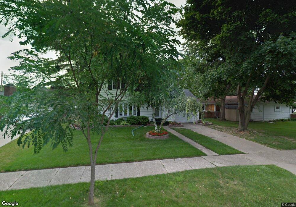
533 Mc Pherson Ave Lansing, MI 48915
Westside NeighborhoodEstimated Value: $221,000 - $244,000
3
Beds
2
Baths
1,660
Sq Ft
$141/Sq Ft
Est. Value
About This Home
This home is located at 533 Mc Pherson Ave, Lansing, MI 48915 and is currently estimated at $233,799, approximately $140 per square foot. 533 Mc Pherson Ave is a home located in Ingham County with nearby schools including Riddle Elementary School, Pattengill Academy, and J.W. Sexton High School.
Ownership History
Date
Name
Owned For
Owner Type
Purchase Details
Closed on
Nov 1, 2022
Sold by
Walker Willard K and Walker Victoria
Bought by
Lettau Vincent Jerome
Current Estimated Value
Home Financials for this Owner
Home Financials are based on the most recent Mortgage that was taken out on this home.
Original Mortgage
$190,000
Outstanding Balance
$180,162
Interest Rate
4%
Mortgage Type
Balloon
Estimated Equity
$53,637
Purchase Details
Closed on
Mar 3, 2021
Sold by
Walker Willard K
Bought by
Walker Willard K and Key Walker Victoria
Purchase Details
Closed on
Aug 17, 2007
Sold by
Walker Quintella
Bought by
Walker Willard A
Create a Home Valuation Report for This Property
The Home Valuation Report is an in-depth analysis detailing your home's value as well as a comparison with similar homes in the area
Home Values in the Area
Average Home Value in this Area
Purchase History
| Date | Buyer | Sale Price | Title Company |
|---|---|---|---|
| Lettau Vincent Jerome | $190,000 | Diversified National Title | |
| Walker Willard K | -- | None Available | |
| Walker Willard A | -- | None Available |
Source: Public Records
Mortgage History
| Date | Status | Borrower | Loan Amount |
|---|---|---|---|
| Open | Lettau Vincent Jerome | $190,000 |
Source: Public Records
Tax History
| Year | Tax Paid | Tax Assessment Tax Assessment Total Assessment is a certain percentage of the fair market value that is determined by local assessors to be the total taxable value of land and additions on the property. | Land | Improvement |
|---|---|---|---|---|
| 2025 | $125 | $94,900 | $12,500 | $82,400 |
| 2024 | $43 | $87,400 | $12,500 | $74,900 |
| 2023 | $122 | $78,300 | $12,500 | $65,800 |
| 2022 | $3,011 | $73,100 | $9,300 | $63,800 |
| 2021 | $2,948 | $68,200 | $9,300 | $58,900 |
| 2020 | $2,931 | $64,500 | $9,300 | $55,200 |
| 2019 | $2,810 | $59,100 | $9,300 | $49,800 |
| 2018 | $2,632 | $56,100 | $9,300 | $46,800 |
| 2017 | $2,520 | $56,100 | $9,300 | $46,800 |
| 2016 | $2,490 | $48,200 | $9,300 | $38,900 |
| 2015 | $2,490 | $43,700 | $18,692 | $25,008 |
| 2014 | $2,490 | $44,500 | $24,000 | $20,500 |
Source: Public Records
Map
Nearby Homes
- 524 Everett Dr
- 511 Mcpherson Ave
- 609 Everett Dr
- 437 S Verlinden Ave
- 519 West St
- 418 West St
- 824 Nipp Ave
- 1500 W Saint Joseph St
- 320 Huron St
- 1411 W Washtenaw St
- 900 Middle St
- 1140 W Lenawee St
- 216 Haze St
- 1403 W Michigan Ave
- 1912 Moores River Dr
- 609 S Rosemary St
- 1400 W Michigan Ave
- 2505 W Michigan Ave
- 314 Alger St
- 1233 W Michigan Ave
- 533 Mcpherson Ave
- 525 Mc Pherson Ave
- 525 Mcpherson Ave
- 1920 W Hillsdale St
- 534 Mcpherson Ave
- 1900 W Hillsdale St
- 519 Mcpherson Ave
- 528 Everett Dr
- 528 Mcpherson Ave
- 520 Mcpherson Ave
- 2000 W Hillsdale St
- 520 Everett Dr
- 1901 W Hillsdale St
- 512 Mcpherson Ave
- 1911 W Hillsdale St
- 516 Everett Dr
- 1927 W Hillsdale St
- 1919 W Hillsdale St
- 527 S Verlinden Ave
- 533 S Verlinden Ave
Your Personal Tour Guide
Ask me questions while you tour the home.