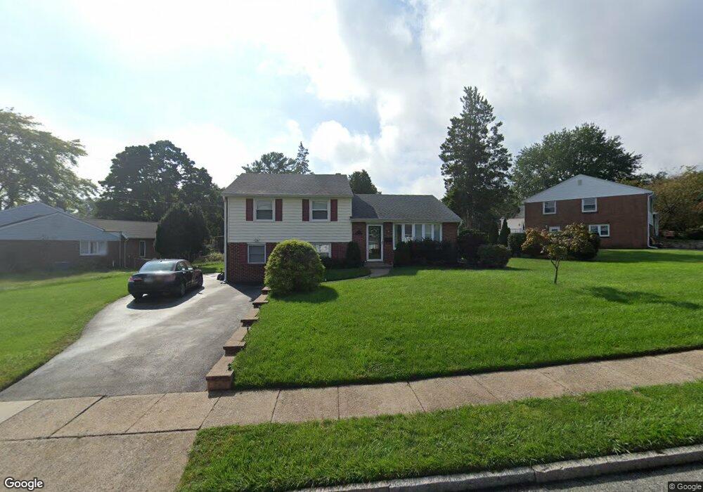
534 Maddock Rd Springfield, PA 19064
Estimated Value: $532,000 - $616,000
3
Beds
2
Baths
1,983
Sq Ft
$280/Sq Ft
Est. Value
About This Home
This home is located at 534 Maddock Rd, Springfield, PA 19064 and is currently estimated at $554,654, approximately $279 per square foot. 534 Maddock Rd is a home located in Delaware County with nearby schools including Springfield High School, St Francis Of Assisi School, and Cardinal O'Hara High School.
Ownership History
Date
Name
Owned For
Owner Type
Purchase Details
Closed on
Aug 30, 2011
Sold by
Matyok Anthony P
Bought by
Baransky Eugene and Baransky Joyce
Current Estimated Value
Purchase Details
Closed on
Jul 23, 1999
Sold by
Bland Elizabeth J
Bought by
Matyok Anthony P and Lewandowski Amanda
Home Financials for this Owner
Home Financials are based on the most recent Mortgage that was taken out on this home.
Original Mortgage
$133,600
Interest Rate
7.65%
Create a Home Valuation Report for This Property
The Home Valuation Report is an in-depth analysis detailing your home's value as well as a comparison with similar homes in the area
Home Values in the Area
Average Home Value in this Area
Purchase History
| Date | Buyer | Sale Price | Title Company |
|---|---|---|---|
| Baransky Eugene | $300,000 | -- | |
| Matyok Anthony P | $167,000 | Fidelity National Title Ins |
Source: Public Records
Mortgage History
| Date | Status | Borrower | Loan Amount |
|---|---|---|---|
| Previous Owner | Matyok Anthony P | $133,600 |
Source: Public Records
Tax History
| Year | Tax Paid | Tax Assessment Tax Assessment Total Assessment is a certain percentage of the fair market value that is determined by local assessors to be the total taxable value of land and additions on the property. | Land | Improvement |
|---|---|---|---|---|
| 2025 | $7,649 | $272,140 | $108,770 | $163,370 |
| 2024 | $7,649 | $272,140 | $108,770 | $163,370 |
| 2023 | $7,365 | $272,140 | $108,770 | $163,370 |
| 2022 | $7,206 | $272,140 | $108,770 | $163,370 |
| 2021 | $11,160 | $272,140 | $108,770 | $163,370 |
| 2020 | $6,877 | $151,770 | $52,300 | $99,470 |
| 2019 | $6,716 | $151,770 | $52,300 | $99,470 |
| 2018 | $6,620 | $151,770 | $0 | $0 |
| 2017 | $6,467 | $151,770 | $0 | $0 |
| 2016 | $833 | $151,770 | $0 | $0 |
| 2015 | $850 | $151,770 | $0 | $0 |
| 2014 | $833 | $144,920 | $0 | $0 |
Source: Public Records
Map
Nearby Homes
- 641 W Sproul Rd
- 436 Kerr Ln
- 359 Spring Valley Rd
- 499 Collins Dr
- 606 W Springfield Rd
- 249 Gleaves Rd
- 412 Foster Dr
- 364 S Rolling Rd
- 1291 Country Club Dr Unit Q137
- 493 Wheatsheaf Rd
- 1363 Palmer Dr Unit O122
- 264 Pancoast Ave
- 231 E Woodland Ave
- 120 W Springfield Rd
- 501 Flora Cir
- 253 Saxer Ave
- 226 Lynbrooke Rd
- 1588 Nicklaus Dr Unit H65
- 225 Lynbrooke Rd
- 208 Jackdaw Aly
- 544 Maddock Rd
- 524 Maddock Rd
- 516 Maddock Rd
- 554 Maddock Rd
- 539 Maddock Rd
- 543 Maddock Rd
- 564 Maddock Rd
- 535 Maddock Rd
- 570 Maddock Rd
- 531 Maddock Rd
- 512 Maddock Rd
- 547 Maddock Rd
- 527 Maddock Rd
- 523 Maddock Rd
- 519 Maddock Rd
- 551 Maddock Rd
- 555 Maddock Rd
- 574 Maddock Rd
- 515 Maddock Rd
- 639 W Sproul Rd
Your Personal Tour Guide
Ask me questions while you tour the home.