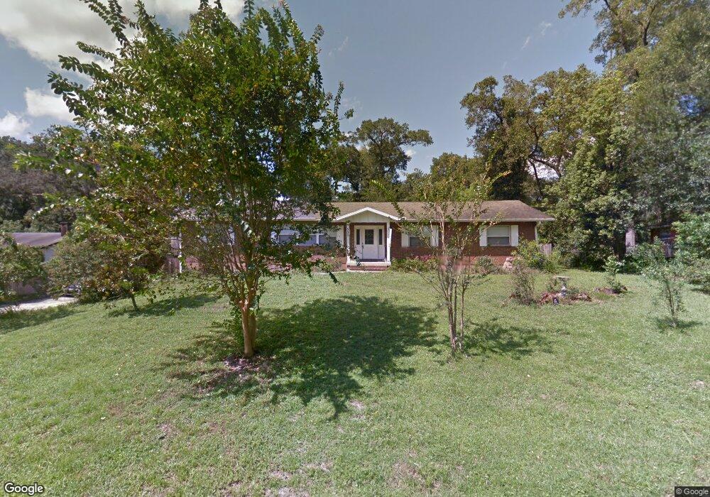
535 Compton Ct Deland, FL 32724
North DeLand NeighborhoodEstimated Value: $396,000 - $422,000
4
Beds
2
Baths
4,512
Sq Ft
$91/Sq Ft
Est. Value
About This Home
This home is located at 535 Compton Ct, Deland, FL 32724 and is currently estimated at $409,522, approximately $90 per square foot. 535 Compton Ct is a home located in Volusia County with nearby schools including Deland High School, George W. Marks Elementary School, and Deland Middle School.
Ownership History
Date
Name
Owned For
Owner Type
Purchase Details
Closed on
Sep 23, 2022
Sold by
Collins John I and Collins Tenisha L
Bought by
John I Collins Iii Revocable Living Trust
Current Estimated Value
Purchase Details
Closed on
Oct 15, 1992
Bought by
Collins John I and Collins Tenisha L
Purchase Details
Closed on
Mar 15, 1983
Bought by
Collins John I and Collins Tenisha L
Purchase Details
Closed on
Oct 15, 1972
Bought by
Collins John I and Collins Tenisha L
Create a Home Valuation Report for This Property
The Home Valuation Report is an in-depth analysis detailing your home's value as well as a comparison with similar homes in the area
Home Values in the Area
Average Home Value in this Area
Purchase History
| Date | Buyer | Sale Price | Title Company |
|---|---|---|---|
| John I Collins Iii Revocable Living Trust | $100 | -- | |
| Collins John I | $89,000 | -- | |
| Collins John I | $85,000 | -- | |
| Collins John I | $2,400 | -- |
Source: Public Records
Tax History
| Year | Tax Paid | Tax Assessment Tax Assessment Total Assessment is a certain percentage of the fair market value that is determined by local assessors to be the total taxable value of land and additions on the property. | Land | Improvement |
|---|---|---|---|---|
| 2026 | $1,988 | $138,398 | -- | -- |
| 2025 | $1,988 | $134,760 | -- | -- |
| 2024 | $1,866 | $130,963 | -- | -- |
| 2023 | $1,866 | $127,149 | $0 | $0 |
| 2022 | $1,810 | $123,446 | $0 | $0 |
| 2021 | $1,856 | $119,850 | $0 | $0 |
| 2020 | $1,823 | $118,195 | $0 | $0 |
| 2019 | $1,864 | $115,538 | $0 | $0 |
| 2018 | $1,843 | $113,384 | $0 | $0 |
| 2017 | $1,823 | $111,052 | $0 | $0 |
| 2016 | $1,734 | $108,768 | $0 | $0 |
| 2015 | $1,764 | $108,012 | $0 | $0 |
| 2014 | $1,746 | $107,155 | $0 | $0 |
Source: Public Records
Map
Nearby Homes
- 577 Parkdale Ct
- 14 Sunshine Blvd
- 975 N Boston Ave
- 905 Northern Oaks Terrace
- 708 Montreville Ave
- 1412 N Garfield Ave
- 1150 Orangewood Ave
- 516 Grace Ave
- 735 Montreville Ave
- 1207 N Amelia Ave
- 436 E Bennett Ave
- 426 E Plymouth Ave
- 1435 Hensley Dr
- 927 Azalea Walk Cir
- 1301 N Amelia Ave
- 930 N Amelia Ave
- 1 Smith Ct
- 1004 Hartford Dr
- 715 Eastover Cir
- 576 E International Speedway Blvd
- 531 Compton Ct
- 537 Compton Ct
- 539 Compton Ct
- 1107 N Garfield Ave
- 568 Parkdale Ct
- 524 Compton Ct
- 530 Compton Ct
- 1105 N Garfield Ave
- 571 Compton Ct
- 1103 N Garfield Ave
- 570 Parkdale Ct
- 540 Compton Ct
- 511 Sandale Ct
- 550 Compton Ct
- 1101 N Garfield Ave
- 573 Compton Ct
- 509 Sandale Ct
- 572 Parkdale Ct
- 507 Sandale Ct
- 513 Sandale Ct
Your Personal Tour Guide
Ask me questions while you tour the home.