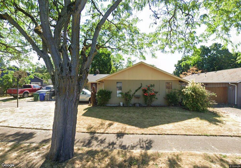
535 Kodiak St Eugene, OR 97401
Harlow NeighborhoodEstimated Value: $386,000 - $407,000
About This Home
This home is located at 535 Kodiak St, Eugene, OR 97401 and is currently estimated at $397,743, approximately $360 per square foot. 535 Kodiak St is a home located in Lane County with nearby schools including Holt Elementary School, Monroe Middle School, and Sheldon High School.
Ownership History
We collect this data history from publicly available records. To have your information removed, we recommend requesting removal directly through your county’s website.
Purchase Details
Home Financials for this Owner
Home Financials are based on the most recent Mortgage that was taken out on this home.Purchase Details
Purchase Details
Home Financials for this Owner
Home Financials are based on the most recent Mortgage that was taken out on this home.Purchase Details
Home Financials for this Owner
Home Financials are based on the most recent Mortgage that was taken out on this home.Home Values in the Area
Average Home Value in this Area
Purchase History
We collect this data history from publicly available records. To have your information removed, we recommend requesting removal directly through your county’s website.
| Date | Buyer | Sale Price | Title Company |
|---|---|---|---|
| -- | Servicelink | ||
| -- | None Listed On Document | ||
| $209,000 | Western Title & Escrow Compa | ||
| $155,000 | Western Title & Escrow Co |
Mortgage History
We collect this data history from publicly available records. To have your information removed, we recommend requesting removal directly through your county’s website.
| Date | Status | Borrower | Loan Amount |
|---|---|---|---|
| Open | $234,000 | ||
| Previous Owner | $41,800 | ||
| Previous Owner | $167,200 | ||
| Previous Owner | $90,000 |
Tax History
We collect this data history from publicly available records. To have your information removed, we recommend requesting removal directly through your county’s website.
| Year | Tax Paid | Tax Assessment Tax Assessment Total Assessment is a certain percentage of the fair market value that is determined by local assessors to be the total taxable value of land and additions on the property. | Land | Improvement |
|---|---|---|---|---|
| 2025 | $4,018 | $206,218 | -- | -- |
| 2024 | $3,968 | $200,212 | -- | -- |
| 2023 | $3,968 | $194,381 | $0 | $0 |
| 2022 | $3,717 | $188,720 | $0 | $0 |
| 2021 | $3,491 | $183,224 | $0 | $0 |
| 2020 | $3,504 | $177,888 | $0 | $0 |
| 2019 | $3,384 | $172,707 | $0 | $0 |
| 2018 | $3,185 | $162,793 | $0 | $0 |
| 2017 | $3,013 | $162,793 | $0 | $0 |
| 2016 | $2,876 | $158,051 | $0 | $0 |
| 2015 | $2,758 | $153,448 | $0 | $0 |
| 2014 | $2,666 | $148,979 | $0 | $0 |
Map
- 511 Panda Loop
- 640 N Garden Way
- 730 Arcadia Dr
- 1233 Kenray Loop
- 3588 Sisters View Ave
- 855 Calvin St
- 1148 Darlene Ave
- 3457 Mahlon Ave
- 3700 Babcock Ln
- 3700 Babcock Ln Unit 87
- 3499 Western Dr
- 540 Sunshine Acres Dr
- 2727 Gateway St Unit 18
- 2727 Gateway St Unit 6
- 1271 Arcadia Dr
- 807 Vincent St
- 3095 Dapple Way
- 3224 Sorrel Way
- 1120 W Fairview Dr Unit 48
- 2994 Dapple Way
Ask me questions while you tour the home.