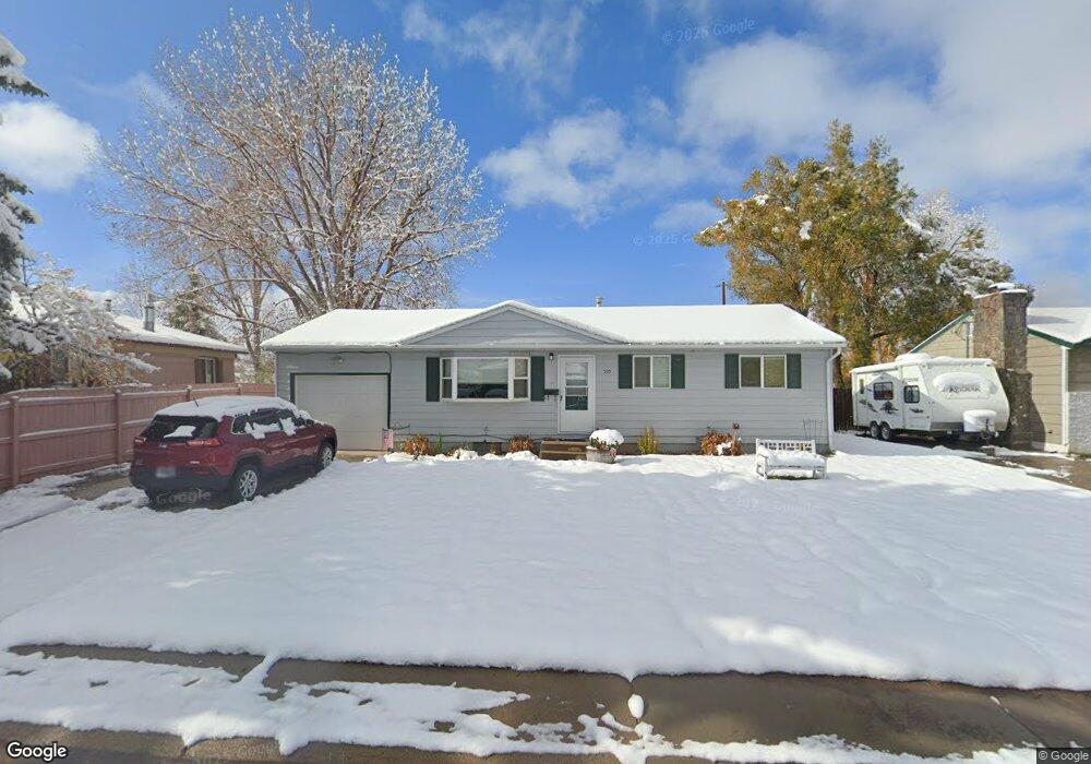
535 Smith St Lander, WY 82520
Estimated Value: $302,794 - $326,000
3
Beds
2
Baths
912
Sq Ft
$343/Sq Ft
Est. Value
About This Home
This home is located at 535 Smith St, Lander, WY 82520 and is currently estimated at $313,199, approximately $343 per square foot. 535 Smith St is a home located in Fremont County with nearby schools including Lander Valley High School and Lander Christian Academy.
Ownership History
Date
Name
Owned For
Owner Type
Purchase Details
Closed on
Feb 25, 2008
Sold by
Tamim Caroline Craze
Bought by
Mele Anthony W and Mele Sherry M
Current Estimated Value
Home Financials for this Owner
Home Financials are based on the most recent Mortgage that was taken out on this home.
Original Mortgage
$134,000
Outstanding Balance
$84,105
Interest Rate
5.88%
Mortgage Type
New Conventional
Estimated Equity
$229,094
Purchase Details
Closed on
Sep 27, 2006
Sold by
Lang Kyllan and Fiordalisl Bruce William
Bought by
Tamim Carollne Craze
Create a Home Valuation Report for This Property
The Home Valuation Report is an in-depth analysis detailing your home's value as well as a comparison with similar homes in the area
Purchase History
| Date | Buyer | Sale Price | Title Company |
|---|---|---|---|
| Mele Anthony W | -- | None Available | |
| Tamim Carollne Craze | -- | None Available |
Source: Public Records
Mortgage History
| Date | Status | Borrower | Loan Amount |
|---|---|---|---|
| Open | Mele Anthony W | $134,000 |
Source: Public Records
Tax History
| Year | Tax Paid | Tax Assessment Tax Assessment Total Assessment is a certain percentage of the fair market value that is determined by local assessors to be the total taxable value of land and additions on the property. | Land | Improvement |
|---|---|---|---|---|
| 2025 | $1,927 | $21,552 | $3,797 | $17,755 |
| 2024 | $1,927 | $27,965 | $5,063 | $22,902 |
| 2023 | $1,832 | $26,929 | $4,906 | $22,023 |
| 2022 | $1,489 | $22,876 | $4,906 | $17,970 |
| 2021 | $1,303 | $19,829 | $4,782 | $15,047 |
| 2020 | $1,283 | $19,606 | $4,782 | $14,824 |
| 2019 | $1,265 | $19,112 | $4,743 | $14,369 |
| 2018 | $1,254 | $18,796 | $4,743 | $14,053 |
| 2017 | $1,185 | $17,892 | $4,743 | $13,149 |
| 2016 | $1,187 | $17,935 | $4,743 | $13,192 |
| 2015 | $1,119 | $17,239 | $4,743 | $12,496 |
| 2014 | $994 | $15,669 | $4,743 | $10,926 |
Source: Public Records
Map
Nearby Homes
- 515 Smith St
- 555 Smith St
- 575 Smith St
- 560 Smith St
- 1080 Spriggs Dr
- 1080 Spriggs Dr Unit Smith St.
- 1055 Spriggs Dr
- 580 Smith St
- 1060 Spriggs Dr
- 1070 Mcdougall Dr
- 475 Smith St
- 1035 Spriggs Dr
- 1030 Mcdougall Dr
- 460 Smith St
- 1050 Spriggs Dr
- 455 Smith St
- 1080 Mcdougall Dr
- 1020 Mcdougall Dr
- 1025 Spriggs Dr
- 440 Smith St
Your Personal Tour Guide
Ask me questions while you tour the home.