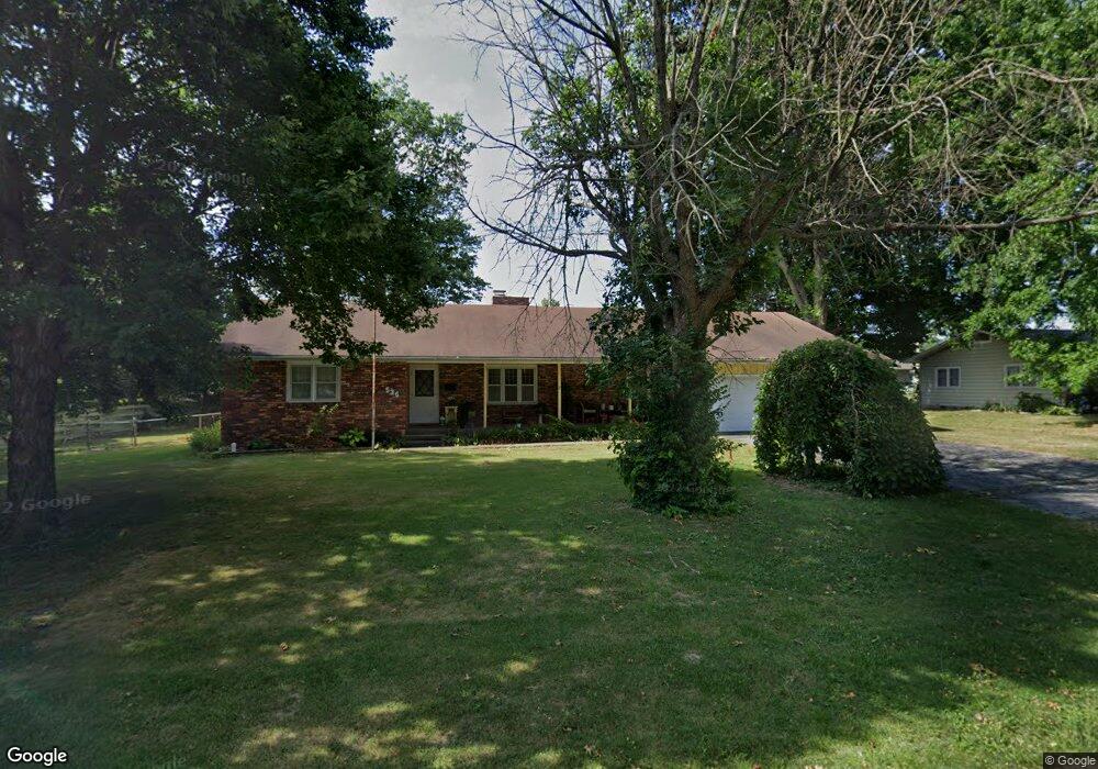
536 S Buxton Ln Republic, MO 65738
Estimated Value: $216,000 - $268,000
3
Beds
3
Baths
1,960
Sq Ft
$126/Sq Ft
Est. Value
About This Home
This home is located at 536 S Buxton Ln, Republic, MO 65738 and is currently estimated at $246,027, approximately $125 per square foot. 536 S Buxton Ln is a home located in Greene County with nearby schools including Schofield Elementary School, Republic Middle School, and Republic High School.
Ownership History
Date
Name
Owned For
Owner Type
Purchase Details
Closed on
Jan 13, 2015
Sold by
Lee Deborah A and West Deborah A
Bought by
Lee Deborah A
Current Estimated Value
Home Financials for this Owner
Home Financials are based on the most recent Mortgage that was taken out on this home.
Original Mortgage
$72,000
Outstanding Balance
$54,690
Interest Rate
3.93%
Mortgage Type
New Conventional
Estimated Equity
$191,337
Purchase Details
Closed on
Mar 26, 2012
Sold by
West Gerald Keith and West Deborah A
Bought by
West Gerald Keith and West Deborah A
Purchase Details
Closed on
Sep 9, 2009
Sold by
Aurorl Loan Services Llc
Bought by
West Gerald K and West Gerald Keith
Home Financials for this Owner
Home Financials are based on the most recent Mortgage that was taken out on this home.
Original Mortgage
$74,330
Interest Rate
5.16%
Mortgage Type
VA
Purchase Details
Closed on
Jun 17, 2009
Sold by
Inman Craig
Bought by
Aurora Loan Services Llc
Create a Home Valuation Report for This Property
The Home Valuation Report is an in-depth analysis detailing your home's value as well as a comparison with similar homes in the area
Home Values in the Area
Average Home Value in this Area
Purchase History
We collect this data history from publicly available records. To have your information removed, we recommend requesting removal directly through your county’s website.
| Date | Buyer | Sale Price | Title Company |
|---|---|---|---|
| Lee Deborah A | -- | -- | |
| West Gerald Keith | -- | Lincoln Land Title | |
| West Gerald K | -- | Mokhkan Title Services Llc | |
| Aurora Loan Services Llc | $112,669 | None Available |
Source: Public Records
Mortgage History
We collect this data history from publicly available records. To have your information removed, we recommend requesting removal directly through your county’s website.
| Date | Status | Borrower | Loan Amount |
|---|---|---|---|
| Open | Lee Deborah A | $72,000 | |
| Previous Owner | West Gerald K | $74,330 |
Source: Public Records
Tax History
| Year | Tax Paid | Tax Assessment Tax Assessment Total Assessment is a certain percentage of the fair market value that is determined by local assessors to be the total taxable value of land and additions on the property. | Land | Improvement |
|---|---|---|---|---|
| 2025 | $1,295 | $25,730 | $5,700 | $20,030 |
| 2024 | $1,295 | $23,180 | $4,750 | $18,430 |
| 2023 | $1,270 | $23,180 | $4,750 | $18,430 |
| 2022 | $1,181 | $21,450 | $4,750 | $16,700 |
| 2021 | $1,174 | $21,450 | $4,750 | $16,700 |
| 2020 | $1,193 | $21,450 | $4,750 | $16,700 |
| 2019 | $1,188 | $21,450 | $4,750 | $16,700 |
| 2018 | $1,116 | $19,460 | $3,800 | $15,660 |
| 2017 | $1,106 | $18,240 | $3,800 | $14,440 |
| 2016 | $1,049 | $18,240 | $3,800 | $14,440 |
| 2015 | $1,045 | $18,240 | $3,800 | $14,440 |
| 2014 | $1,049 | $18,160 | $3,800 | $14,360 |
Source: Public Records
Map
Nearby Homes
- 202 S Jackson St
- 500 Ethan Ave
- 0 Highway 60 Unit 60319554
- 0 Highway 60 Unit 60319555
- 833 W Charlotte St
- 130 S Walnut Ave
- 874 W Charlotte Ct
- 511 S Main Ave
- 916 W Charlotte Ct
- 1001 W Broad St
- 1011 W Crestview Ln
- 000 W Crestview Ln
- 154 E Brooks St
- 427 N College Ave
- 1135 W Broad St
- 208 E Brooks St
- 211 E Mill St
- 521 N Forest Ln
- 586 S Caroline
- 435 W Logan St
- 543 S Forest Ln
- 531 N Forest Ln
- 531 S Forest Ln
- 528 S Eagan St
- 555 S Forest Ln
- Tbd S Buxton Ln
- 539 S Buxton Ln
- 529 S Forest Ln
- 535 Blk West Forest
- 316 S Eagan St
- 567 S Forest Ln
- Tbd S Forest Ln
- S Tbd S Forest Ln
- 547 S Buxton Ln
- 556 S Buxton Ln
- 517 S Forest Ln
- 579 S Forest Ln
- 323 S Buxton Ln
- Lot 48 Hudson
- 557 S Buxton Ln
Your Personal Tour Guide
Ask me questions while you tour the home.