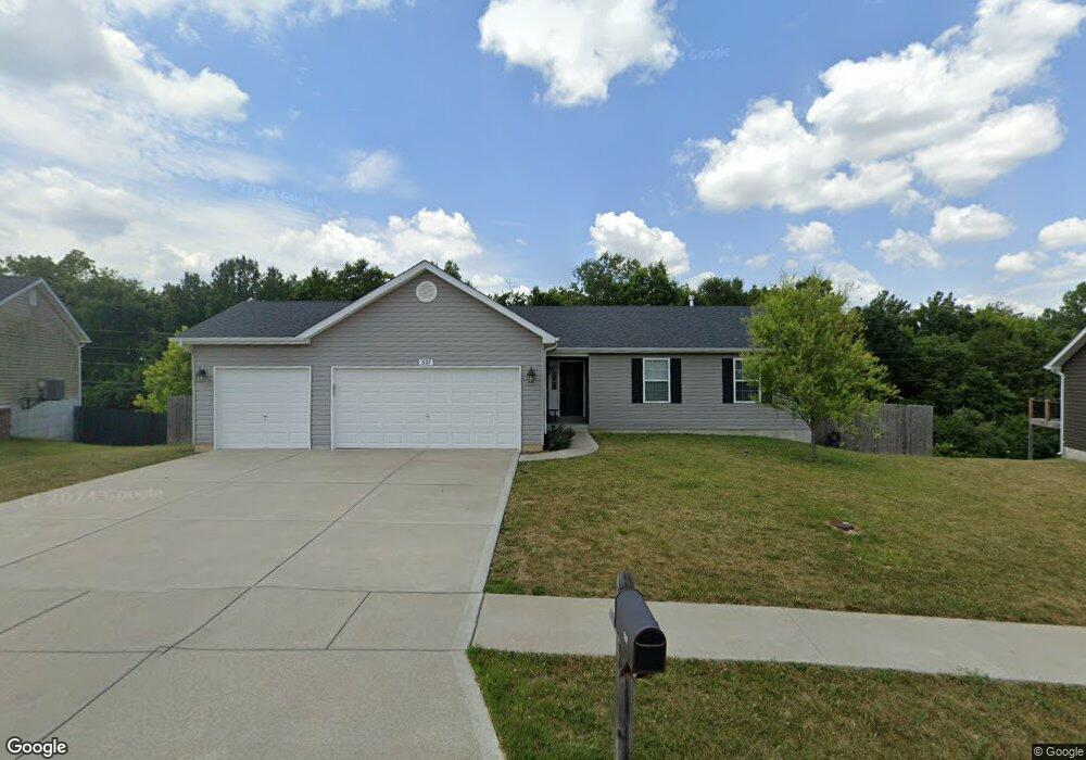
537 Falcons Flight Wright City, MO 63390
Estimated Value: $309,000 - $331,000
Studio
2
Baths
1,441
Sq Ft
$220/Sq Ft
Est. Value
About This Home
This home is located at 537 Falcons Flight, Wright City, MO 63390 and is currently estimated at $316,871, approximately $219 per square foot. 537 Falcons Flight is a home located in Warren County with nearby schools including Wright City West Elementary School, Wright City East Elementary School, and Wright City Middle School.
Ownership History
Date
Name
Owned For
Owner Type
Purchase Details
Closed on
Jan 19, 2021
Sold by
Hurych Taylor A and Thornberry Taylor A
Bought by
Thornberry Taylor A and Thornberry Thomas W
Current Estimated Value
Home Financials for this Owner
Home Financials are based on the most recent Mortgage that was taken out on this home.
Original Mortgage
$187,850
Outstanding Balance
$165,989
Interest Rate
2.67%
Mortgage Type
Balloon
Estimated Equity
$150,882
Purchase Details
Closed on
Nov 30, 2018
Sold by
Larry Terbrock Const Co
Bought by
Hurrch Taylor A
Home Financials for this Owner
Home Financials are based on the most recent Mortgage that was taken out on this home.
Original Mortgage
$7,181
Interest Rate
4.8%
Mortgage Type
Unknown
Create a Home Valuation Report for This Property
The Home Valuation Report is an in-depth analysis detailing your home's value as well as a comparison with similar homes in the area
Home Values in the Area
Average Home Value in this Area
Purchase History
| Date | Buyer | Sale Price | Title Company |
|---|---|---|---|
| Thornberry Taylor A | -- | None Listed On Document | |
| Hurrch Taylor A | -- | -- |
Source: Public Records
Mortgage History
| Date | Status | Borrower | Loan Amount |
|---|---|---|---|
| Open | Thornberry Taylor A | $187,850 | |
| Previous Owner | Hurrch Taylor A | $7,181 | |
| Previous Owner | Hurrch Taylor A | $179,513 |
Source: Public Records
Tax History
| Year | Tax Paid | Tax Assessment Tax Assessment Total Assessment is a certain percentage of the fair market value that is determined by local assessors to be the total taxable value of land and additions on the property. | Land | Improvement |
|---|---|---|---|---|
| 2025 | $2,627 | $36,898 | $5,565 | $31,333 |
| 2024 | $2,627 | $32,654 | $4,925 | $27,729 |
| 2023 | $2,282 | $32,654 | $4,925 | $27,729 |
| 2022 | $2,129 | $30,235 | $4,560 | $25,675 |
| 2021 | $2,129 | $30,235 | $4,560 | $25,675 |
| 2020 | $2,159 | $30,235 | $4,560 | $25,675 |
| 2019 | $2,153 | $30,235 | $0 | $0 |
| 2017 | $157 | $2,280 | $0 | $0 |
| 2016 | $158 | $2,280 | $0 | $0 |
| 2015 | -- | $2,280 | $0 | $0 |
| 2011 | -- | $2,280 | $0 | $0 |
Source: Public Records
Map
Nearby Homes
- 709 Talon Dr
- 707 Talon Dr
- lot 16 Pine Crest Estates
- 16310 Sugar Pine Ct
- 235 Winter Wheat Dr
- 327 Late Harvest Dr
- 1021 Samwise St
- 1019 Samwise St
- 1017 Samwise St
- 1015 Samwise St
- 1013 Samwise St
- 1011 Samwise St
- 416 Fredricksburg Way
- 26950 Trembley Ln
- 305 Stonewall Ave
- 7 Bridle Spur Ct
- 12 Willow Ct
- 27499 Franklin Rd
- 120 Peruque Creek Manor
- 111 Peruque Creek Manor
- 537 Falcons Flight
- 539 Falcons Flight
- 539 Falcons Flight
- 535 Falcons Flight
- 535 Falcons Flight
- 541 Falcons Flight
- 541 Falcons Flight
- 533 Falcons Flight
- 533 Falcons Flight
- 532 Falcons Flight
- 533 Falcons Flight
- 540 Falcons Flight
- 416 Falcons Prey
- 416 Falcons Prey
- 416 Falcons Prey
- 543 Falcons Flight
- 531 Falcons Flight
- 2408 Falcons Prey Lot 66
- 2408Lot 66 Falcons Prey
- 540 Falcons Flight Lot 85
Your Personal Tour Guide
Ask me questions while you tour the home.