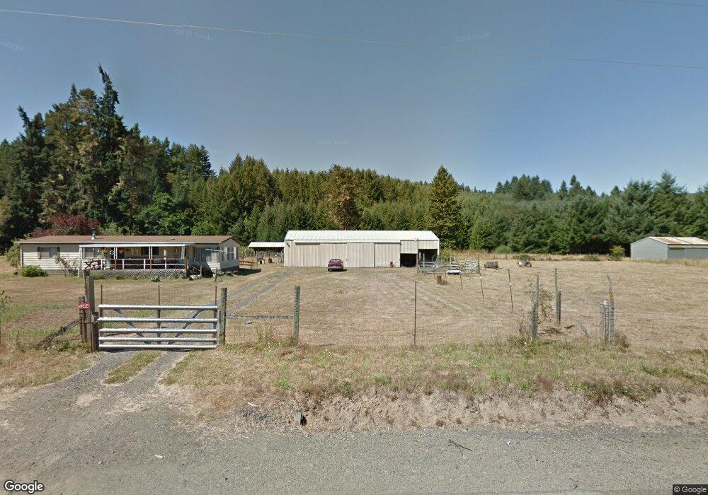
5394 Hayhurst Rd Yoncalla, OR 97499
Estimated Value: $298,813 - $410,000
3
Beds
2
Baths
1,440
Sq Ft
$254/Sq Ft
Est. Value
About This Home
This home is located at 5394 Hayhurst Rd, Yoncalla, OR 97499 and is currently estimated at $365,953, approximately $254 per square foot. 5394 Hayhurst Rd is a home located in Douglas County with nearby schools including Yoncalla Elementary School and Yoncalla High School.
Ownership History
Date
Name
Owned For
Owner Type
Purchase Details
Closed on
May 27, 2014
Sold by
Allen Eula E and Allen Dale
Bought by
Trump James B and Trump Sundee L
Current Estimated Value
Home Financials for this Owner
Home Financials are based on the most recent Mortgage that was taken out on this home.
Original Mortgage
$100,000
Outstanding Balance
$75,702
Interest Rate
4.23%
Mortgage Type
Unknown
Estimated Equity
$290,251
Purchase Details
Closed on
Feb 12, 2010
Sold by
Allen Eula E
Bought by
Allen Eula E and Allen Dale
Create a Home Valuation Report for This Property
The Home Valuation Report is an in-depth analysis detailing your home's value as well as a comparison with similar homes in the area
Purchase History
| Date | Buyer | Sale Price | Title Company |
|---|---|---|---|
| Trump James B | $130,000 | Amerititle | |
| Allen Eula E | -- | None Available |
Source: Public Records
Mortgage History
| Date | Status | Borrower | Loan Amount |
|---|---|---|---|
| Open | Trump James B | $100,000 |
Source: Public Records
Tax History
| Year | Tax Paid | Tax Assessment Tax Assessment Total Assessment is a certain percentage of the fair market value that is determined by local assessors to be the total taxable value of land and additions on the property. | Land | Improvement |
|---|---|---|---|---|
| 2025 | $1,246 | $126,780 | -- | -- |
| 2024 | $1,200 | $123,088 | -- | -- |
| 2023 | $1,167 | $119,503 | $0 | $0 |
| 2022 | $1,135 | $116,023 | $0 | $0 |
| 2021 | $1,104 | $112,644 | $0 | $0 |
| 2020 | $1,073 | $109,364 | $0 | $0 |
| 2019 | $1,044 | $106,179 | $0 | $0 |
| 2018 | $1,016 | $103,087 | $0 | $0 |
| 2017 | $988 | $100,085 | $0 | $0 |
| 2016 | $961 | $97,170 | $0 | $0 |
Source: Public Records
Map
Nearby Homes
- 5312 Hayhurst Rd
- 5301 Hayhurst Rd
- 5256 Hayhurst Rd
- 5228 Hayhurst Rd
- 5227 Hayhurst Rd
- 5210 Hayhurst Rd
- 5195 Hayhurst Rd
- 0 Skelly Rd Unit 9056789
- 5939 Hayhurst Rd
- 5990 Hayhurst Rd
- 6021 Hayhurst Rd
- 453 Skelly Rd
- 5992 Hayhurst Rd
- 479 Skelly Rd
- 567 Skelly Rd
- 5996 Hayhurst Rd
- 151 Skelly South Rd
- 175 Skelly South Rd
- 868 Skelly Rd
- 835 Skelly Rd
Your Personal Tour Guide
Ask me questions while you tour the home.