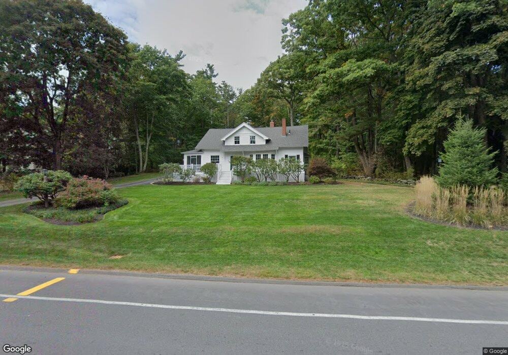
54 Foreside Rd Cumberland Foreside, ME 04110
Cumberland Foreside NeighborhoodEstimated Value: $1,066,173 - $1,500,000
3
Beds
2
Baths
2,568
Sq Ft
$471/Sq Ft
Est. Value
About This Home
This home is located at 54 Foreside Rd, Cumberland Foreside, ME 04110 and is currently estimated at $1,210,293, approximately $471 per square foot. 54 Foreside Rd is a home located in Cumberland County with nearby schools including Mabel I. Wilson School, Greely Middle School 4-5, and Greely Middle School.
Ownership History
Date
Name
Owned For
Owner Type
Purchase Details
Closed on
Feb 8, 2006
Sold by
Goodrich John F and Goodrich Cornelia S
Bought by
Karkos Scott and Karkos Denise
Current Estimated Value
Create a Home Valuation Report for This Property
The Home Valuation Report is an in-depth analysis detailing your home's value as well as a comparison with similar homes in the area
Home Values in the Area
Average Home Value in this Area
Purchase History
| Date | Buyer | Sale Price | Title Company |
|---|---|---|---|
| Karkos Scott | -- | -- | |
| Karkos Scott | -- | -- | |
| Karkos Scott | -- | -- |
Source: Public Records
Mortgage History
| Date | Status | Borrower | Loan Amount |
|---|---|---|---|
| Open | Karkos Scott | $40,500 | |
| Open | Karkos Scott | $417,000 | |
| Closed | Karkos Scott | $30,000 | |
| Closed | Karkos Scott | $451,400 |
Source: Public Records
Tax History
| Year | Tax Paid | Tax Assessment Tax Assessment Total Assessment is a certain percentage of the fair market value that is determined by local assessors to be the total taxable value of land and additions on the property. | Land | Improvement |
|---|---|---|---|---|
| 2025 | $12,497 | $496,300 | $234,800 | $261,500 |
| 2024 | $11,539 | $496,300 | $234,800 | $261,500 |
| 2023 | $10,993 | $496,300 | $234,800 | $261,500 |
| 2022 | $10,522 | $496,300 | $234,800 | $261,500 |
| 2021 | $10,199 | $496,300 | $234,800 | $261,500 |
| 2020 | $10,100 | $496,300 | $234,800 | $261,500 |
| 2019 | $9,852 | $496,300 | $234,800 | $261,500 |
| 2018 | $9,641 | $489,400 | $234,800 | $254,600 |
| 2017 | $9,129 | $485,600 | $234,800 | $250,800 |
| 2016 | $8,862 | $485,600 | $234,800 | $250,800 |
| 2015 | $8,789 | $485,600 | $234,800 | $250,800 |
| 2014 | $8,449 | $485,600 | $234,800 | $250,800 |
| 2013 | $8,255 | $485,600 | $234,800 | $250,800 |
Source: Public Records
Map
Nearby Homes
- 35 Deans Way
- 52 Maeves Way
- 10 Eagles Way Unit 10
- 9 Conifer Ridge
- 59 Underwood Rd
- 24 Amerescoggin Rd
- 24 Johnson Rd
- 76 Johnson Rd
- 252 Foreside Rd
- 16 Town Landing Rd
- 5 & 6 Harmony Way
- 5 Harmony Way
- 267 U S Route 1 Unit 308
- 267 U S 1 Unit 305
- 267 U S 1 Unit 301
- 267 U S 1 Unit 404
- 267 U S 1 Unit 201
- 267 U S 1 Unit 309
- 267 U S 1 Unit PH503
- 140 Longwoods Rd
- 52 Foreside Rd
- Lot 9 Maeve's Way
- Lot 11 Maeve's Way
- Lot Five Maeve's Way
- Lot 5 Maeve's Way
- Lot 13 Maeve's Way
- Lot 8 Maeve's Way
- Lot 10 Maeve's Way
- 4 Maeve's Way
- Lot 14 Maeve's Way
- Lot 16 Maeve's Way
- Lot 2 Maeve's Way
- 1 Starboard Ln
- 48 Foreside Rd
- 46 Foreside Rd
- 47 Foreside Rd
- 42 Foreside Rd
- 29 Maeve's Way
- 29 Maeves Way
- 29 Maeves Way
Your Personal Tour Guide
Ask me questions while you tour the home.