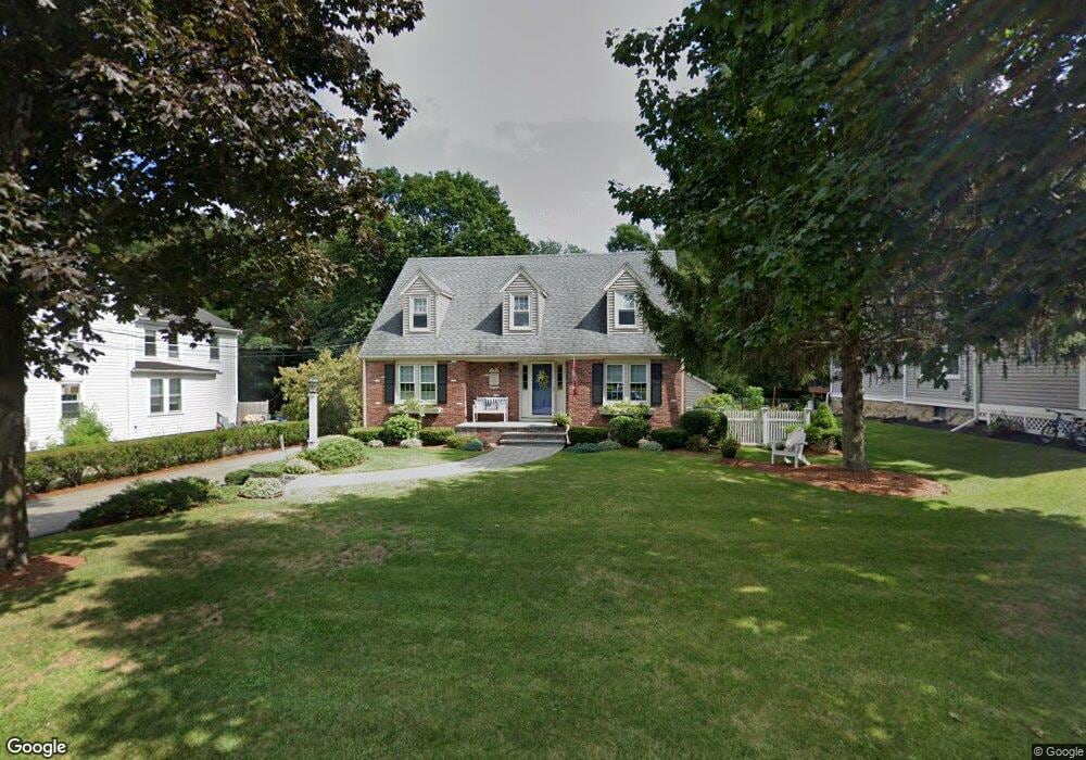
54 Messinger St Canton, MA 02021
Estimated Value: $822,000 - $1,041,000
3
Beds
2
Baths
2,154
Sq Ft
$410/Sq Ft
Est. Value
About This Home
This home is located at 54 Messinger St, Canton, MA 02021 and is currently estimated at $883,946, approximately $410 per square foot. 54 Messinger St is a home located in Norfolk County with nearby schools including Canton High School, St. John the Evangelist School, and Chabad Day School of School.
Ownership History
Date
Name
Owned For
Owner Type
Purchase Details
Closed on
Jan 14, 2019
Sold by
Callahan Albert J and Callahan Diane E
Bought by
Albert & Diane Callahan Irt
Current Estimated Value
Create a Home Valuation Report for This Property
The Home Valuation Report is an in-depth analysis detailing your home's value as well as a comparison with similar homes in the area
Home Values in the Area
Average Home Value in this Area
Purchase History
| Date | Buyer | Sale Price | Title Company |
|---|---|---|---|
| Albert & Diane Callahan Irt | -- | -- |
Source: Public Records
Tax History
| Year | Tax Paid | Tax Assessment Tax Assessment Total Assessment is a certain percentage of the fair market value that is determined by local assessors to be the total taxable value of land and additions on the property. | Land | Improvement |
|---|---|---|---|---|
| 2025 | $8,166 | $825,700 | $294,600 | $531,100 |
| 2024 | $7,984 | $800,800 | $283,300 | $517,500 |
| 2023 | $7,640 | $722,800 | $283,300 | $439,500 |
| 2022 | $7,320 | $644,900 | $269,800 | $375,100 |
| 2021 | $7,174 | $588,000 | $245,200 | $342,800 |
| 2020 | $6,616 | $541,000 | $210,200 | $330,800 |
| 2019 | $6,441 | $519,400 | $180,400 | $339,000 |
| 2018 | $6,081 | $489,600 | $163,300 | $326,300 |
| 2017 | $6,193 | $484,200 | $160,100 | $324,100 |
| 2016 | $6,096 | $476,600 | $156,200 | $320,400 |
| 2015 | $6,269 | $489,000 | $151,700 | $337,300 |
Source: Public Records
Map
Nearby Homes
- 8 Walnut Knolls
- 80 Walnut St Unit 403
- 80 Walnut St Unit 311
- 424 Washington St
- 20 Sapphire Cir Unit Lot 2
- 20 Dunbar St
- 3 Revere Ct
- 81 Neponset St Unit 81
- 77 Neponset St Unit 77
- 87 Neponset St Unit 87
- 4 Forge Pond Unit D
- 651 Washington St
- 24 Forge Pond Unit H
- 1 Centre St Unit 11
- 15 Revolution Way Unit 2205
- 1 Revolution Way Unit 307
- 60 Coppersmith Way Unit 304
- 29 Maple St Unit G
- 16 Danforth St
- 12 Danforth St
- 44 Messinger St Unit 44
- 56 Messinger St
- 42 Messinger St
- 90 Messinger St Unit 1
- 90 Messinger St Unit 90
- 62 Messinger St
- 40 Messinger St
- 68 Messinger St
- 36 Messinger St
- 101 Walnut St
- 82 Messinger St
- 21 Messinger St
- 8 Messinger St
- 99 Walnut St
- 107 Walnut St Unit B
- 107 Walnut St Unit A
- 107 A Walnut St Unit A
- 107 Walnut St
- 13 Walnut Knolls
- 79 Messinger St
Your Personal Tour Guide
Ask me questions while you tour the home.