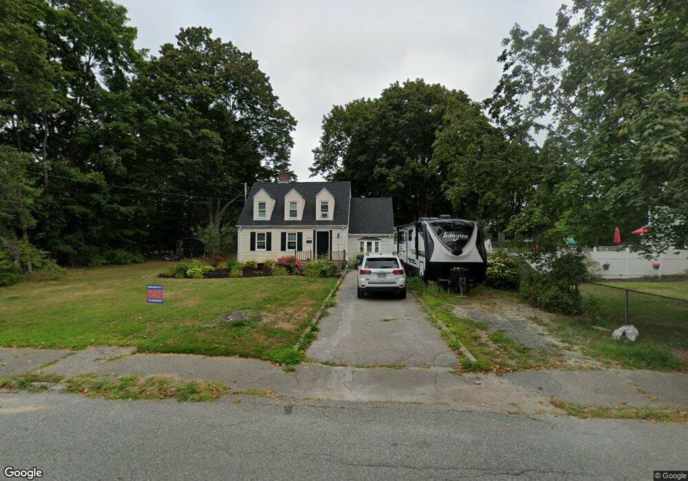
54 Pine St Abington, MA 02351
Estimated Value: $533,000 - $598,000
4
Beds
3
Baths
1,728
Sq Ft
$327/Sq Ft
Est. Value
About This Home
This home is located at 54 Pine St, Abington, MA 02351 and is currently estimated at $565,505, approximately $327 per square foot. 54 Pine St is a home located in Plymouth County with nearby schools including Beaver Brook Elementary School, Abington Middle School, and Woodsdale School.
Ownership History
Date
Name
Owned For
Owner Type
Purchase Details
Closed on
Apr 20, 2023
Sold by
Collins Kathryn A
Bought by
Collins Deborah M
Current Estimated Value
Purchase Details
Closed on
Jul 28, 2021
Sold by
Collins Deborah M
Bought by
Collins Kathryn A and Collins Deborah M
Purchase Details
Closed on
Sep 19, 1985
Bought by
Collins Deborah M
Create a Home Valuation Report for This Property
The Home Valuation Report is an in-depth analysis detailing your home's value as well as a comparison with similar homes in the area
Home Values in the Area
Average Home Value in this Area
Purchase History
We collect this data history from publicly available records. To have your information removed, we recommend requesting removal directly through your county’s website.
| Date | Buyer | Sale Price | Title Company |
|---|---|---|---|
| Collins Deborah M | -- | None Available | |
| Collins Kathryn A | -- | None Available | |
| Collins Deborah M | -- | -- |
Source: Public Records
Mortgage History
We collect this data history from publicly available records. To have your information removed, we recommend requesting removal directly through your county’s website.
| Date | Status | Borrower | Loan Amount |
|---|---|---|---|
| Previous Owner | Collins Deborah M | $190,200 | |
| Previous Owner | Collins Deborah M | $150,000 | |
| Previous Owner | Collins Deborah M | $58,000 | |
| Previous Owner | Collins Deborah M | $10,000 |
Source: Public Records
Tax History
| Year | Tax Paid | Tax Assessment Tax Assessment Total Assessment is a certain percentage of the fair market value that is determined by local assessors to be the total taxable value of land and additions on the property. | Land | Improvement |
|---|---|---|---|---|
| 2025 | $6,470 | $495,400 | $241,400 | $254,000 |
| 2024 | $6,452 | $482,200 | $219,700 | $262,500 |
| 2023 | $6,129 | $431,300 | $191,300 | $240,000 |
| 2022 | $6,012 | $395,000 | $167,700 | $227,300 |
| 2021 | $5,575 | $338,300 | $152,300 | $186,000 |
| 2020 | $5,668 | $333,400 | $147,700 | $185,700 |
| 2019 | $5,361 | $308,300 | $140,800 | $167,500 |
| 2018 | $5,366 | $301,100 | $140,800 | $160,300 |
| 2017 | $4,962 | $270,400 | $140,800 | $129,600 |
| 2016 | $4,601 | $256,600 | $134,200 | $122,400 |
| 2015 | $4,379 | $257,600 | $134,200 | $123,400 |
Source: Public Records
Map
Nearby Homes
- 57 Battery St
- 147 Oak St
- 1065 Bedford St
- 1148 Bedford St
- 33 Brookline St
- 77 Highland Rd
- 40 Fir Rd Unit 386
- 17 Birch St
- 16 Hemlock St Unit 222
- 30 Leisurewoods Dr
- 24 Leisurewoods Dr Unit 84
- 28 Nevens Cir
- 11 Hawthorne St
- 0 Bedford St
- 138 Randolph St
- 7 Chestnut Cir
- 86 Leisurewoods Dr Unit 279
- 87 Leisurewoods Dr
- 9 Juniper Cir
- 1 Canterbury Ln
Your Personal Tour Guide
Ask me questions while you tour the home.