Estimated Value: $265,000 - $323,000
3
Beds
2
Baths
1,102
Sq Ft
$262/Sq Ft
Est. Value
About This Home
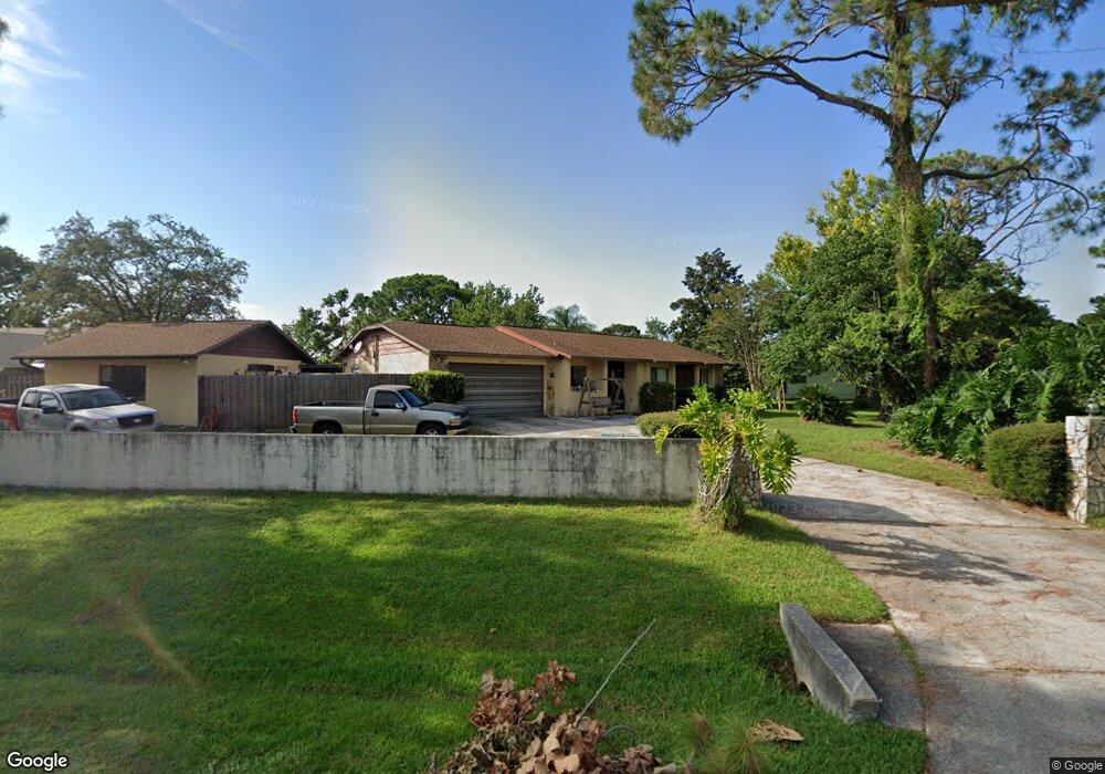
This home is located at 5400 Hastings St, Cocoa, FL 32927 and is currently estimated at $288,192, approximately $261 per square foot. 5400 Hastings St is a home located in Brevard County with nearby schools including Enterprise Elementary School, Space Coast Junior/Senior High School, and Sculptor Charter School.
Ownership History
Date
Name
Owned For
Owner Type
Purchase Details
Closed on
Jul 30, 1996
Sold by
Hilliard Philip L and Hilliard Michaela F
Bought by
Blum Norman K and Blum Susan J
Current Estimated Value
Home Financials for this Owner
Home Financials are based on the most recent Mortgage that was taken out on this home.
Original Mortgage
$55,000
Outstanding Balance
$4,367
Interest Rate
8.26%
Estimated Equity
$283,825
Create a Home Valuation Report for This Property
The Home Valuation Report is an in-depth analysis detailing your home's value as well as a comparison with similar homes in the area
Home Values in the Area
Average Home Value in this Area
Purchase History
We collect this data history from publicly available records. To have your information removed, we recommend requesting removal directly through your county’s website.
| Date | Buyer | Sale Price | Title Company |
|---|---|---|---|
| Blum Norman K | $70,000 | -- |
Source: Public Records
Mortgage History
We collect this data history from publicly available records. To have your information removed, we recommend requesting removal directly through your county’s website.
| Date | Status | Borrower | Loan Amount |
|---|---|---|---|
| Open | Blum Norman K | $55,000 |
Source: Public Records
Tax History
| Year | Tax Paid | Tax Assessment Tax Assessment Total Assessment is a certain percentage of the fair market value that is determined by local assessors to be the total taxable value of land and additions on the property. | Land | Improvement |
|---|---|---|---|---|
| 2025 | $1,392 | $106,140 | -- | -- |
| 2024 | $1,356 | $103,150 | -- | -- |
| 2023 | $1,356 | $100,150 | $0 | $0 |
| 2022 | $1,262 | $97,240 | $0 | $0 |
| 2021 | $1,261 | $94,410 | $0 | $0 |
| 2020 | $1,211 | $93,110 | $0 | $0 |
| 2019 | $1,147 | $91,020 | $0 | $0 |
| 2018 | $1,140 | $89,330 | $0 | $0 |
| 2017 | $1,135 | $87,500 | $0 | $0 |
| 2016 | $1,135 | $85,710 | $26,000 | $59,710 |
| 2015 | $1,147 | $85,120 | $26,000 | $59,120 |
| 2014 | $1,148 | $84,450 | $26,000 | $58,450 |
Source: Public Records
Map
Nearby Homes
- 6615 Dock Ave
- 6601 Cedar Ave
- 6760 Cairo Rd
- 6815 Bryant Rd
- 6965 Hundred Acre Dr
- 6581 Bancroft Ave
- 6813 Cecil Rd
- 6643 Emil Ave
- 5555 Brandon St
- 6450 Ember Ave
- 5525 Fairbridge St
- 5424 Flint Rd
- 00 Unknown
- 5145 Carter St
- 5070 Curtis Blvd
- 6438 Hudson Rd
- 5155 Mayflower St
- 5165 Patricia St
- 5075 Carter St
- 5770 Fairbridge St
- 6720 Cedar Ave
- 5430 Hastings St
- 5413 Hastings St
- 5401 Hastings St
- 6740 Cedar Ave
- 6715 Cedar Ave
- 5437 Hastings St
- 6725 Cedar Ave
- 5440 Hastings St
- 6640 Cairo Rd
- 6760 Cedar Ave
- 6715 Bryant Rd
- 6636 Cedar Ave
- 6745 Cedar Ave
- 6710 Bryant Rd
- 6849 Sweet Bay Ct
- 6650 Cairo Rd
- 6720 Bryant Rd
- 6625 Dock Ave
- 6725 Bryant Rd
Your Personal Tour Guide
Ask me questions while you tour the home.