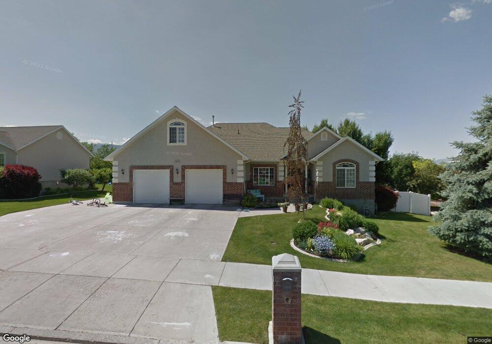
542 E 520 S Smithfield, UT 84335
Estimated Value: $538,000 - $669,000
Studio
--
Bath
2,122
Sq Ft
$291/Sq Ft
Est. Value
About This Home
This home is located at 542 E 520 S, Smithfield, UT 84335 and is currently estimated at $618,522, approximately $291 per square foot. 542 E 520 S is a home with nearby schools including Sunrise School, Cedar Ridge School, and North Cache Middle School.
Ownership History
Date
Name
Owned For
Owner Type
Purchase Details
Closed on
Oct 22, 2021
Sold by
Taylor Michael I and Taylor Katie G
Bought by
Widmer Sterling G and Widmer Sabrina E
Current Estimated Value
Home Financials for this Owner
Home Financials are based on the most recent Mortgage that was taken out on this home.
Original Mortgage
$300,000
Outstanding Balance
$272,978
Interest Rate
2.8%
Mortgage Type
New Conventional
Estimated Equity
$345,544
Purchase Details
Closed on
Mar 18, 2021
Sold by
Taylor Michael L and Taylor Katie
Bought by
Taylor Michael L and Taylor Katie G
Home Financials for this Owner
Home Financials are based on the most recent Mortgage that was taken out on this home.
Original Mortgage
$400,000
Interest Rate
2.7%
Mortgage Type
Credit Line Revolving
Purchase Details
Closed on
Jun 22, 2017
Sold by
Taylor Michael L and Taylor Katie G
Bought by
Taylor Michael L and Taylor Katie G
Purchase Details
Closed on
Feb 12, 2008
Sold by
Merrill Stephanie H
Bought by
Taylor Michael L and Taylor Katie G
Home Financials for this Owner
Home Financials are based on the most recent Mortgage that was taken out on this home.
Original Mortgage
$288,000
Interest Rate
6.04%
Mortgage Type
New Conventional
Purchase Details
Closed on
Jul 15, 2005
Sold by
East Sky View Development Inc
Bought by
Merrill Paul and Merrill Stephanie
Home Financials for this Owner
Home Financials are based on the most recent Mortgage that was taken out on this home.
Original Mortgage
$40,000
Interest Rate
5.55%
Mortgage Type
Seller Take Back
Purchase Details
Closed on
Dec 12, 2001
Sold by
Merrill Paul and Merrill Stephanie
Bought by
Merrill Stephanie H
Home Financials for this Owner
Home Financials are based on the most recent Mortgage that was taken out on this home.
Original Mortgage
$231,300
Interest Rate
6.57%
Purchase Details
Closed on
Mar 2, 2001
Sold by
Merrill Paul and Merrill Stephanie
Bought by
Merrill Stephanie H
Create a Home Valuation Report for This Property
The Home Valuation Report is an in-depth analysis detailing your home's value as well as a comparison with similar homes in the area
Home Values in the Area
Average Home Value in this Area
Purchase History
| Date | Buyer | Sale Price | Title Company |
|---|---|---|---|
| Widmer Sterling G | -- | Hickman Land Title Logan | |
| Taylor Michael L | -- | American Secure Ttl Brigham | |
| Taylor Michael L | -- | American Secure Ttl Brigham | |
| Taylor Michael L | -- | None Available | |
| Taylor Michael L | -- | Cache Title Company | |
| Merrill Paul | -- | Hickman Land Title Company | |
| Merrill Stephanie H | -- | Cache Title Company Inc | |
| Merrill Paul | -- | Cache Title Company Inc | |
| Merrill Stephanie H | -- | -- |
Source: Public Records
Mortgage History
| Date | Status | Borrower | Loan Amount |
|---|---|---|---|
| Open | Widmer Sterling G | $300,000 | |
| Previous Owner | Taylor Michael L | $400,000 | |
| Previous Owner | Taylor Michael L | $288,000 | |
| Previous Owner | Merrill Paul | $40,000 | |
| Previous Owner | Merrill Paul | $231,300 |
Source: Public Records
Tax History
| Year | Tax Paid | Tax Assessment Tax Assessment Total Assessment is a certain percentage of the fair market value that is determined by local assessors to be the total taxable value of land and additions on the property. | Land | Improvement |
|---|---|---|---|---|
| 2025 | $2,722 | $364,335 | $0 | $0 |
| 2024 | $2,670 | $335,350 | $0 | $0 |
| 2023 | $2,807 | $333,320 | $0 | $0 |
| 2022 | $2,853 | $333,320 | $0 | $0 |
| 2021 | $2,800 | $499,830 | $75,000 | $424,830 |
| 2020 | $2,624 | $437,020 | $75,000 | $362,020 |
| 2019 | $2,621 | $416,020 | $54,000 | $362,020 |
| 2018 | $2,402 | $368,800 | $54,000 | $314,800 |
| 2017 | $2,021 | $169,455 | $0 | $0 |
| 2016 | $2,056 | $169,455 | $0 | $0 |
| 2015 | $1,845 | $151,460 | $0 | $0 |
| 2014 | $1,821 | $152,450 | $0 | $0 |
| 2013 | -- | $152,450 | $0 | $0 |
Source: Public Records
Map
Nearby Homes
- 442 S 455 E
- 396 S 455 E
- 641 S 380 E
- 127 S 830 E Unit 304
- 805 S 270 E Unit 1
- 809 S 270 E Unit 2
- 813 S 270 E Unit 3
- 161 E 560 S
- 817 S 270 E Unit 4
- 821 S 270 E Unit 5
- 825 S 270 E Unit 6
- 434 S Cardon Ridge Dr
- 219 E 830 S
- 145 E 650 S
- 641 S 1080 E Unit 44
- 118 E 620 S
- 670 S 1080 E Unit 37
- 628 S 1080 E
- 1092 E 300 S
- 1400 E 300 S
Your Personal Tour Guide
Ask me questions while you tour the home.