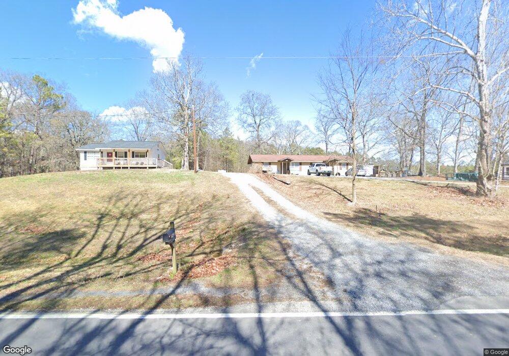
5420 Apison Rd Cohutta, GA 30710
Estimated Value: $102,000 - $172,000
About This Home
This home is located at 5420 Apison Rd, Cohutta, GA 30710 and is currently estimated at $150,558, approximately $106 per square foot. 5420 Apison Rd is a home located in Whitfield County with nearby schools including Cohutta Elementary School and Coahulla Creek High School.
Ownership History
We collect this data history from publicly available records. To have your information removed, we recommend requesting removal directly through your county’s website.
Purchase Details
Purchase Details
Purchase Details
Purchase Details
Purchase Details
Purchase Details
Purchase Details
Home Financials for this Owner
Home Financials are based on the most recent Mortgage that was taken out on this home.Purchase Details
Home Financials for this Owner
Home Financials are based on the most recent Mortgage that was taken out on this home.Purchase Details
Purchase Details
Purchase Details
Purchase History
We collect this data history from publicly available records. To have your information removed, we recommend requesting removal directly through your county’s website.
| Date | Buyer | Sale Price | Title Company |
|---|---|---|---|
| -- | None Listed On Document | ||
| -- | None Listed On Document | ||
| -- | None Listed On Document | ||
| -- | None Listed On Document | ||
| -- | None Listed On Document | ||
| -- | None Listed On Document | ||
| -- | None Listed On Document | ||
| -- | None Listed On Document | ||
| $13,395 | -- | ||
| $13,395 | -- | ||
| $27,305 | -- | ||
| $27,305 | -- | ||
| $52,500 | -- | ||
| $52,500 | -- | ||
| $76,126 | -- | ||
| $76,126 | -- | ||
| $72,000 | -- | ||
| $72,000 | -- | ||
| $57,000 | -- | ||
| $57,000 | -- | ||
| -- | -- | ||
| -- | -- | ||
| -- | -- | ||
| -- | -- |
Mortgage History
We collect this data history from publicly available records. To have your information removed, we recommend requesting removal directly through your county’s website.
| Date | Status | Borrower | Loan Amount |
|---|---|---|---|
| Previous Owner | $13,200 | ||
| Previous Owner | $72,000 |
Tax History
We collect this data history from publicly available records. To have your information removed, we recommend requesting removal directly through your county’s website.
| Year | Tax Paid | Tax Assessment Tax Assessment Total Assessment is a certain percentage of the fair market value that is determined by local assessors to be the total taxable value of land and additions on the property. | Land | Improvement |
|---|---|---|---|---|
| 2025 | $1,459 | $68,347 | $4,489 | $63,858 |
| 2024 | $1,459 | $68,347 | $4,489 | $63,858 |
| 2023 | $809 | $27,416 | $2,924 | $24,492 |
| 2022 | $760 | $25,769 | $2,869 | $22,900 |
| 2021 | $760 | $25,769 | $2,869 | $22,900 |
| 2020 | $786 | $25,769 | $2,869 | $22,900 |
| 2019 | $799 | $25,769 | $2,869 | $22,900 |
| 2018 | $797 | $25,284 | $2,384 | $22,900 |
| 2017 | $797 | $25,284 | $2,384 | $22,900 |
| 2016 | $704 | $23,212 | $2,384 | $20,828 |
| 2014 | $637 | $23,656 | $2,828 | $20,828 |
| 2013 | -- | $23,655 | $2,827 | $20,828 |
Map
- 00 Maughtey Chapel Rd
- 5032 Red Clay Rd
- 242 Tag Dr
- 523 Bryant Rd
- 0-A Cleveland Hwy
- 7 Old Dalton Cleveland Hwy
- 312 Stonegate Place
- 14 Stonechase Ln
- 13 Stonechase Ln
- Tract 3 Old Dalton Cleveland Hwy
- Tract 2 Old Dalton Cleveland Hwy Unit 10
- Tract 7 Old Dalton Cleveland Hwy
- Tract 1F Cleveland Hwy Unit 1A
- Tract 1B Cleveland Hwy Unit 1A
- Tract 1D Cleveland Hwy Unit 1A
- Tract 1E Cleveland Hwy Unit 1A
- Tract 1C Cleveland Hwy Unit 1A
- Tract 1A Cleveland Hwy Unit 1A
- 230 Sedgwick Way
- 0 Mount Vernon Rd Unit 131441
- 5420 Apison Rd Unit 1
- 5422 Apison Rd
- 5442 Apison Rd
- 5410 Apison Rd
- 5402 Apison Rd
- 5428 Apison Rd
- 5400 Dry Valley Rd
- 488 Old Apison Rd
- 26.22 Acres On Dry Valley Rd
- 5420 Dry Valley Rd
- 0 Dry Valley Rd
- 5440 Dry Valley Rd
- 420 Old Apison Rd
- 5349 Apison Rd
- 5504 Dry Valley Rd
- 5504 Apison Rd
- 5333 Apison Rd
- 260 Lucydee Way
- 5511 Dry Valley Rd
- 5520 Dry Valley Rd
Ask me questions while you tour the home.