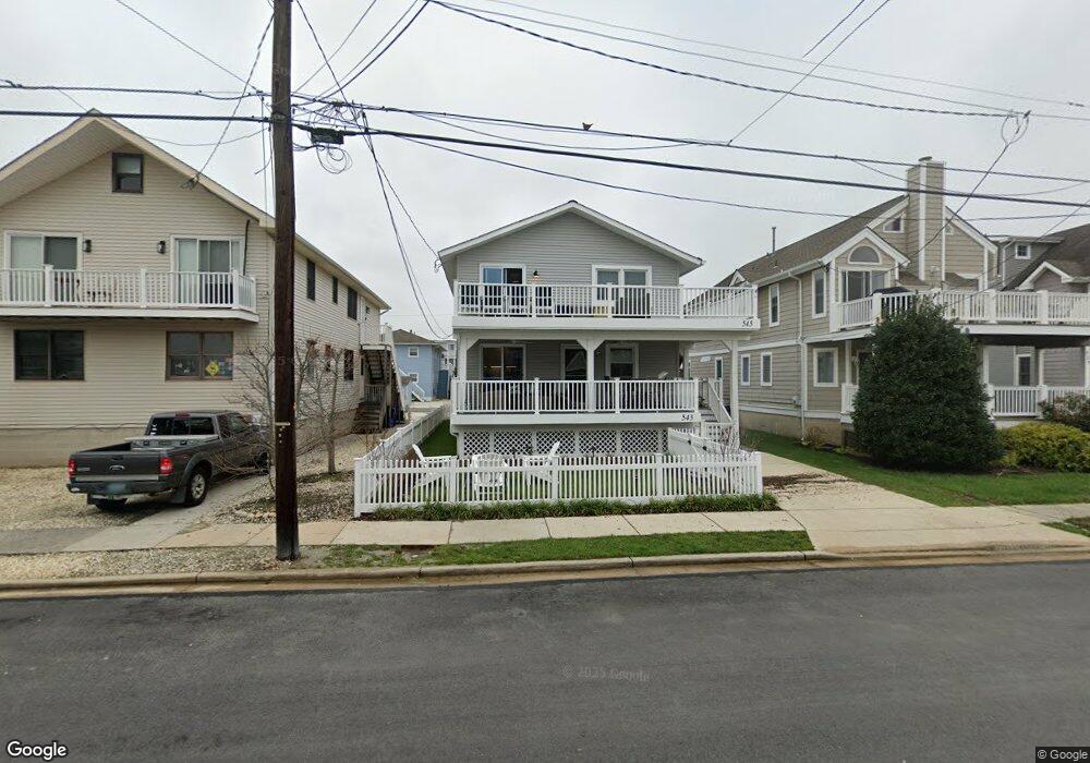
543 22nd St Avalon, NJ 08202
Avalon AreaEstimated Value: $1,533,699 - $2,226,000
About This Home
This home is located at 543 22nd St, Avalon, NJ 08202 and is currently estimated at $1,781,175, approximately $1,767 per square foot. 543 22nd St is a home located in Cape May County with nearby schools including Avalon Elementary School.
Ownership History
We collect this data history from publicly available records. To have your information removed, we recommend requesting removal directly through your county’s website.
Purchase Details
Home Financials for this Owner
Home Financials are based on the most recent Mortgage that was taken out on this home.Purchase Details
Home Financials for this Owner
Home Financials are based on the most recent Mortgage that was taken out on this home.Purchase Details
Purchase Details
Purchase Details
Purchase Details
Home Values in the Area
Average Home Value in this Area
Purchase History
We collect this data history from publicly available records. To have your information removed, we recommend requesting removal directly through your county’s website.
| Date | Buyer | Sale Price | Title Company |
|---|---|---|---|
| -- | Seaboard Title | ||
| $610,000 | -- | ||
| $200,000 | -- | ||
| $185,000 | -- | ||
| -- | -- | ||
| -- | -- |
Mortgage History
We collect this data history from publicly available records. To have your information removed, we recommend requesting removal directly through your county’s website.
| Date | Status | Borrower | Loan Amount |
|---|---|---|---|
| Open | $473,000 | ||
| Closed | $473,000 | ||
| Previous Owner | $488,000 |
Tax History
We collect this data history from publicly available records. To have your information removed, we recommend requesting removal directly through your county’s website.
| Year | Tax Paid | Tax Assessment Tax Assessment Total Assessment is a certain percentage of the fair market value that is determined by local assessors to be the total taxable value of land and additions on the property. | Land | Improvement |
|---|---|---|---|---|
| 2026 | $3,369 | $548,700 | $400,000 | $148,700 |
| 2025 | $3,369 | $548,700 | $400,000 | $148,700 |
| 2024 | $3,369 | $548,700 | $400,000 | $148,700 |
| 2023 | $3,342 | $548,700 | $400,000 | $148,700 |
| 2022 | $3,117 | $548,700 | $400,000 | $148,700 |
| 2021 | $3,001 | $548,700 | $400,000 | $148,700 |
| 2020 | $2,886 | $548,700 | $400,000 | $148,700 |
| 2019 | $2,798 | $548,700 | $400,000 | $148,700 |
| 2018 | $4,087 | $647,500 | $450,000 | $197,500 |
| 2017 | $4,076 | $736,100 | $550,000 | $186,100 |
| 2016 | $4,049 | $736,100 | $550,000 | $186,100 |
| 2015 | $3,982 | $736,100 | $550,000 | $186,100 |
| 2014 | $3,938 | $736,100 | $550,000 | $186,100 |
Map
- 2090 5th Ave Unit 2090
- 647 Barry Rd
- 447 24th St
- 890 21st St
- 401 24th St Unit A
- 733 21st St
- 386 24th St
- 386 24th St Unit Upper
- 2425 Harbor Ave Unit 2425
- 2318 Ocean Dr Unit 2318
- 2328 Ocean Dr Unit 2328
- 1878 Ocean Dr
- 237 26th St Unit 237
- 2928 Ocean Dr Unit C-N
- 174 23rd St
- 2934 Ocean Dr Unit North
- 3030 Ocean Dr Unit N
- 244 14th St
- 223 29th St Unit East
- 179 27th St
- 551 22nd St
- 551 22nd St Unit 2
- 551 22nd St Unit 2nd Floor
- 551 22nd St Unit B
- 545 22nd St
- 545 22nd St Unit 2nd Floor
- 559 22nd St
- 543 22nd St Unit 1st Floor
- 565 22nd St Unit 565
- 535 22nd St
- 567 22nd St
- 575 22nd St
- 558 21st St
- 556 21st St
- 570 21st St
- 570 21st St Unit 1st Floor
- 572 21st St
- 572 21st St Unit 2nd Floor
- 560 21st St
- 527 22nd St
Ask me questions while you tour the home.