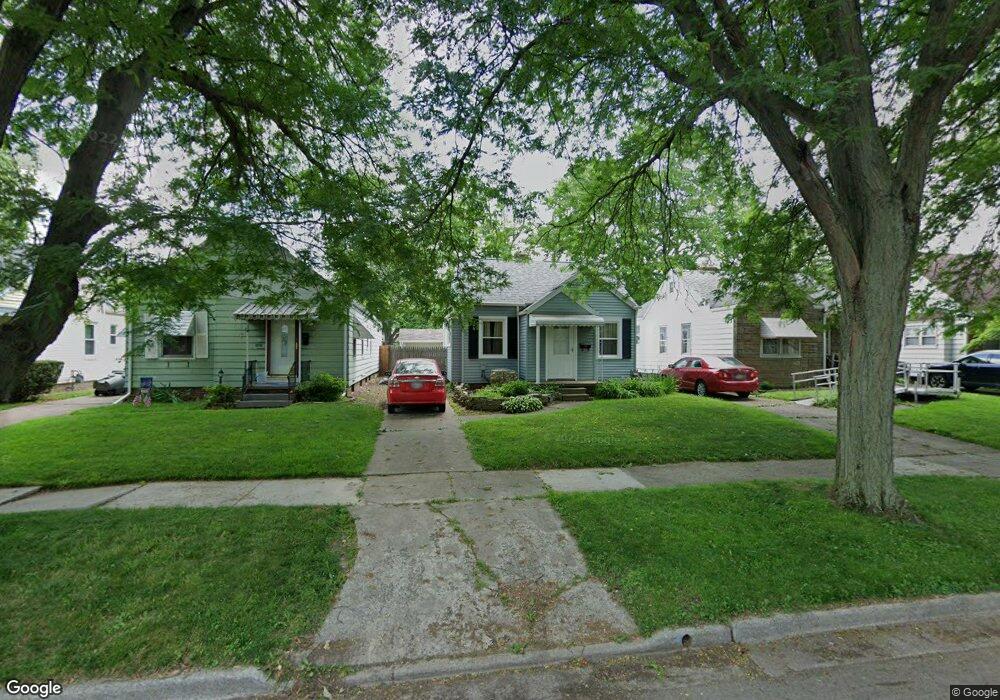
543 Federman St Toledo, OH 43609
Southside NeighborhoodEstimated Value: $54,000 - $72,117
3
Beds
1
Bath
1,025
Sq Ft
$58/Sq Ft
Est. Value
About This Home
This home is located at 543 Federman St, Toledo, OH 43609 and is currently estimated at $59,779, approximately $58 per square foot. 543 Federman St is a home located in Lucas County with nearby schools including Burroughs Elementary School, Bowsher High School, and Explorers Academy of Science and Technology.
Ownership History
Date
Name
Owned For
Owner Type
Purchase Details
Closed on
Aug 21, 2025
Sold by
Hancock Vickie Marie
Bought by
Phax-Genix Inc
Current Estimated Value
Purchase Details
Closed on
Nov 23, 2020
Sold by
Hancock Vickie Marie and Hancock Victoria Marie
Bought by
Hancock Vickie Marie
Purchase Details
Closed on
Apr 15, 2016
Sold by
Winterhalter William R
Bought by
Hancock Victoria Marie
Purchase Details
Closed on
Jul 26, 2006
Sold by
Hinkle Ruth C
Bought by
Winterhalter William and Winterhalter Ramona
Create a Home Valuation Report for This Property
The Home Valuation Report is an in-depth analysis detailing your home's value as well as a comparison with similar homes in the area
Home Values in the Area
Average Home Value in this Area
Purchase History
| Date | Buyer | Sale Price | Title Company |
|---|---|---|---|
| Phax-Genix Inc | $54,100 | None Listed On Document | |
| Hancock Vickie Marie | -- | None Available | |
| Hancock Victoria Marie | -- | None Available | |
| Winterhalter William | $70,000 | Louisville Title Agency For |
Source: Public Records
Tax History
| Year | Tax Paid | Tax Assessment Tax Assessment Total Assessment is a certain percentage of the fair market value that is determined by local assessors to be the total taxable value of land and additions on the property. | Land | Improvement |
|---|---|---|---|---|
| 2025 | -- | $18,935 | $5,285 | $13,650 |
| 2024 | $321 | $18,935 | $5,285 | $13,650 |
| 2023 | $261 | $11,620 | $3,990 | $7,630 |
| 2022 | $283 | $11,620 | $3,990 | $7,630 |
| 2021 | $282 | $11,620 | $3,990 | $7,630 |
| 2020 | $874 | $10,745 | $3,675 | $7,070 |
| 2019 | $852 | $10,745 | $3,675 | $7,070 |
| 2018 | $1,111 | $10,745 | $3,675 | $7,070 |
| 2017 | $1,381 | $17,535 | $3,605 | $13,930 |
| 2016 | $1,380 | $50,100 | $10,300 | $39,800 |
| 2015 | $1,367 | $50,100 | $10,300 | $39,800 |
| 2014 | $1,134 | $17,540 | $3,610 | $13,930 |
| 2013 | $1,134 | $17,540 | $3,610 | $13,930 |
Source: Public Records
Map
Nearby Homes
- 2335 Airport Hwy
- 2052 South Ave
- 415 Mayberry St
- 2019 South Ave
- 333 Danberry St
- 511 S Detroit Ave
- 139 Kenmore Ave
- 518 Colima Dr
- 256 Decatur St
- 2010 Airport Hwy
- 1922 Heatherdale Dr
- 732 Colima Dr
- 635 Wright Ave
- 859 National Ave
- 802 Wright Ave
- 1925 Airline Ave
- 142 S Detroit Ave
- 915 Atlantic Ave
- 131 S Detroit Ave
- 219 Storrs St
- 545 Federman St
- 537 Federman St
- 535 Federman St
- 549 Federman St
- 531 Federman St
- 553 Federman St
- 527 Federman St
- 557 Federman St
- 540 Danberry St
- 536 Danberry St
- 550 Danberry St
- 548 Danberry St
- 523 Federman St
- 552 Danberry St
- 528 Danberry St
- 556 Danberry St
- 521 Federman St
- 544 Federman St
- 2230 Dundee St
- 2226 Dundee St
Your Personal Tour Guide
Ask me questions while you tour the home.