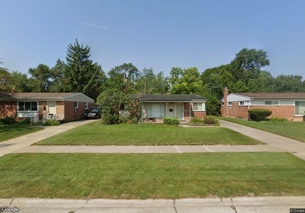
5442 Michael St Dearborn Heights, MI 48125
Estimated Value: $146,000 - $173,000
Studio
1
Bath
1,044
Sq Ft
$151/Sq Ft
Est. Value
About This Home
This home is located at 5442 Michael St, Dearborn Heights, MI 48125 and is currently estimated at $157,945, approximately $151 per square foot. 5442 Michael St is a home located in Wayne County with nearby schools including Quest Charter Academy, West Village Academy, and Peterson-Warren Academy.
Ownership History
Date
Name
Owned For
Owner Type
Purchase Details
Closed on
Sep 23, 2005
Sold by
Miclea Christian and Miclea Michelle Marie
Bought by
Marszalek Frederick
Current Estimated Value
Purchase Details
Closed on
Nov 16, 2004
Sold by
Hud
Bought by
Miclea Cristian
Purchase Details
Closed on
Jun 4, 2003
Sold by
Countrywide Home Loans
Bought by
Hud
Purchase Details
Closed on
May 11, 1998
Sold by
Bos Elizabeth A and Bos Jack R
Bought by
Kwiatkowski Raydell
Purchase Details
Closed on
Mar 31, 1998
Sold by
Va Harriet E Stanley R
Bought by
Kwiatkowski Raydell
Create a Home Valuation Report for This Property
The Home Valuation Report is an in-depth analysis detailing your home's value as well as a comparison with similar homes in the area
Home Values in the Area
Average Home Value in this Area
Purchase History
| Date | Buyer | Sale Price | Title Company |
|---|---|---|---|
| Marszalek Frederick | $112,000 | Multiple | |
| Miclea Cristian | $90,000 | -- | |
| Hud | -- | -- | |
| Kwiatkowski Raydell | $59,412 | -- | |
| Kwiatkowski Raydell | $33,000 | -- |
Source: Public Records
Tax History
| Year | Tax Paid | Tax Assessment Tax Assessment Total Assessment is a certain percentage of the fair market value that is determined by local assessors to be the total taxable value of land and additions on the property. | Land | Improvement |
|---|---|---|---|---|
| 2025 | $1,414 | $74,700 | $0 | $0 |
| 2024 | $1,357 | $68,200 | $0 | $0 |
| 2023 | $1,218 | $59,300 | $0 | $0 |
| 2022 | $1,652 | $51,000 | $0 | $0 |
| 2021 | $1,654 | $43,900 | $0 | $0 |
| 2019 | $1,508 | $34,600 | $0 | $0 |
| 2018 | $1,055 | $31,300 | $0 | $0 |
| 2017 | $828 | $31,300 | $0 | $0 |
| 2016 | $1,434 | $31,800 | $0 | $0 |
| 2015 | $2,960 | $29,600 | $0 | $0 |
| 2013 | $3,100 | $31,700 | $0 | $0 |
| 2010 | -- | $38,800 | $0 | $0 |
Source: Public Records
Map
Nearby Homes
- 5367 Vivian St
- 5904 Janet St
- 000 Currier St
- 4856 Carolee Ln
- 25474 McDonald St
- 25651 McDonald St
- 5852 Beech Daly Rd
- 25513 Annapolis St
- 25965 Currier St
- 25926 Powers Ave
- 25038 Annapolis St
- 0 Hopkins St
- 5969 Fellrath St
- 24337 Pennie St
- 25521 Stanford St
- 25529 Stanford St
- 6041 Fellrath St
- 24339 Eton Ave
- 25046 Stanford St
- 25646 Stanford St
- 5432 Michael St
- 5506 Michael St
- 5415 S Gulley Rd
- 5516 Michael St
- 5422 Michael St
- 5367 S Gulley Rd
- 5427 S Gulley Rd
- 5357 S Gulley Rd
- 5435 S Gulley Rd
- 5435 Michael St
- 5526 Michael St
- 5445 Michael St
- 5412 Michael St
- 5431 S Gulley Rd
- 5425 Michael St
- 5509 Michael St
- 5443 S Gulley Rd
- 5347 S Gulley Rd
- 5415 Michael St
- 5519 Michael St
Your Personal Tour Guide
Ask me questions while you tour the home.