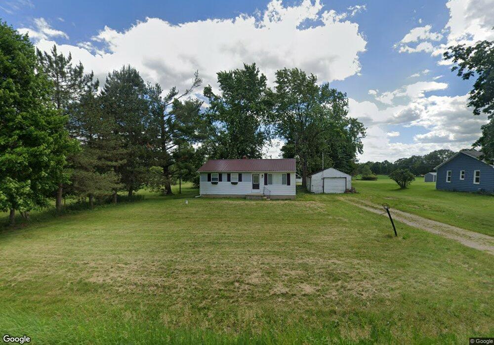
5465 Simpson Rd Owosso, MI 48867
Estimated Value: $137,753 - $236,000
Studio
--
Bath
--
Sq Ft
174,240
Sq Ft Lot
About This Home
This home is located at 5465 Simpson Rd, Owosso, MI 48867 and is currently estimated at $169,938. 5465 Simpson Rd is a home located in Shiawassee County with nearby schools including Owosso High School.
Ownership History
Date
Name
Owned For
Owner Type
Purchase Details
Closed on
Oct 16, 2024
Sold by
Fuoss Kristopher
Bought by
Nolen-Morris Logan C and Morris Logan
Current Estimated Value
Home Financials for this Owner
Home Financials are based on the most recent Mortgage that was taken out on this home.
Original Mortgage
$109,250
Outstanding Balance
$108,101
Interest Rate
6.35%
Mortgage Type
New Conventional
Estimated Equity
$61,837
Purchase Details
Closed on
Oct 14, 2024
Sold by
Fuoss Brothers Inc
Bought by
Fuoss Kristopher
Home Financials for this Owner
Home Financials are based on the most recent Mortgage that was taken out on this home.
Original Mortgage
$109,250
Outstanding Balance
$108,101
Interest Rate
6.35%
Mortgage Type
New Conventional
Estimated Equity
$61,837
Create a Home Valuation Report for This Property
The Home Valuation Report is an in-depth analysis detailing your home's value as well as a comparison with similar homes in the area
Purchase History
| Date | Buyer | Sale Price | Title Company |
|---|---|---|---|
| Nolen-Morris Logan C | $115,000 | Ata National Title Group | |
| Fuoss Kristopher | $60,000 | Midstate Title Agency |
Source: Public Records
Mortgage History
| Date | Status | Borrower | Loan Amount |
|---|---|---|---|
| Open | Nolen-Morris Logan C | $109,250 |
Source: Public Records
Tax History
| Year | Tax Paid | Tax Assessment Tax Assessment Total Assessment is a certain percentage of the fair market value that is determined by local assessors to be the total taxable value of land and additions on the property. | Land | Improvement |
|---|---|---|---|---|
| 2025 | $1,274 | $63,500 | $0 | $0 |
| 2024 | $1,296 | $61,000 | $0 | $0 |
| 2023 | $452 | $58,200 | $0 | $0 |
| 2022 | $430 | $53,600 | $0 | $0 |
| 2021 | $1,126 | $45,800 | $0 | $0 |
| 2020 | $1,116 | $40,700 | $0 | $0 |
| 2019 | $1,094 | $38,200 | $0 | $0 |
| 2018 | $1,110 | $37,800 | $0 | $0 |
| 2017 | $892 | $36,600 | $0 | $0 |
| 2016 | -- | $36,600 | $0 | $0 |
| 2015 | -- | $35,000 | $0 | $0 |
| 2014 | $4 | $32,500 | $0 | $0 |
Source: Public Records
Map
Nearby Homes
- 860 Gaiser Rd
- 2930 S Ruess Rd
- 2375 W Dewey Rd
- 841 N Warren Rd
- 1938 Bock St
- 302 Lafayette Blvd
- 1568 Kenneth St
- 1507 Lynn St
- 704 Isham St
- 1432 Young St
- 1514 W Stewart St
- 1510 W Stewart St
- 1532 Alta Vista Dr
- 802 Wilkinson St
- 1408 W Main St
- 4101 Shaftsburg Rd
- 1310 Frederick St
- 1423 Olmstead St
- 1987 N Warren Rd
- 526 S Chipman St
Your Personal Tour Guide
Ask me questions while you tour the home.