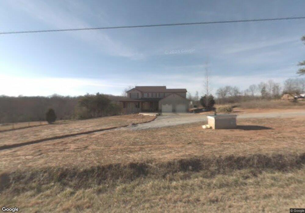
547 E Airport Rd Greer, SC 29651
Greer AreaEstimated Value: $557,701 - $655,000
About This Home
This home is located at 547 E Airport Rd, Greer, SC 29651 and is currently estimated at $598,425, approximately $199 per square foot. 547 E Airport Rd is a home located in Greenville County with nearby schools including Skyland Elementary School, Blue Ridge Middle School, and Blue Ridge High School.
Ownership History
We collect this data history from publicly available records. To have your information removed, we recommend requesting removal directly through your county’s website.
Purchase Details
Home Financials for this Owner
Home Financials are based on the most recent Mortgage that was taken out on this home.Purchase Details
Home Values in the Area
Average Home Value in this Area
Purchase History
We collect this data history from publicly available records. To have your information removed, we recommend requesting removal directly through your county’s website.
| Date | Buyer | Sale Price | Title Company |
|---|---|---|---|
| $292,000 | -- | ||
| $150,000 | -- |
Mortgage History
We collect this data history from publicly available records. To have your information removed, we recommend requesting removal directly through your county’s website.
| Date | Status | Borrower | Loan Amount |
|---|---|---|---|
| Open | $266,000 | ||
| Previous Owner | $213,750 | ||
| Previous Owner | $220,000 | ||
| Previous Owner | $213,000 |
Tax History
We collect this data history from publicly available records. To have your information removed, we recommend requesting removal directly through your county’s website.
| Year | Tax Paid | Tax Assessment Tax Assessment Total Assessment is a certain percentage of the fair market value that is determined by local assessors to be the total taxable value of land and additions on the property. | Land | Improvement |
|---|---|---|---|---|
| 2025 | $2,140 | $14,430 | $1,220 | $13,210 |
| 2024 | $2,140 | $12,550 | $790 | $11,760 |
| 2023 | $2,066 | $12,550 | $790 | $11,760 |
| 2022 | $1,926 | $12,550 | $790 | $11,760 |
| 2021 | $1,906 | $12,550 | $790 | $11,760 |
| 2020 | $1,887 | $11,790 | $650 | $11,140 |
| 2019 | $1,875 | $11,790 | $650 | $11,140 |
| 2018 | $1,870 | $11,790 | $650 | $11,140 |
| 2017 | $1,824 | $11,790 | $650 | $11,140 |
| 2016 | $1,755 | $294,680 | $16,230 | $278,450 |
| 2015 | $1,755 | $294,680 | $16,230 | $278,450 |
| 2014 | $1,775 | $299,360 | $16,230 | $283,130 |
Map
- 125 Fox Farm Way
- 406 Charney Ln
- 3798 Ballenger Rd
- 3798 Ballenger Rd
- 111 Elevation Ct
- 204 Claridge Way
- 210 Claridge Way
- 125 C and S Dr
- 3936 Cripple Creek Rd
- 104 Josh Ct
- 104 Josh Ct
- 3696 S Carolina 14
- 3686 S Carolina 14
- 499 Mount Lebanon Church Rd
- 112 Rustcraft Dr
- 400 Panther Ct
- 5 Sunriff Ct
- 524 Sapling Gap Rd
- 16 Oak Edge Ln
- 9 Dovetuck Rd
- 549 E Airport Rd
- 551 E Airport Rd
- 557 E Airport Rd
- 555 E Airport Rd
- 544 E Airport Rd
- 307 Brockway Ln
- 306 Brockway Ln
- 540 E Airport Rd
- 545 E Airport Rd
- 409 Copper Ct
- 305 Brockway Ln
- 304 Brockway Ln
- 407 Copper Ct
- 303 Brockway Ln
- 553 E Airport Rd
- 408 Copper Ct
- 302 Brockway Ln
- 405 Copper Ct
- 532 E Airport Rd
- 529 E Airport Rd
Ask me questions while you tour the home.