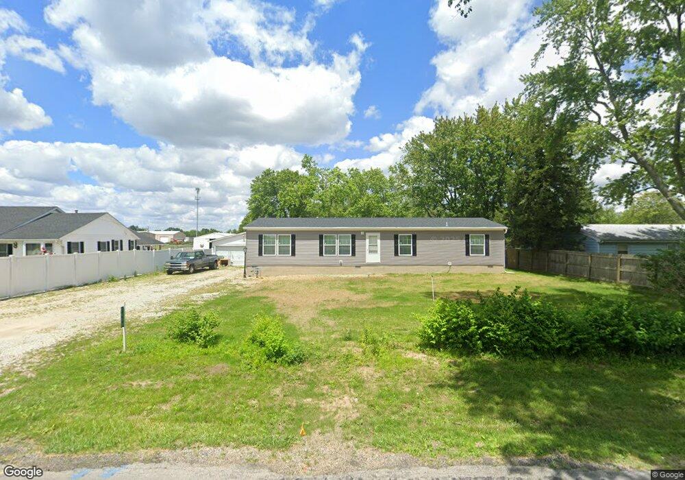
5480 E Firehouse Rd Decatur, IL 62521
Estimated Value: $54,000 - $137,000
3
Beds
1
Bath
864
Sq Ft
$106/Sq Ft
Est. Value
About This Home
This home is located at 5480 E Firehouse Rd, Decatur, IL 62521 and is currently estimated at $91,319, approximately $105 per square foot. 5480 E Firehouse Rd is a home located in Macon County with nearby schools including McGaughey Elementary School, Mt. Zion Intermediate School, and Mt. Zion Elementary School.
Ownership History
Date
Name
Owned For
Owner Type
Purchase Details
Closed on
Jun 25, 2022
Sold by
Deaton Angela D and Deaton Vernon R
Bought by
Carter Eric
Current Estimated Value
Purchase Details
Closed on
Apr 25, 2022
Sold by
Maier Brian
Bought by
Deaton Angela D and Deaton Vernon R
Purchase Details
Closed on
Mar 29, 2022
Sold by
Maier Eugene A
Bought by
Maier Brian
Purchase Details
Closed on
Sep 17, 2013
Sold by
Maier Sandra K
Bought by
Maier Eugene A
Purchase Details
Closed on
Feb 1, 1986
Create a Home Valuation Report for This Property
The Home Valuation Report is an in-depth analysis detailing your home's value as well as a comparison with similar homes in the area
Purchase History
| Date | Buyer | Sale Price | Title Company |
|---|---|---|---|
| Carter Eric | $43,500 | Chiligiris Andrew P | |
| Deaton Angela D | $30,000 | None Listed On Document | |
| Maier Brian | -- | None Listed On Document | |
| Maier Brian | -- | None Listed On Document | |
| Maier Eugene A | -- | None Available | |
| -- | $18,000 | -- |
Source: Public Records
Tax History
| Year | Tax Paid | Tax Assessment Tax Assessment Total Assessment is a certain percentage of the fair market value that is determined by local assessors to be the total taxable value of land and additions on the property. | Land | Improvement |
|---|---|---|---|---|
| 2024 | $1,669 | $26,547 | $5,163 | $21,384 |
| 2023 | $766 | $11,610 | $4,797 | $6,813 |
| 2022 | $159 | $13,399 | $4,510 | $8,889 |
| 2021 | $50 | $12,703 | $4,276 | $8,427 |
| 2020 | $50 | $12,141 | $4,087 | $8,054 |
| 2019 | $50 | $12,141 | $4,087 | $8,054 |
| 2018 | $50 | $11,875 | $3,997 | $7,878 |
| 2017 | $51 | $11,729 | $3,948 | $7,781 |
| 2016 | $50 | $11,722 | $3,946 | $7,776 |
| 2015 | $39 | $11,571 | $3,895 | $7,676 |
| 2014 | $764 | $11,571 | $3,895 | $7,676 |
| 2013 | $375 | $11,571 | $3,895 | $7,676 |
Source: Public Records
Map
Nearby Homes
- 2420 Rolling Creek Ct
- 2415 Lot 15 Rolling Creek Ct
- 2405 Lot 14 Rolling Creek Ct
- 2312 Lot 24 Rolling Creek Dr
- 2347 Rolling Creek Dr
- 2331 Rolling Creek Dr
- 2276 Lot 26 Rolling Creek Dr
- 2311 Rolling Creek Dr
- 2295 Rolling Creek Dr
- 2258 Lot 27 Rolling Creek Dr
- 2277 Rolling Creek Dr
- 2261 Rolling Creek Dr
- 2243 Rolling Creek Dr
- 2235 Rolling Creek Dr
- 5941 Monarch Rd
- 3335 S Mount Zion Rd
- 2833 S Glenwood Dr
- 4224 E Lost Bridge Rd
- 6455 Birchwood Ln
- 1745 S 44th St
- 5490 E Firehouse Rd
- 5530 E Firehouse Rd
- 5485 E Firehouse Rd
- 5465 E Firehouse Rd
- 5560 E Firehouse Rd
- 2535 S Twin Bridge Rd
- 2585 S Twin Bridge Rd
- 5445 E Firehouse Rd
- 2531 S Twin Bridge Rd
- 2515 S Twin Bridge Rd
- 2635 S Twin Bridge Rd
- 5425 E Firehouse Rd
- 2705 S Twin Bridge Rd
- 2525 S Twin Bridge Rd
- 2580 S Twin Bridge Rd
- 2590 S Twin Bridge Rd
- 2560 S Twin Bridge Rd
- 2706 S Twin Bridge Rd
- 5335 E Firehouse Rd
- 2536 S Twin Bridge Rd
Your Personal Tour Guide
Ask me questions while you tour the home.