Estimated Value: $304,736 - $314,000
About This Home
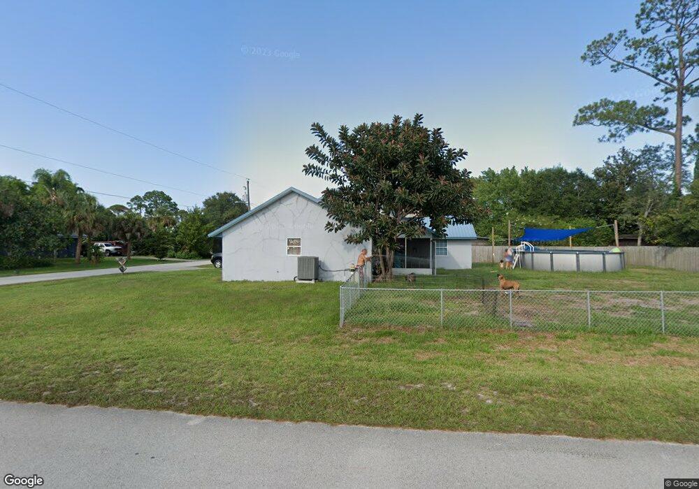
This home is located at 5497 Flint Rd, Cocoa, FL 32927 and is currently estimated at $308,684, approximately $199 per square foot. 5497 Flint Rd is a home located in Brevard County with nearby schools including Enterprise Elementary School, Space Coast Junior/Senior High School, and Sculptor Charter School.
Ownership History
We collect this data history from publicly available records. To have your information removed, we recommend requesting removal directly through your county’s website.
Purchase Details
Purchase Details
Purchase Details
Home Values in the Area
Average Home Value in this Area
Purchase History
We collect this data history from publicly available records. To have your information removed, we recommend requesting removal directly through your county’s website.
| Date | Buyer | Sale Price | Title Company |
|---|---|---|---|
| -- | None Available | ||
| -- | None Available | ||
| $73,000 | -- |
Tax History
We collect this data history from publicly available records. To have your information removed, we recommend requesting removal directly through your county’s website.
| Year | Tax Paid | Tax Assessment Tax Assessment Total Assessment is a certain percentage of the fair market value that is determined by local assessors to be the total taxable value of land and additions on the property. | Land | Improvement |
|---|---|---|---|---|
| 2025 | $1,098 | $82,110 | -- | -- |
| 2024 | $1,060 | $79,800 | -- | -- |
| 2023 | $1,060 | $77,480 | -- | -- |
| 2022 | $1,039 | $75,230 | $0 | $0 |
| 2021 | $1,045 | $73,040 | $0 | $0 |
| 2020 | $987 | $72,040 | $0 | $0 |
| 2019 | $934 | $70,430 | $0 | $0 |
| 2018 | $934 | $69,120 | $0 | $0 |
| 2017 | $934 | $67,700 | $0 | $0 |
| 2016 | $942 | $66,310 | $18,000 | $48,310 |
| 2015 | $950 | $65,850 | $15,000 | $50,850 |
| 2014 | $955 | $65,330 | $11,000 | $54,330 |
Map
- 6442 Fairchild Ave
- 5424 Flint Rd
- 6438 Hudson Rd
- 6450 Ember Ave
- 5525 Fairbridge St
- 6460 Irving Rd
- 5220 Holden Rd
- 6560 Dock Ave
- 5209 Holden Rd
- 6601 Cedar Ave
- 00 Unknown
- 5221 Carrick Rd
- No Access W
- 6574 Haven Ave
- 6615 Dock Ave
- 6581 Bancroft Ave
- 6570 Bancroft Ave
- 6020 Cannon Ave
- 5614 Jamaica Rd
- 5946 Deer Ln
- 5481 Flint Rd
- 5488 Flint Rd
- 5480 Flint Rd
- 6345 Gillette Ave
- 5485 Flint Rd
- 5495 Flint Rd
- 5489 Flint Rd
- 6365 Gillette Ave
- 5493 Flint Rd
- 5464 Flint Rd
- 6375 Gillette Ave
- 5473 Flint Rd
- 6346 Fairchild Ave
- 5370 Fay Blvd
- 5350 Fay Blvd
- 6370 Fairchild Ave
- 5456 Flint Rd
- 5504 Flint Rd
- 6360 Gillette Ave
- 5505 Flint Rd
Ask me questions while you tour the home.