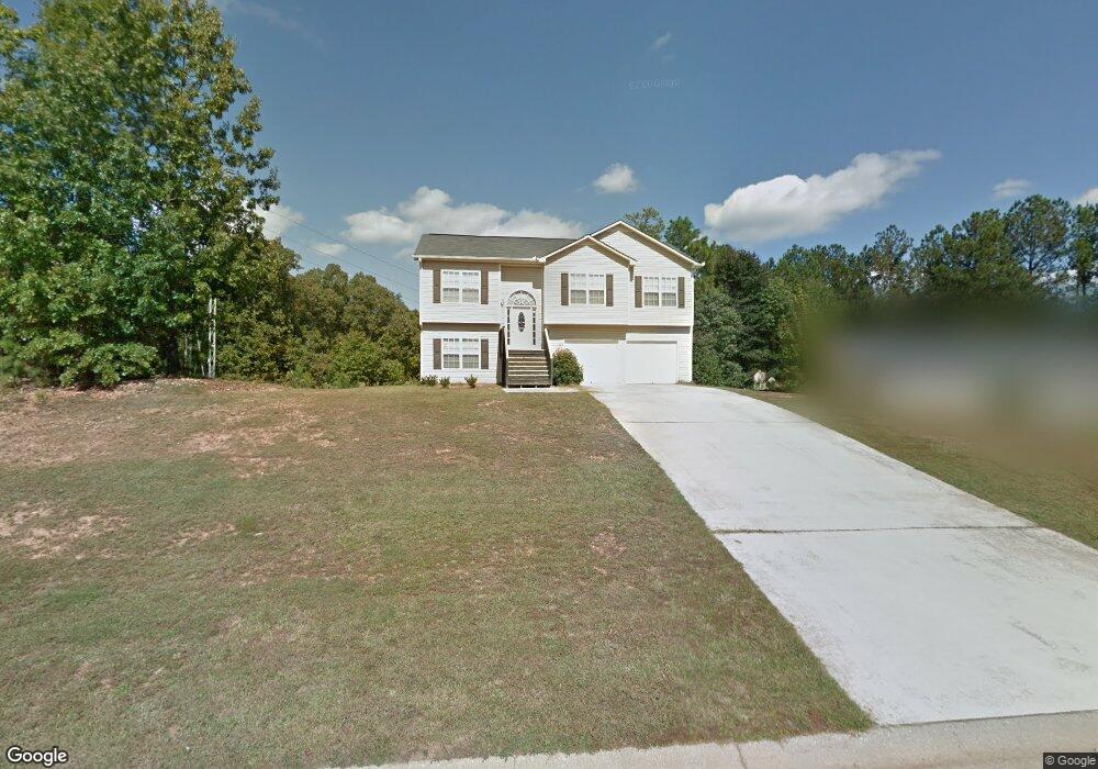
55 Corn Crib Ct Newnan, GA 30263
Estimated Value: $278,000 - $313,000
About This Home
This home is located at 55 Corn Crib Ct, Newnan, GA 30263 and is currently estimated at $300,615, approximately $116 per square foot. 55 Corn Crib Ct is a home located in Coweta County with nearby schools including Atkinson Elementary School, Smokey Road Middle School, and Newnan High School.
Ownership History
We collect this data history from publicly available records. To have your information removed, we recommend requesting removal directly through your county’s website.
Purchase Details
Home Financials for this Owner
Home Financials are based on the most recent Mortgage that was taken out on this home.Purchase Details
Home Financials for this Owner
Home Financials are based on the most recent Mortgage that was taken out on this home.Purchase Details
Purchase Details
Home Financials for this Owner
Home Financials are based on the most recent Mortgage that was taken out on this home.Purchase Details
Purchase Details
Purchase Details
Purchase Details
Purchase History
We collect this data history from publicly available records. To have your information removed, we recommend requesting removal directly through your county’s website.
| Date | Buyer | Sale Price | Title Company |
|---|---|---|---|
| $160,000 | -- | ||
| $124,900 | -- | ||
| $115,900 | -- | ||
| $113,500 | -- | ||
| $200,000 | -- | ||
| $50,000 | -- | ||
| $143,800 | -- | ||
| -- | -- |
Mortgage History
We collect this data history from publicly available records. To have your information removed, we recommend requesting removal directly through your county’s website.
| Date | Status | Borrower | Loan Amount |
|---|---|---|---|
| Open | $157,102 | ||
| Previous Owner | $24,980 | ||
| Previous Owner | $99,920 | ||
| Previous Owner | $112,512 |
Tax History
We collect this data history from publicly available records. To have your information removed, we recommend requesting removal directly through your county’s website.
| Year | Tax Paid | Tax Assessment Tax Assessment Total Assessment is a certain percentage of the fair market value that is determined by local assessors to be the total taxable value of land and additions on the property. | Land | Improvement |
|---|---|---|---|---|
| 2025 | $2,640 | $117,155 | $20,000 | $97,155 |
| 2024 | $2,492 | $111,949 | $20,000 | $91,949 |
| 2023 | $2,492 | $94,064 | $16,000 | $78,064 |
| 2022 | $1,825 | $78,768 | $16,000 | $62,768 |
| 2021 | $1,562 | $64,000 | $8,723 | $55,277 |
| 2020 | $1,711 | $64,551 | $8,800 | $55,751 |
| 2019 | $1,660 | $56,730 | $8,000 | $48,730 |
| 2018 | $1,663 | $56,730 | $8,000 | $48,730 |
| 2017 | $1,546 | $52,730 | $4,000 | $48,730 |
| 2016 | $1,098 | $37,899 | $4,000 | $33,899 |
| 2015 | $717 | $25,187 | $4,000 | $21,187 |
| 2014 | $385 | $18,143 | $4,000 | $14,143 |
Map
- 45 Corn Row Ct
- 175 Beverly Park Ct
- 180 Beverly Park Ct
- 298 Millard Farmer Rd
- 394 Brandish Dr
- 46 Brandish Dr
- 9 Bob o Link Dr
- 5 Carlow Ct
- 115 S Robin Ln
- 19 Festiva Dr
- 0 Smokey Rd Unit 10495165
- 4 Sweetbriar Rd
- 266 Lagrange St
- 153 Carlow Ct
- 57 Natures Cove Rd
- 105 Pineland Dr Unit 6
- 12 Smokey Ridge Ct
- 55 Woodrow Place
- 109 Arlington Ct
- 6 Colonial Dr
- 45 Corn Crib Ct
- 65 Corn Crib Ct
- 23 Corn Crib Ct
- 60 Corn Crib Ct
- 70 Corn Crib Ct
- 35 Corn Crib Ct
- 75 Corn Crib Ct
- 50 Corn Crib Ct
- 25 Corn Crib Ct
- 40 Corn Crib Ct
- 80 Corn Crib Ct
- 85 Corn Crib Ct
- 90 Corn Crib Dr
- 30 Corn Crib Ct
- 100 Corn Crib Dr
- 15 Corn Crib Ct
- 90 Corn Crib Ct
- 110 Corn Crib Dr
- 70 Corn Crib Dr
- 95 Corn Crib Ct
Ask me questions while you tour the home.