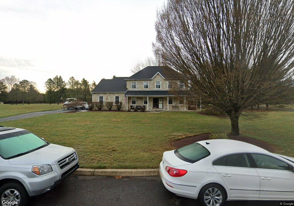
55 Hill Rd Warminster, PA 18974
Estimated Value: $805,000 - $981,000
4
Beds
3
Baths
2,534
Sq Ft
$352/Sq Ft
Est. Value
About This Home
This home is located at 55 Hill Rd, Warminster, PA 18974 and is currently estimated at $893,048, approximately $352 per square foot. 55 Hill Rd is a home located in Bucks County with nearby schools including Maureen M. Welch Elementary School, Richboro Middle School, and Council Rock High School - South.
Ownership History
Date
Name
Owned For
Owner Type
Purchase Details
Closed on
Jun 23, 2008
Sold by
Lutzker Stuart and Lutzker Mary
Bought by
Lewis Robert W and Lewis Meredith A
Current Estimated Value
Home Financials for this Owner
Home Financials are based on the most recent Mortgage that was taken out on this home.
Original Mortgage
$412,000
Interest Rate
6.07%
Mortgage Type
Unknown
Purchase Details
Closed on
Jul 21, 1994
Sold by
Hidden Meadow Properties Inc
Bought by
Lutzker Stuart and Lutzker Mary
Home Financials for this Owner
Home Financials are based on the most recent Mortgage that was taken out on this home.
Original Mortgage
$145,000
Interest Rate
8.25%
Purchase Details
Closed on
Jan 5, 1994
Sold by
C & B Development Inc
Bought by
Hidden Meadow Properties Inc
Create a Home Valuation Report for This Property
The Home Valuation Report is an in-depth analysis detailing your home's value as well as a comparison with similar homes in the area
Home Values in the Area
Average Home Value in this Area
Purchase History
| Date | Buyer | Sale Price | Title Company |
|---|---|---|---|
| Lewis Robert W | $515,000 | None Available | |
| Lutzker Stuart | $236,000 | -- | |
| Hidden Meadow Properties Inc | $104,000 | -- |
Source: Public Records
Mortgage History
| Date | Status | Borrower | Loan Amount |
|---|---|---|---|
| Closed | Lewis Robert W | $412,000 | |
| Previous Owner | Lutzker Stuart | $145,000 |
Source: Public Records
Tax History
| Year | Tax Paid | Tax Assessment Tax Assessment Total Assessment is a certain percentage of the fair market value that is determined by local assessors to be the total taxable value of land and additions on the property. | Land | Improvement |
|---|---|---|---|---|
| 2025 | $9,445 | $49,040 | $11,960 | $37,080 |
| 2024 | $9,445 | $49,040 | $11,960 | $37,080 |
| 2023 | $6,380 | $49,040 | $11,960 | $37,080 |
| 2022 | $8,821 | $49,040 | $11,960 | $37,080 |
| 2021 | $8,542 | $49,040 | $11,960 | $37,080 |
| 2020 | $8,350 | $49,040 | $11,960 | $37,080 |
| 2019 | $7,992 | $49,040 | $11,960 | $37,080 |
| 2018 | $7,850 | $49,040 | $11,960 | $37,080 |
| 2017 | $7,547 | $49,040 | $11,960 | $37,080 |
| 2016 | $7,547 | $49,040 | $11,960 | $37,080 |
| 2015 | -- | $49,040 | $11,960 | $37,080 |
| 2014 | -- | $49,040 | $11,960 | $37,080 |
Source: Public Records
Map
Nearby Homes
- 1280 Grenoble Rd Unit B
- 920 Nathaniel Trail
- 931 Nathaniel Trail
- 304 Julian Dr E
- 1107 Maxwell Manor
- 9 Spring Dr
- 105 Silver Oak Ct
- 11 Spring Dr
- 15 Spring Mill Dr
- 12 Spring Mill Dr
- 21 Spring Mill Dr Unit 12
- 111 Grandview Dr
- 25 Creekside Dr
- 104 Shannon Ct
- 55 Parry Way
- 86 Parry Way
- 716 W Bristol Rd
- 2423 April Dr
- 2419 April Dr
- 2417 April Dr
Your Personal Tour Guide
Ask me questions while you tour the home.